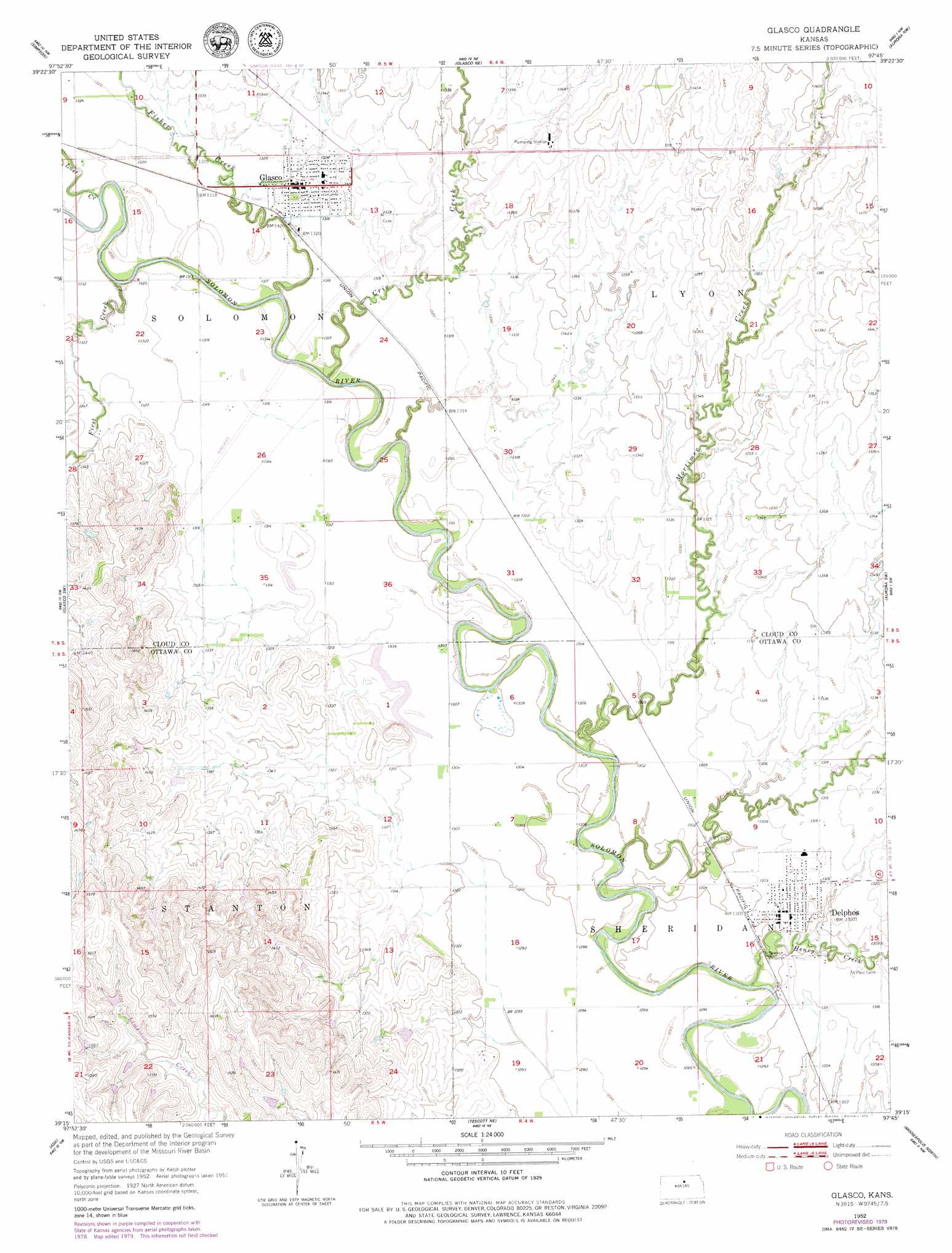
Glasco Topo Map Kansas
To zoom in, hover over the map of Glasco
USGS Topo Quad 39097c7 - 1:24,000 scale
| Topo Map Name: | Glasco |
| USGS Topo Quad ID: | 39097c7 |
| Print Size: | ca. 21 1/4" wide x 27" high |
| Southeast Coordinates: | 39.25° N latitude / 97.75° W longitude |
| Map Center Coordinates: | 39.3125° N latitude / 97.8125° W longitude |
| U.S. State: | KS |
| Filename: | o39097c7.jpg |
| Download Map JPG Image: | Glasco topo map 1:24,000 scale |
| Map Type: | Topographic |
| Topo Series: | 7.5´ |
| Map Scale: | 1:24,000 |
| Source of Map Images: | United States Geological Survey (USGS) |
| Alternate Map Versions: |
Glasco KS 1952, updated 1954 Download PDF Buy paper map Glasco KS 1952, updated 1979 Download PDF Buy paper map Glasco KS 2009 Download PDF Buy paper map Glasco KS 2012 Download PDF Buy paper map Glasco KS 2015 Download PDF Buy paper map |
1:24,000 Topo Quads surrounding Glasco
Jewell Se |
Scottsville |
Jamestown |
Concordia |
Rice |
Beloit |
Simpson |
Glasco Ne |
Aurora Nw |
Aurora |
Beloit Se |
Glasco Sw |
Glasco |
Aurora Sw |
Lamar |
Barnard |
Ada |
Tescott Ne |
Minneapolis North |
Wells |
Shady Bend |
Tescott |
Tescott Se |
Minneapolis South |
Bennington |
> Back to 39097a1 at 1:100,000 scale
> Back to 39096a1 at 1:250,000 scale
> Back to U.S. Topo Maps home
Glasco topo map: Gazetteer
Glasco: Populated Places
Delphos elevation 396m 1299′Glasco elevation 399m 1309′
Glasco: Streams
Cris Creek elevation 393m 1289′First Creek elevation 393m 1289′
Fisher Creek elevation 396m 1299′
Henry Creek elevation 387m 1269′
Lost Creek elevation 396m 1299′
Mortimer Creek elevation 389m 1276′
Yockey Creek elevation 389m 1276′
Glasco digital topo map on disk
Buy this Glasco topo map showing relief, roads, GPS coordinates and other geographical features, as a high-resolution digital map file on DVD: