Washington Topo Map Kansas
To zoom in, hover over the map of Washington
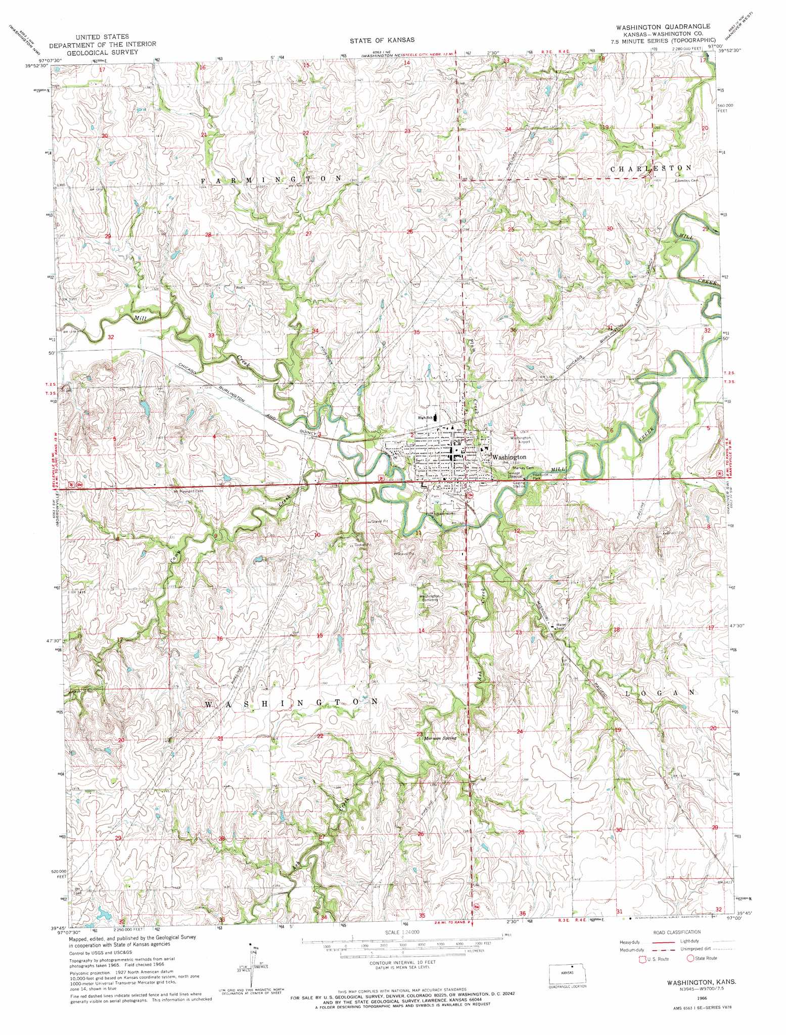
USGS Topo Quad 39097g1 - 1:24,000 scale
| Topo Map Name: | Washington |
| USGS Topo Quad ID: | 39097g1 |
| Print Size: | ca. 21 1/4" wide x 27" high |
| Southeast Coordinates: | 39.75° N latitude / 97° W longitude |
| Map Center Coordinates: | 39.8125° N latitude / 97.0625° W longitude |
| U.S. State: | KS |
| Filename: | o39097g1.jpg |
| Download Map JPG Image: | Washington topo map 1:24,000 scale |
| Map Type: | Topographic |
| Topo Series: | 7.5´ |
| Map Scale: | 1:24,000 |
| Source of Map Images: | United States Geological Survey (USGS) |
| Alternate Map Versions: |
Washington KS 1966, updated 1967 Download PDF Buy paper map Washington KS 2009 Download PDF Buy paper map Washington KS 2012 Download PDF Buy paper map Washington KS 2015 Download PDF Buy paper map |
1:24,000 Topo Quads surrounding Washington
Reynolds |
Fairbury Sw |
Endicott |
Diller |
Odell |
Mahaska |
Washington Nw |
Washington Ne |
Hanover West |
Hanover East |
Haddam |
Morrowville |
Washington |
Hanover Sw |
Hanover Se |
Brantford |
Palmer |
Linn |
Greenleaf |
Barnes |
Clifton |
Linn Sw |
Linn Se |
Kimeo |
Greenleaf Se |
> Back to 39097e1 at 1:100,000 scale
> Back to 39096a1 at 1:250,000 scale
> Back to U.S. Topo Maps home
Washington topo map: Gazetteer
Washington: Airports
Washington Municipal Airport elevation 394m 1292′Washington: Dams
Washington Water Reservoir Dam elevation 388m 1272′Washington: Populated Places
Washington elevation 404m 1325′Washington: Springs
Mormon Spring elevation 403m 1322′Washington: Streams
Ash Creek elevation 387m 1269′Camp Creek elevation 389m 1276′
Plum Creek elevation 387m 1269′
Washington digital topo map on disk
Buy this Washington topo map showing relief, roads, GPS coordinates and other geographical features, as a high-resolution digital map file on DVD: