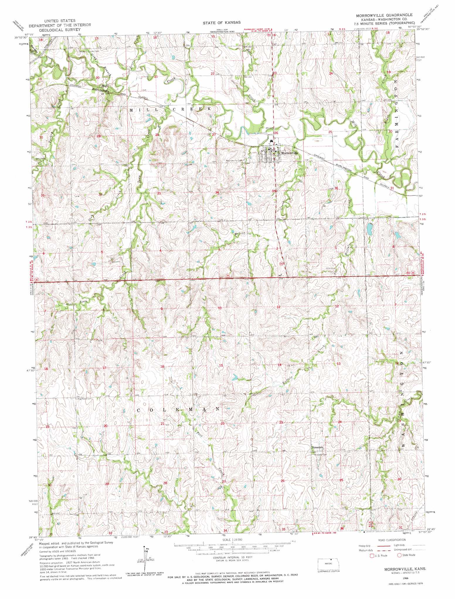
Morrowville Topo Map Kansas
To zoom in, hover over the map of Morrowville
USGS Topo Quad 39097g2 - 1:24,000 scale
| Topo Map Name: | Morrowville |
| USGS Topo Quad ID: | 39097g2 |
| Print Size: | ca. 21 1/4" wide x 27" high |
| Southeast Coordinates: | 39.75° N latitude / 97.125° W longitude |
| Map Center Coordinates: | 39.8125° N latitude / 97.1875° W longitude |
| U.S. State: | KS |
| Filename: | o39097g2.jpg |
| Download Map JPG Image: | Morrowville topo map 1:24,000 scale |
| Map Type: | Topographic |
| Topo Series: | 7.5´ |
| Map Scale: | 1:24,000 |
| Source of Map Images: | United States Geological Survey (USGS) |
| Alternate Map Versions: |
Morrowville KS 1966, updated 1967 Download PDF Buy paper map Morrowville KS 2009 Download PDF Buy paper map Morrowville KS 2012 Download PDF Buy paper map Morrowville KS 2015 Download PDF Buy paper map |
1:24,000 Topo Quads surrounding Morrowville
Hubbell |
Reynolds |
Fairbury Sw |
Endicott |
Diller |
Narka |
Mahaska |
Washington Nw |
Washington Ne |
Hanover West |
Cuba |
Haddam |
Morrowville |
Washington |
Hanover Sw |
Agenda |
Brantford |
Palmer |
Linn |
Greenleaf |
Clyde |
Clifton |
Linn Sw |
Linn Se |
Kimeo |
> Back to 39097e1 at 1:100,000 scale
> Back to 39096a1 at 1:250,000 scale
> Back to U.S. Topo Maps home
Morrowville topo map: Gazetteer
Morrowville: Populated Places
Enosdale elevation 439m 1440′Morrowville elevation 411m 1348′
Morrowville: Streams
Bowman Creek elevation 410m 1345′Buffalo Creek elevation 396m 1299′
Gray Branch elevation 408m 1338′
Iowa Creek elevation 406m 1332′
Jones Creek elevation 406m 1332′
Melvin Creek elevation 403m 1322′
Riddle Creek elevation 399m 1309′
Salt Creek elevation 403m 1322′
Stub Creek elevation 410m 1345′
Turkey Creek elevation 408m 1338′
Morrowville digital topo map on disk
Buy this Morrowville topo map showing relief, roads, GPS coordinates and other geographical features, as a high-resolution digital map file on DVD: