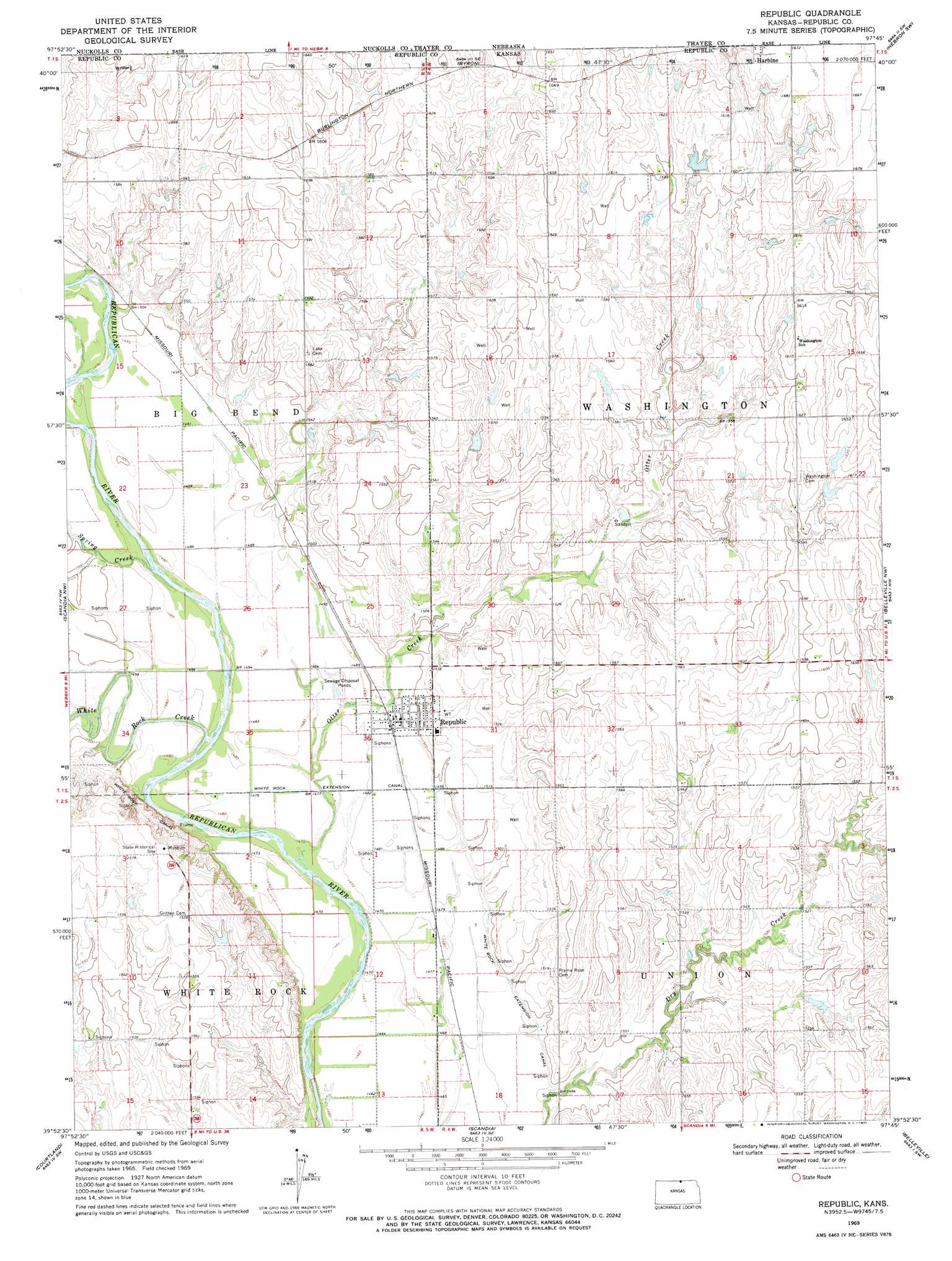
Republic Topo Map Kansas
To zoom in, hover over the map of Republic
USGS Topo Quad 39097h7 - 1:24,000 scale
| Topo Map Name: | Republic |
| USGS Topo Quad ID: | 39097h7 |
| Print Size: | ca. 21 1/4" wide x 27" high |
| Southeast Coordinates: | 39.875° N latitude / 97.75° W longitude |
| Map Center Coordinates: | 39.9375° N latitude / 97.8125° W longitude |
| U.S. State: | KS |
| Filename: | o39097h7.jpg |
| Download Map JPG Image: | Republic topo map 1:24,000 scale |
| Map Type: | Topographic |
| Topo Series: | 7.5´ |
| Map Scale: | 1:24,000 |
| Source of Map Images: | United States Geological Survey (USGS) |
| Alternate Map Versions: |
Republic KS 1969, updated 1971 Download PDF Buy paper map Republic KS 2009 Download PDF Buy paper map Republic KS 2012 Download PDF Buy paper map Republic KS 2015 Download PDF Buy paper map |
1:24,000 Topo Quads surrounding Republic
Nelson |
Oak |
Ruskin |
Deshler |
Hebron |
Superior |
Hardy |
Byron |
Hebron Sw |
Chester |
Webber |
Scandia Nw |
Republic |
Belleville Nw |
Munden |
Montrose |
Courtland |
Scandia |
Belleville |
Belleville Se |
Randall |
Jamestown Nw |
Kackley |
Condordia Nw |
Wayne |
> Back to 39097e1 at 1:100,000 scale
> Back to 39096a1 at 1:250,000 scale
> Back to U.S. Topo Maps home
Republic topo map: Gazetteer
Republic: Parks
Pawnee Indian Village elevation 486m 1594′Republic: Populated Places
Harbine elevation 512m 1679′Republic elevation 457m 1499′
Republic: Streams
Otter Creek elevation 445m 1459′Spring Creek elevation 451m 1479′
White Rock Creek elevation 448m 1469′
Republic digital topo map on disk
Buy this Republic topo map showing relief, roads, GPS coordinates and other geographical features, as a high-resolution digital map file on DVD: