Beloit Topo Map Kansas
To zoom in, hover over the map of Beloit
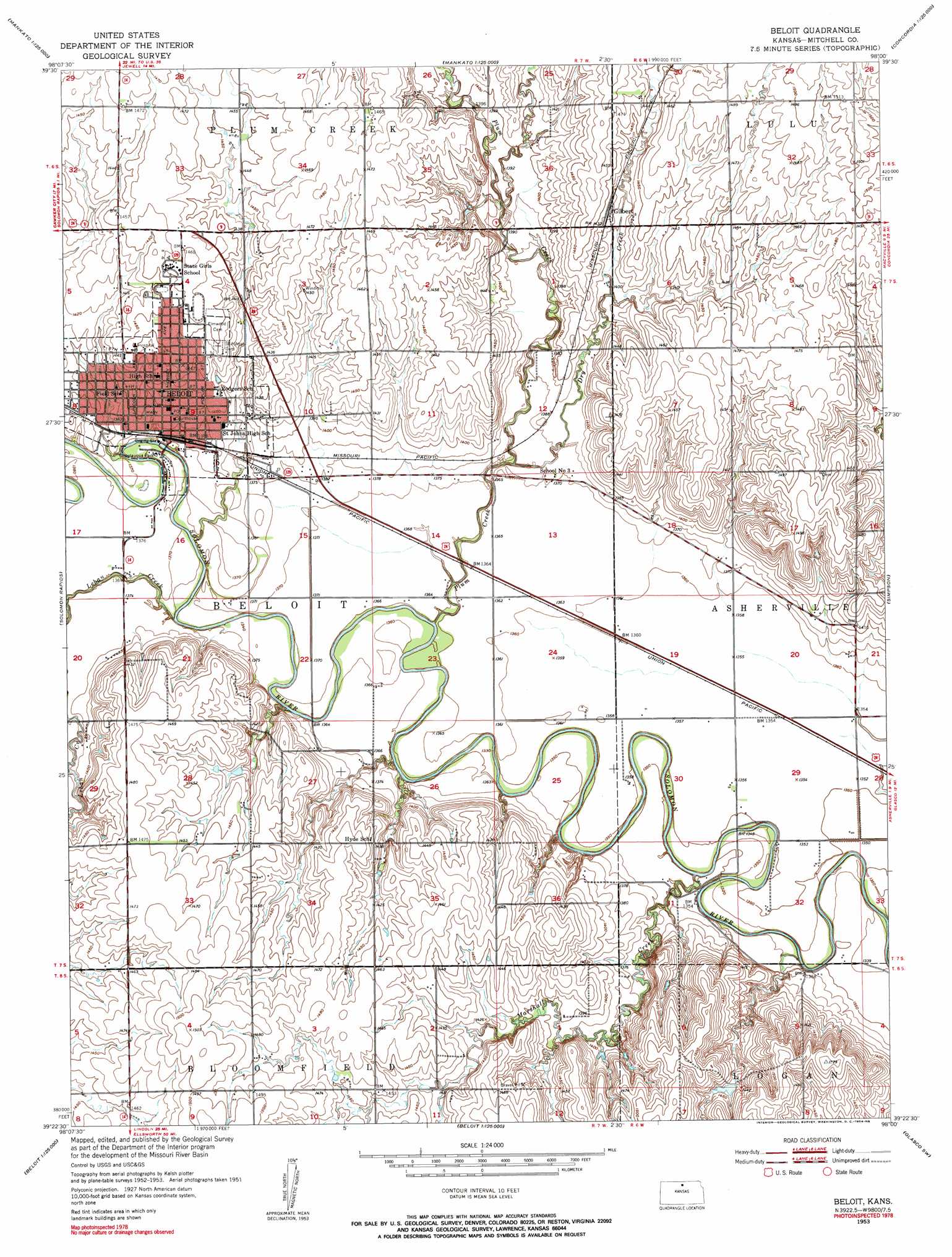
USGS Topo Quad 39098d1 - 1:24,000 scale
| Topo Map Name: | Beloit |
| USGS Topo Quad ID: | 39098d1 |
| Print Size: | ca. 21 1/4" wide x 27" high |
| Southeast Coordinates: | 39.375° N latitude / 98° W longitude |
| Map Center Coordinates: | 39.4375° N latitude / 98.0625° W longitude |
| U.S. State: | KS |
| Filename: | o39098d1.jpg |
| Download Map JPG Image: | Beloit topo map 1:24,000 scale |
| Map Type: | Topographic |
| Topo Series: | 7.5´ |
| Map Scale: | 1:24,000 |
| Source of Map Images: | United States Geological Survey (USGS) |
| Alternate Map Versions: |
Beloit KS 1953, updated 1954 Download PDF Buy paper map Beloit KS 1953, updated 1954 Download PDF Buy paper map Beloit KS 2009 Download PDF Buy paper map Beloit KS 2012 Download PDF Buy paper map Beloit KS 2015 Download PDF Buy paper map |
1:24,000 Topo Quads surrounding Beloit
Ionia |
Jewell |
Randall |
Jamestown Nw |
Kackley |
Glen Elder North |
Jewell Sw |
Jewell Se |
Scottsville |
Jamestown |
Glen Elder South |
Solomon Rapids |
Beloit |
Simpson |
Glasco Ne |
Blue Hill |
Beloit Sw |
Beloit Se |
Glasco Sw |
Glasco |
Ash Grove |
Lincoln Nw |
Barnard |
Ada |
Tescott Ne |
> Back to 39098a1 at 1:100,000 scale
> Back to 39098a1 at 1:250,000 scale
> Back to U.S. Topo Maps home
Beloit topo map: Gazetteer
Beloit: Parks
Chautauqua Park elevation 416m 1364′Beloit: Populated Places
Beloit elevation 422m 1384′Gilbert elevation 436m 1430′
Beloit: Streams
Dry Creek elevation 412m 1351′Leban Creek elevation 412m 1351′
Marshall Creek elevation 405m 1328′
Plum Creek elevation 416m 1364′
Beloit digital topo map on disk
Buy this Beloit topo map showing relief, roads, GPS coordinates and other geographical features, as a high-resolution digital map file on DVD: