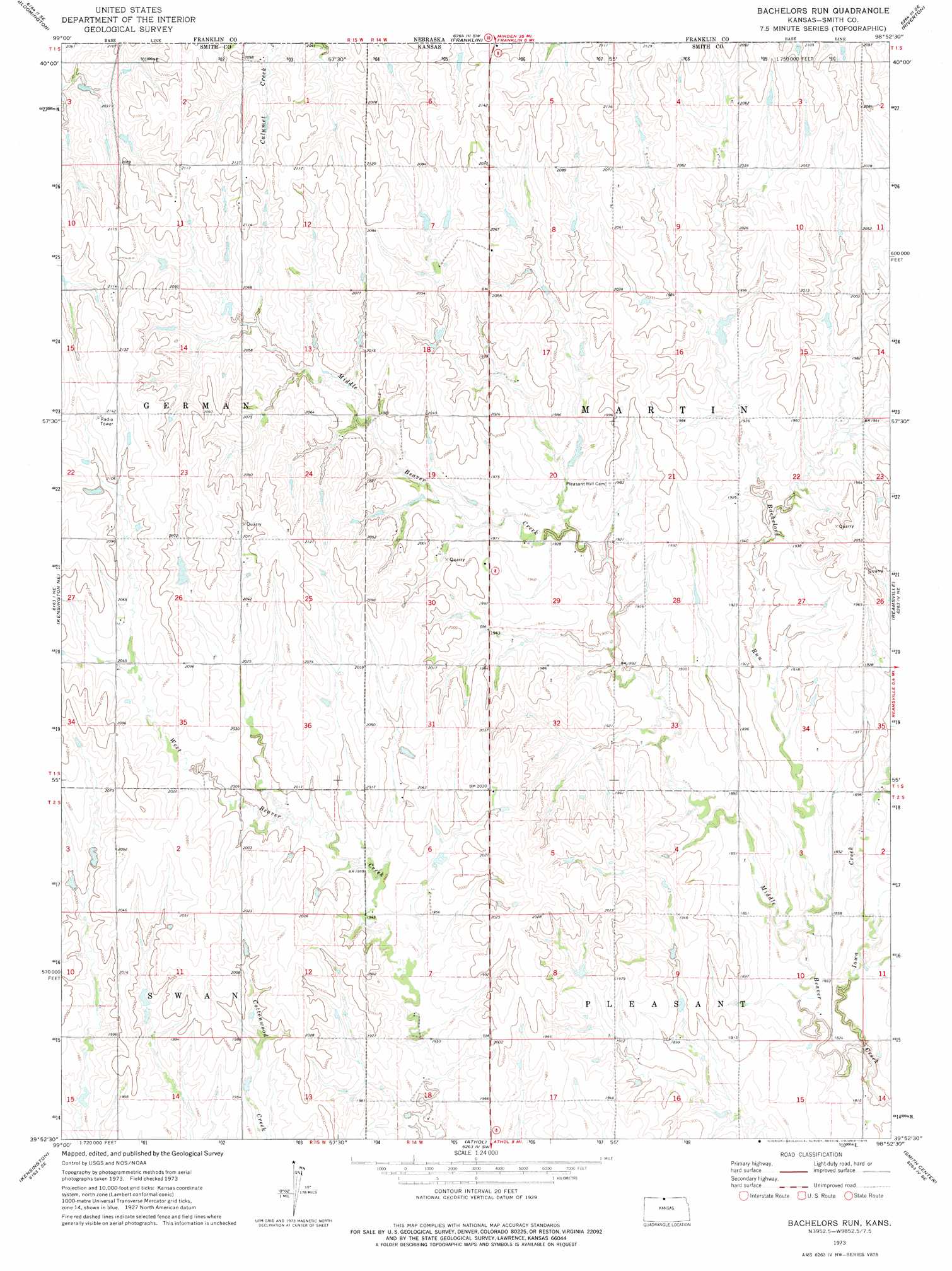
Bachelors Run Topo Map Kansas
To zoom in, hover over the map of Bachelors Run
USGS Topo Quad 39098h8 - 1:24,000 scale
| Topo Map Name: | Bachelors Run |
| USGS Topo Quad ID: | 39098h8 |
| Print Size: | ca. 21 1/4" wide x 27" high |
| Southeast Coordinates: | 39.875° N latitude / 98.875° W longitude |
| Map Center Coordinates: | 39.9375° N latitude / 98.9375° W longitude |
| U.S. State: | KS |
| Filename: | o39098h8.jpg |
| Download Map JPG Image: | Bachelors Run topo map 1:24,000 scale |
| Map Type: | Topographic |
| Topo Series: | 7.5´ |
| Map Scale: | 1:24,000 |
| Source of Map Images: | United States Geological Survey (USGS) |
| Alternate Map Versions: |
Bachelors Run KS 1973, updated 1975 Download PDF Buy paper map Bachelors Run KS 2009 Download PDF Buy paper map Bachelors Run KS 2012 Download PDF Buy paper map Bachelors Run KS 2015 Download PDF Buy paper map |
1:24,000 Topo Quads surrounding Bachelors Run
Republican City Nw |
Republican City Ne |
Macon |
Franklin Ne |
Red Cloud Nw |
Republican City |
Bloomington |
Franklin |
Riverton |
Inavale |
Kensington Nw |
Kensington Ne |
Bachelors Run |
Reamsville |
Cora |
Gretna |
Kensington |
Athol |
Smith Center |
Bellaire |
Kirwin Reservoir |
Kirwin |
Cedar |
Gaylord |
Portis Nw |
> Back to 39098e1 at 1:100,000 scale
> Back to 39098a1 at 1:250,000 scale
> Back to U.S. Topo Maps home
Bachelors Run topo map: Gazetteer
Bachelors Run: Streams
Bachelors Run elevation 558m 1830′Iowa Creek elevation 543m 1781′
Bachelors Run digital topo map on disk
Buy this Bachelors Run topo map showing relief, roads, GPS coordinates and other geographical features, as a high-resolution digital map file on DVD: