Stockton Topo Map Kansas
To zoom in, hover over the map of Stockton
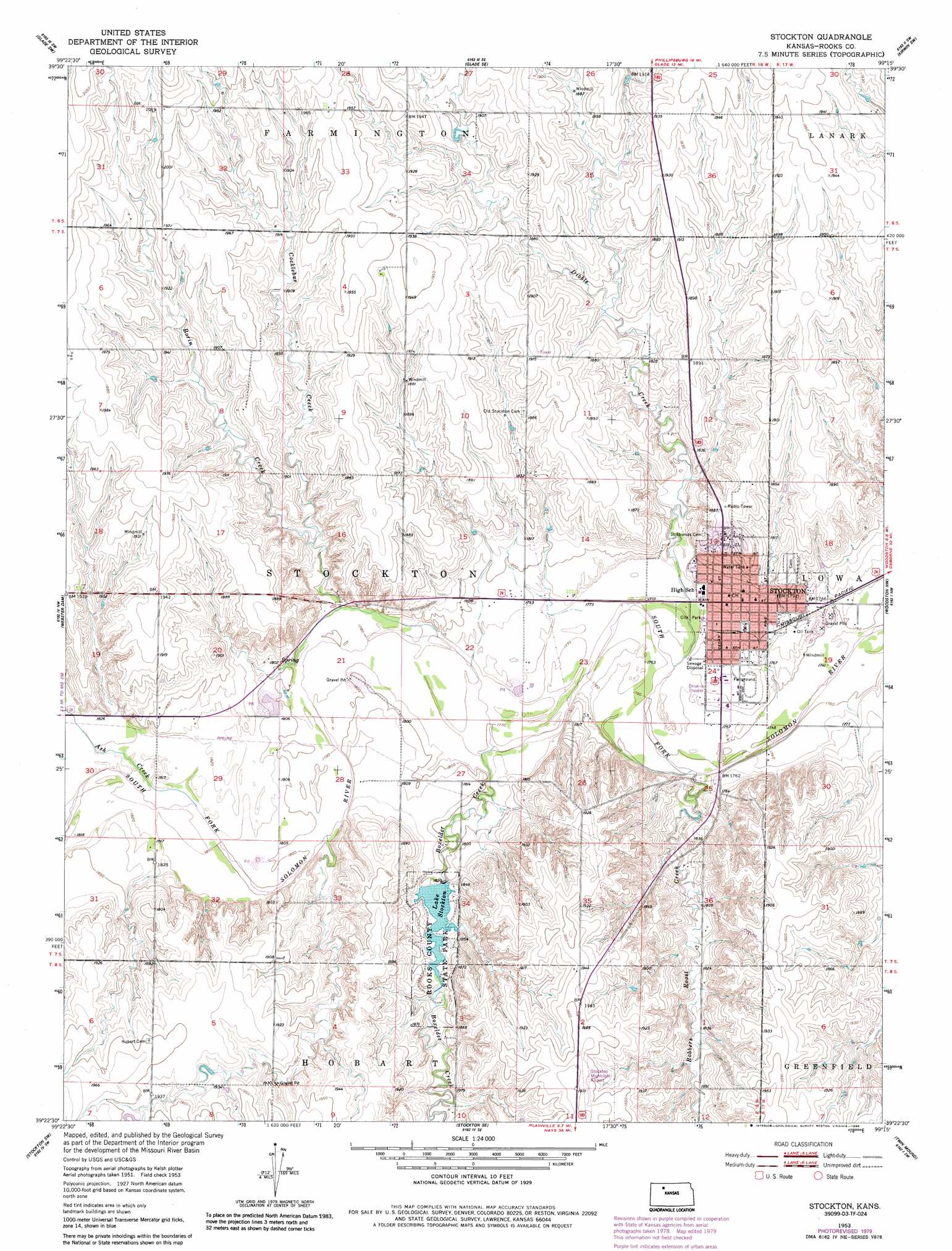
USGS Topo Quad 39099d3 - 1:24,000 scale
| Topo Map Name: | Stockton |
| USGS Topo Quad ID: | 39099d3 |
| Print Size: | ca. 21 1/4" wide x 27" high |
| Southeast Coordinates: | 39.375° N latitude / 99.25° W longitude |
| Map Center Coordinates: | 39.4375° N latitude / 99.3125° W longitude |
| U.S. State: | KS |
| Filename: | o39099d3.jpg |
| Download Map JPG Image: | Stockton topo map 1:24,000 scale |
| Map Type: | Topographic |
| Topo Series: | 7.5´ |
| Map Scale: | 1:24,000 |
| Source of Map Images: | United States Geological Survey (USGS) |
| Alternate Map Versions: |
Stockton KS 1953, updated 1954 Download PDF Buy paper map Stockton KS 1953, updated 1979 Download PDF Buy paper map Stockton KS 1953, updated 1986 Download PDF Buy paper map Stockton KS 2009 Download PDF Buy paper map Stockton KS 2012 Download PDF Buy paper map Stockton KS 2015 Download PDF Buy paper map |
1:24,000 Topo Quads surrounding Stockton
Logan |
Speed |
Phillipsburg South |
Kirwin Reservoir |
Kirwin |
Logan Se |
Glade Sw |
Glade Se |
Kirwin Sw |
Kirwin Se |
Nicodemus |
Webster Dam |
Stockton |
Woodston Nw |
Woodston |
Palco |
Stockton Sw |
Stockton Se |
Twin Mound |
Laton |
Wild Horse Creek |
Zurich |
Plainville |
Codell |
Natoma |
> Back to 39099a1 at 1:100,000 scale
> Back to 39098a1 at 1:250,000 scale
> Back to U.S. Topo Maps home
Stockton topo map: Gazetteer
Stockton: Airports
Stockton Municipal Airport elevation 598m 1961′Stockton: Dams
Rooks County State Lake Dam elevation 554m 1817′Stockton: Parks
Rooks County State Park elevation 556m 1824′Rooks State Fishing Lake and Wildlife Area elevation 556m 1824′
Stockton: Populated Places
Stockton elevation 548m 1797′Stockton: Reservoirs
Lake Stockton elevation 554m 1817′Stockton: Streams
Ash Creek elevation 552m 1811′Borin Creek elevation 552m 1811′
Boxelder Creek elevation 540m 1771′
Cocklebur Creek elevation 551m 1807′
Dibble Creek elevation 537m 1761′
Robbers Roost Creek elevation 563m 1847′
Roberts Roost Creek elevation 534m 1751′
Stockton digital topo map on disk
Buy this Stockton topo map showing relief, roads, GPS coordinates and other geographical features, as a high-resolution digital map file on DVD: