Logan Topo Map Kansas
To zoom in, hover over the map of Logan
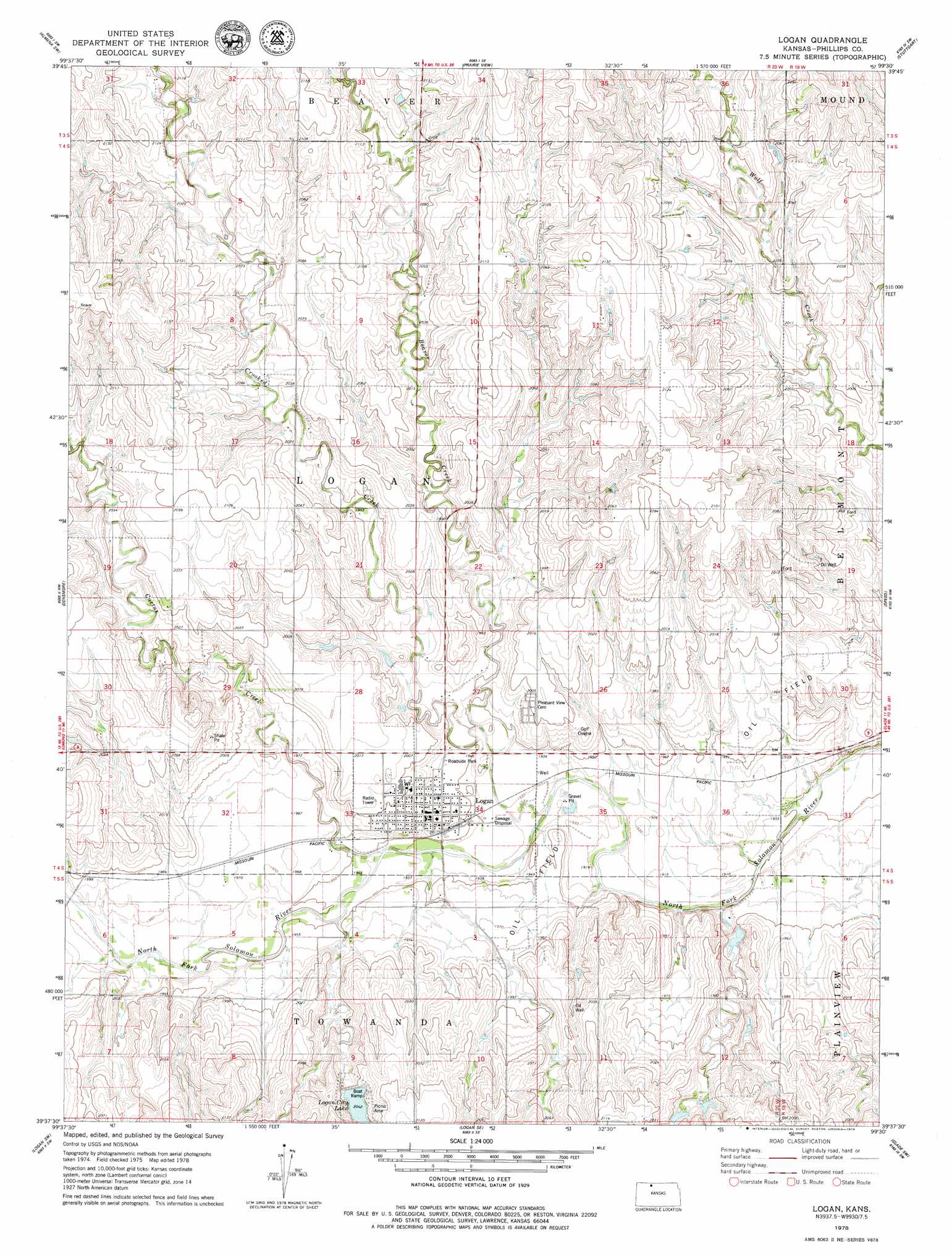
USGS Topo Quad 39099f5 - 1:24,000 scale
| Topo Map Name: | Logan |
| USGS Topo Quad ID: | 39099f5 |
| Print Size: | ca. 21 1/4" wide x 27" high |
| Southeast Coordinates: | 39.625° N latitude / 99.5° W longitude |
| Map Center Coordinates: | 39.6875° N latitude / 99.5625° W longitude |
| U.S. State: | KS |
| Filename: | o39099f5.jpg |
| Download Map JPG Image: | Logan topo map 1:24,000 scale |
| Map Type: | Topographic |
| Topo Series: | 7.5´ |
| Map Scale: | 1:24,000 |
| Source of Map Images: | United States Geological Survey (USGS) |
| Alternate Map Versions: |
Logan KS 1978, updated 1979 Download PDF Buy paper map Logan KS 2009 Download PDF Buy paper map Logan KS 2012 Download PDF Buy paper map Logan KS 2015 Download PDF Buy paper map |
1:24,000 Topo Quads surrounding Logan
Norton Ne |
Almena |
Long Island |
Woodruff |
Stuttgart Ne |
Calvert |
Almena Sw |
Prairie View |
Stuttgart |
Phillipsburg North |
Edmond |
Densmore |
Logan |
Speed |
Phillipsburg South |
Edmond Se |
Logan Sw |
Logan Se |
Glade Sw |
Glade Se |
Hill City North |
Bogue Nw |
Nicodemus |
Webster Dam |
Stockton |
> Back to 39099e1 at 1:100,000 scale
> Back to 39098a1 at 1:250,000 scale
> Back to U.S. Topo Maps home
Logan topo map: Gazetteer
Logan: Dams
Logan City Dam elevation 625m 2050′Logan: Populated Places
Logan elevation 602m 1975′Logan: Reservoirs
Logan City Lake elevation 626m 2053′Logan: Streams
Beaver Creek elevation 588m 1929′Cactus Creek elevation 591m 1938′
Crooked Creek elevation 585m 1919′
Logan digital topo map on disk
Buy this Logan topo map showing relief, roads, GPS coordinates and other geographical features, as a high-resolution digital map file on DVD: