Collyer Topo Map Kansas
To zoom in, hover over the map of Collyer
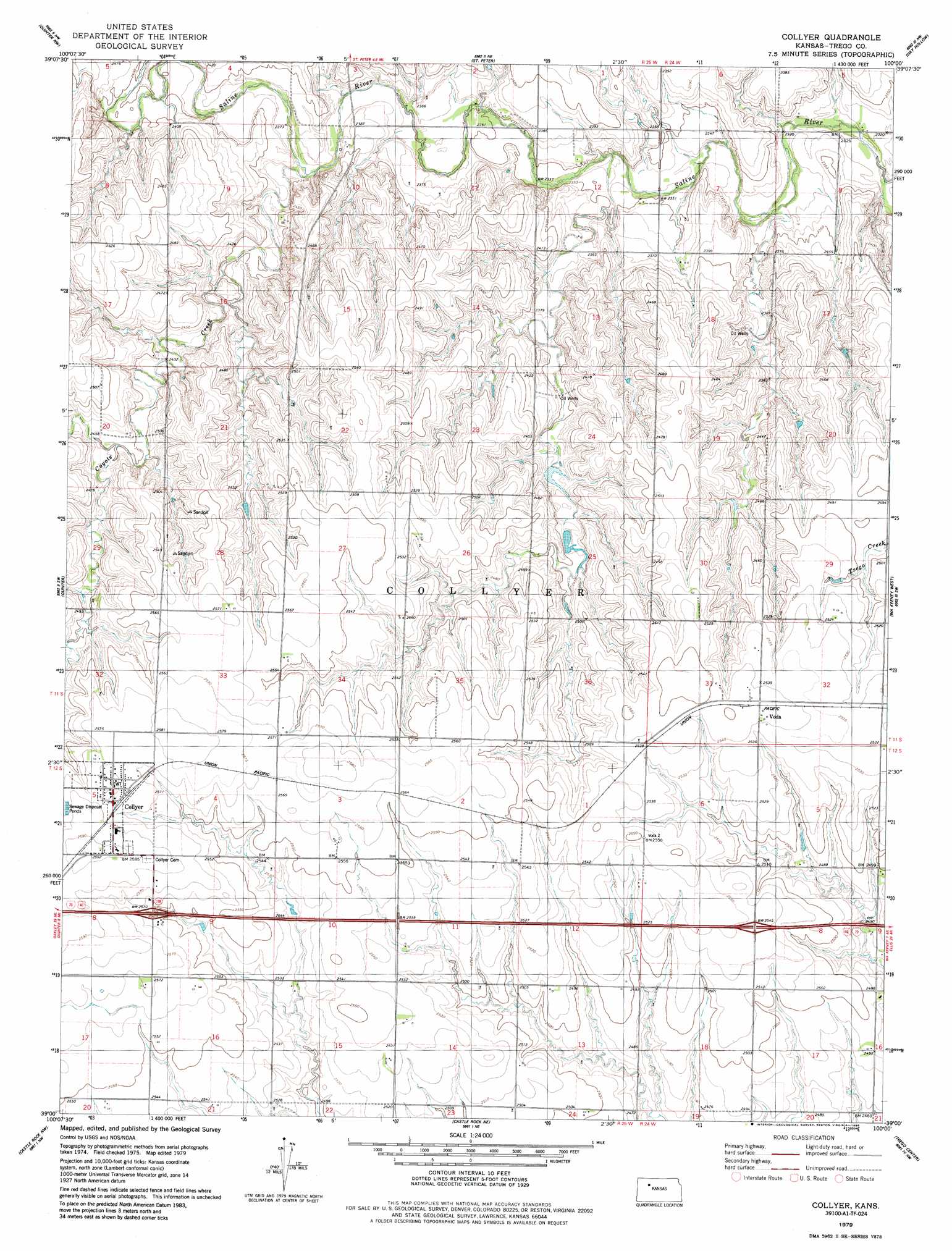
USGS Topo Quad 39100a1 - 1:24,000 scale
| Topo Map Name: | Collyer |
| USGS Topo Quad ID: | 39100a1 |
| Print Size: | ca. 21 1/4" wide x 27" high |
| Southeast Coordinates: | 39° N latitude / 100° W longitude |
| Map Center Coordinates: | 39.0625° N latitude / 100.0625° W longitude |
| U.S. State: | KS |
| Filename: | o39100a1.jpg |
| Download Map JPG Image: | Collyer topo map 1:24,000 scale |
| Map Type: | Topographic |
| Topo Series: | 7.5´ |
| Map Scale: | 1:24,000 |
| Source of Map Images: | United States Geological Survey (USGS) |
| Alternate Map Versions: |
Collyer KS 1979, updated 1979 Download PDF Buy paper map Collyer KS 1979, updated 1986 Download PDF Buy paper map Collyer KS 2009 Download PDF Buy paper map Collyer KS 2012 Download PDF Buy paper map Collyer KS 2015 Download PDF Buy paper map |
1:24,000 Topo Quads surrounding Collyer
Tasco |
Studley |
Morland |
Penokee |
Hill City South |
Midway Draw East |
Quinter Nw |
Saint Peter |
Hay Hollow |
Togo |
Park |
Quinter |
Collyer |
Wa Keeney West |
Wa Keeney East |
Gove Ne |
Castle Rock Nw |
Castle Rock Ne |
Trego Center |
Trego Center Ne |
Gove Se |
Castle Rock |
Gibson Creek |
Fort Downer |
Cedar Bluff |
> Back to 39100a1 at 1:100,000 scale
> Back to 39100a1 at 1:250,000 scale
> Back to U.S. Topo Maps home
Collyer topo map: Gazetteer
Collyer: Populated Places
Collyer elevation 787m 2582′Voda elevation 776m 2545′
Collyer: Streams
Coyote Creek elevation 722m 2368′Collyer digital topo map on disk
Buy this Collyer topo map showing relief, roads, GPS coordinates and other geographical features, as a high-resolution digital map file on DVD: