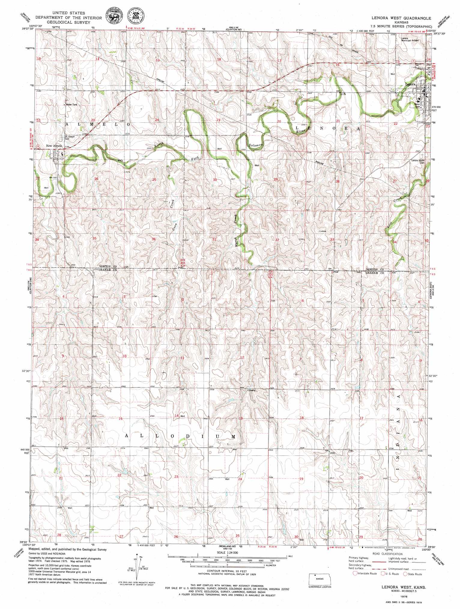
Lenora West Topo Map Kansas
To zoom in, hover over the map of Lenora West
USGS Topo Quad 39100e1 - 1:24,000 scale
| Topo Map Name: | Lenora West |
| USGS Topo Quad ID: | 39100e1 |
| Print Size: | ca. 21 1/4" wide x 27" high |
| Southeast Coordinates: | 39.5° N latitude / 100° W longitude |
| Map Center Coordinates: | 39.5625° N latitude / 100.0625° W longitude |
| U.S. State: | KS |
| Filename: | o39100e1.jpg |
| Download Map JPG Image: | Lenora West topo map 1:24,000 scale |
| Map Type: | Topographic |
| Topo Series: | 7.5´ |
| Map Scale: | 1:24,000 |
| Source of Map Images: | United States Geological Survey (USGS) |
| Alternate Map Versions: |
Lenora West KS 1978, updated 1979 Download PDF Buy paper map Lenora West KS 2010 Download PDF Buy paper map Lenora West KS 2012 Download PDF Buy paper map Lenora West KS 2015 Download PDF Buy paper map |
1:24,000 Topo Quads surrounding Lenora West
Kanona Se |
Norcatur |
Reager |
Norton |
Calvert |
Jennings |
Clayton |
Clayton Ne |
Edmond Nw |
Edmond |
Allison |
Clayton Sw |
Lenora West |
Lenora East |
Edmond Se |
Hoxie Ne |
Lucerne |
Morland Ne |
Hill City Nw |
Hill City North |
Tasco |
Studley |
Morland |
Penokee |
Hill City South |
> Back to 39100e1 at 1:100,000 scale
> Back to 39100a1 at 1:250,000 scale
> Back to U.S. Topo Maps home
Lenora West topo map: Gazetteer
Lenora West: Airports
Lenora Municipal Airfield elevation 700m 2296′Lenora West: Populated Places
Lenora elevation 692m 2270′New Almelo elevation 732m 2401′
Lenora West: Streams
Coon Creek elevation 709m 2326′Marsh Creek elevation 704m 2309′
Lenora West digital topo map on disk
Buy this Lenora West topo map showing relief, roads, GPS coordinates and other geographical features, as a high-resolution digital map file on DVD: