Devizes Topo Map Kansas
To zoom in, hover over the map of Devizes
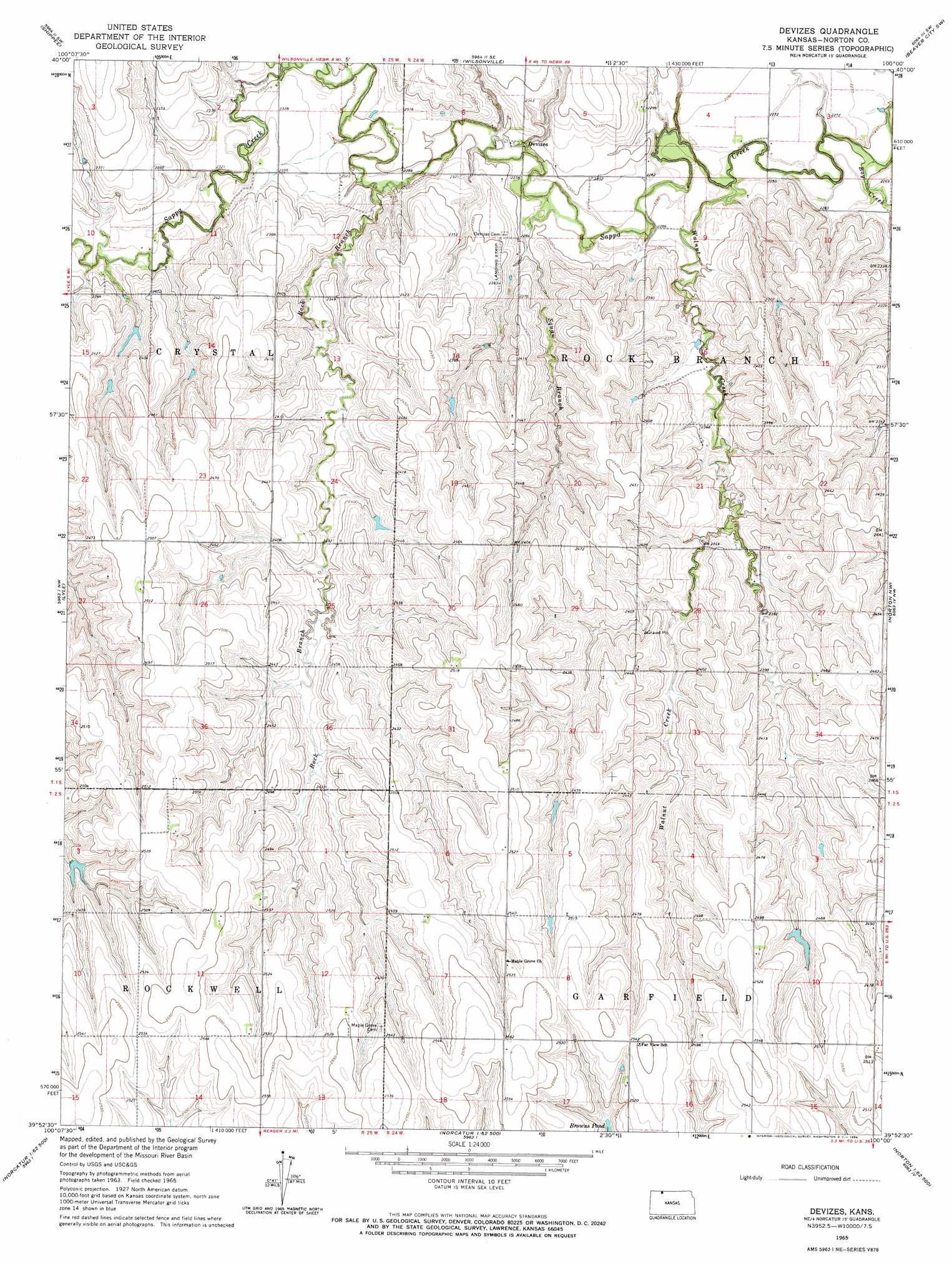
USGS Topo Quad 39100h1 - 1:24,000 scale
| Topo Map Name: | Devizes |
| USGS Topo Quad ID: | 39100h1 |
| Print Size: | ca. 21 1/4" wide x 27" high |
| Southeast Coordinates: | 39.875° N latitude / 100° W longitude |
| Map Center Coordinates: | 39.9375° N latitude / 100.0625° W longitude |
| U.S. State: | KS |
| Filename: | o39100h1.jpg |
| Download Map JPG Image: | Devizes topo map 1:24,000 scale |
| Map Type: | Topographic |
| Topo Series: | 7.5´ |
| Map Scale: | 1:24,000 |
| Source of Map Images: | United States Geological Survey (USGS) |
| Alternate Map Versions: |
Devizes KS 1965, updated 1966 Download PDF Buy paper map Devizes KS 2009 Download PDF Buy paper map Devizes KS 2012 Download PDF Buy paper map Devizes KS 2015 Download PDF Buy paper map |
1:24,000 Topo Quads surrounding Devizes
Danbury Ne |
Wilsonville Nw |
Wilsonville Ne |
Hendley |
Beaver City |
Lebanon |
Shippee |
Wilsonville |
Beaver City Sw |
Beaver City Se |
Kanona Ne |
Lyle |
Devizes |
Norton Nw |
Norton Ne |
Kanona Se |
Norcatur |
Reager |
Norton |
Calvert |
Jennings |
Clayton |
Clayton Ne |
Edmond Nw |
Edmond |
> Back to 39100e1 at 1:100,000 scale
> Back to 39100a1 at 1:250,000 scale
> Back to U.S. Topo Maps home
Devizes topo map: Gazetteer
Devizes: Populated Places
Devizes elevation 702m 2303′Devizes: Streams
Boy Creek elevation 683m 2240′Rock Branch elevation 695m 2280′
Squaw Branch elevation 690m 2263′
Walnut Creek elevation 686m 2250′
Wildcat Creek elevation 699m 2293′
Devizes digital topo map on disk
Buy this Devizes topo map showing relief, roads, GPS coordinates and other geographical features, as a high-resolution digital map file on DVD: