Goodland Nw Topo Map Kansas
To zoom in, hover over the map of Goodland Nw
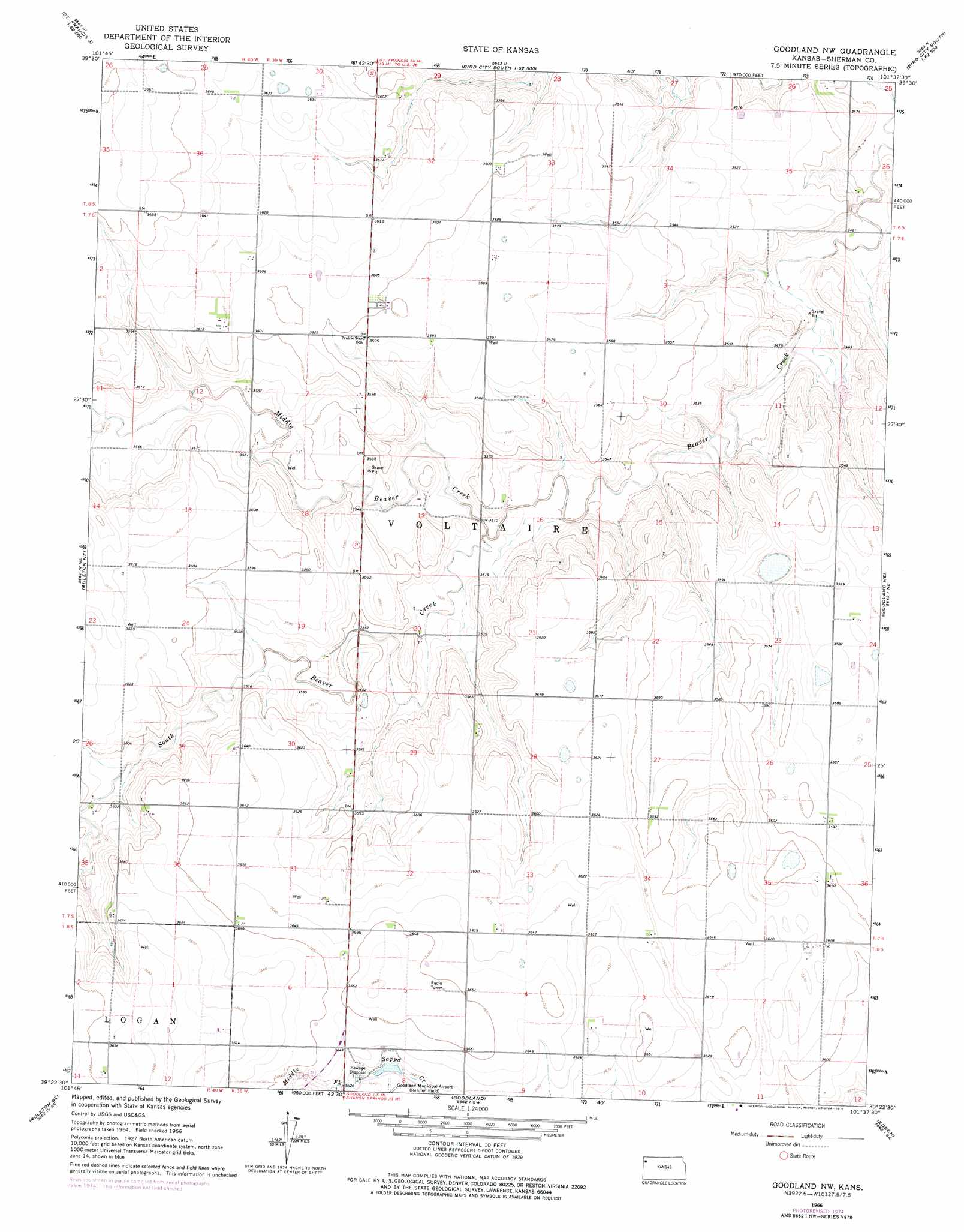
USGS Topo Quad 39101d6 - 1:24,000 scale
| Topo Map Name: | Goodland Nw |
| USGS Topo Quad ID: | 39101d6 |
| Print Size: | ca. 21 1/4" wide x 27" high |
| Southeast Coordinates: | 39.375° N latitude / 101.625° W longitude |
| Map Center Coordinates: | 39.4375° N latitude / 101.6875° W longitude |
| U.S. State: | KS |
| Filename: | o39101d6.jpg |
| Download Map JPG Image: | Goodland Nw topo map 1:24,000 scale |
| Map Type: | Topographic |
| Topo Series: | 7.5´ |
| Map Scale: | 1:24,000 |
| Source of Map Images: | United States Geological Survey (USGS) |
| Alternate Map Versions: |
Goodland NW KS 1966, updated 1967 Download PDF Buy paper map Goodland NW KS 1966, updated 1977 Download PDF Buy paper map Goodland NW KS 2009 Download PDF Buy paper map Goodland NW KS 2012 Download PDF Buy paper map Goodland NW KS 2015 Download PDF Buy paper map |
1:24,000 Topo Quads surrounding Goodland Nw
Crosby Creek |
Drury Creek |
Bird City South Nw |
Bird City South |
Dewey Ranch Nw |
Saint Francis 3 Sw |
Saint Francis 3 Se |
Bird City South Sw |
Bird City South Se |
Dewey Ranch Sw |
Ruleton Nw |
Ruleton Ne |
Goodland Nw |
Goodland Ne |
Brewster Nw |
Ruleton |
Ruleton Se |
Goodland |
Edson |
Brewster |
Horsethief Draw Nw |
Horsethief Draw Ne |
Wild Horse Draw |
Harris Draw Ne |
Mcallaster Nw |
> Back to 39101a1 at 1:100,000 scale
> Back to 39100a1 at 1:250,000 scale
> Back to U.S. Topo Maps home
Goodland Nw topo map: Gazetteer
Goodland Nw: Streams
Middle Beaver Creek elevation 1067m 3500′South Beaver Creek elevation 1067m 3500′
Goodland Nw digital topo map on disk
Buy this Goodland Nw topo map showing relief, roads, GPS coordinates and other geographical features, as a high-resolution digital map file on DVD: