Ramah North Topo Map Colorado
To zoom in, hover over the map of Ramah North
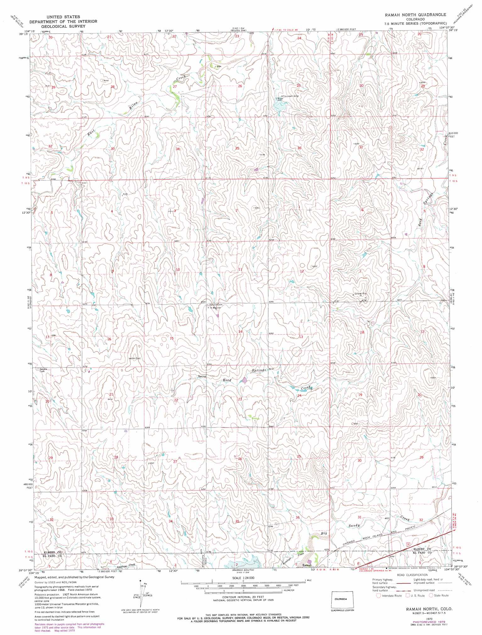
USGS Topo Quad 39104b2 - 1:24,000 scale
| Topo Map Name: | Ramah North |
| USGS Topo Quad ID: | 39104b2 |
| Print Size: | ca. 21 1/4" wide x 27" high |
| Southeast Coordinates: | 39.125° N latitude / 104.125° W longitude |
| Map Center Coordinates: | 39.1875° N latitude / 104.1875° W longitude |
| U.S. State: | CO |
| Filename: | o39104b2.jpg |
| Download Map JPG Image: | Ramah North topo map 1:24,000 scale |
| Map Type: | Topographic |
| Topo Series: | 7.5´ |
| Map Scale: | 1:24,000 |
| Source of Map Images: | United States Geological Survey (USGS) |
| Alternate Map Versions: |
Ramah North CO 1970, updated 1973 Download PDF Buy paper map Ramah North CO 1970, updated 1973 Download PDF Buy paper map Ramah North CO 1970, updated 1979 Download PDF Buy paper map Ramah North CO 2010 Download PDF Buy paper map Ramah North CO 2013 Download PDF Buy paper map Ramah North CO 2016 Download PDF Buy paper map |
1:24,000 Topo Quads surrounding Ramah North
Kiowa Nw |
Kiowa Ne |
Bijou |
Cattle Gulch |
Agate |
Kiowa |
Big Gulch |
Bijou Sw |
Kuhns Crossing |
Beuck Draw |
Bijou Basin |
Fondis |
Ramah North |
Simla |
Matheson |
Peyton |
Calhan |
Ramah South |
Alta Vista |
Matheson Sw |
Haegler Ranch |
Holcolm Hills |
Rush Nw |
Holtwold Store |
Kutch Nw |
> Back to 39104a1 at 1:100,000 scale
> Back to 39104a1 at 1:250,000 scale
> Back to U.S. Topo Maps home
Ramah North topo map: Gazetteer
Ramah North: Dams
Joseph Sproch Number 1 Dam elevation 1904m 6246′Ramah North: Reservoirs
Sproch Reservoir Number 1 elevation 1904m 6246′Ramah North: Streams
Antelope Creek elevation 1851m 6072′Ramah North digital topo map on disk
Buy this Ramah North topo map showing relief, roads, GPS coordinates and other geographical features, as a high-resolution digital map file on DVD: