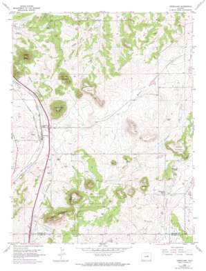
Greenland Topo Map Colorado
To zoom in, hover over the map of Greenland
USGS Topo Quad 39104b7 - 1:24,000 scale
| Topo Map Name: | Greenland |
| USGS Topo Quad ID: | 39104b7 |
| Print Size: | ca. 21 1/4" wide x 27" high |
| Southeast Coordinates: | 39.125° N latitude / 104.75° W longitude |
| Map Center Coordinates: | 39.1875° N latitude / 104.8125° W longitude |
| U.S. State: | CO |
| Filename: | o39104b7.jpg |
| Download Map JPG Image: | Greenland topo map 1:24,000 scale |
| Map Type: | Topographic |
| Topo Series: | 7.5´ |
| Map Scale: | 1:24,000 |
| Source of Map Images: | United States Geological Survey (USGS) |
| Alternate Map Versions: |
Greenland CO 1954, updated 1955 Download PDF Buy paper map Greenland CO 1954, updated 1955 Download PDF Buy paper map Greenland CO 1954, updated 1969 Download PDF Buy paper map Greenland CO 1954, updated 1971 Download PDF Buy paper map Greenland CO 1954, updated 1971 Download PDF Buy paper map Greenland CO 1954, updated 1974 Download PDF Buy paper map Greenland CO 2010 Download PDF Buy paper map Greenland CO 2013 Download PDF Buy paper map Greenland CO 2016 Download PDF Buy paper map |
1:24,000 Topo Quads surrounding Greenland
> Back to 39104a1 at 1:100,000 scale
> Back to 39104a1 at 1:250,000 scale
> Back to U.S. Topo Maps home
Greenland topo map: Gazetteer
Greenland: Dams
Allis Dam elevation 2216m 7270′Franktown Parker FPA-4 Dam elevation 2170m 7119′
Franktown Parker FPA-5 Dam elevation 2101m 6893′
West Cherry Creek Detention Number 7 Dam elevation 2164m 7099′
West Cherry Creek Detention Number 9 Dam elevation 2165m 7103′
Greenland: Populated Places
Greenland elevation 2105m 6906′Greenland: Reservoirs
Allis Reservoir elevation 2216m 7270′Franktown Parker FPA-4 Reservoir elevation 2170m 7119′
Franktown Parker FPA-5 Reservoir elevation 2101m 6893′
West Cherry Creek Detention Number 7 Reservoir elevation 2164m 7099′
West Cherry Creek Detention Number 9 Reservoir elevation 2165m 7103′
Greenland: Streams
Elk Creek elevation 2149m 7050′Haskel Creek elevation 2089m 6853′
Greenland: Summits
Bald Mountain elevation 2404m 7887′Best Butte elevation 2297m 7536′
Corner Mountain elevation 2271m 7450′
Larkspur Butte elevation 2291m 7516′
Lincoln Mountain elevation 2254m 7395′
Nemrick Butte elevation 2279m 7477′
Rattlesnake Butte elevation 2307m 7568′
True Mountain elevation 2374m 7788′
Greenland digital topo map on disk
Buy this Greenland topo map showing relief, roads, GPS coordinates and other geographical features, as a high-resolution digital map file on DVD:


