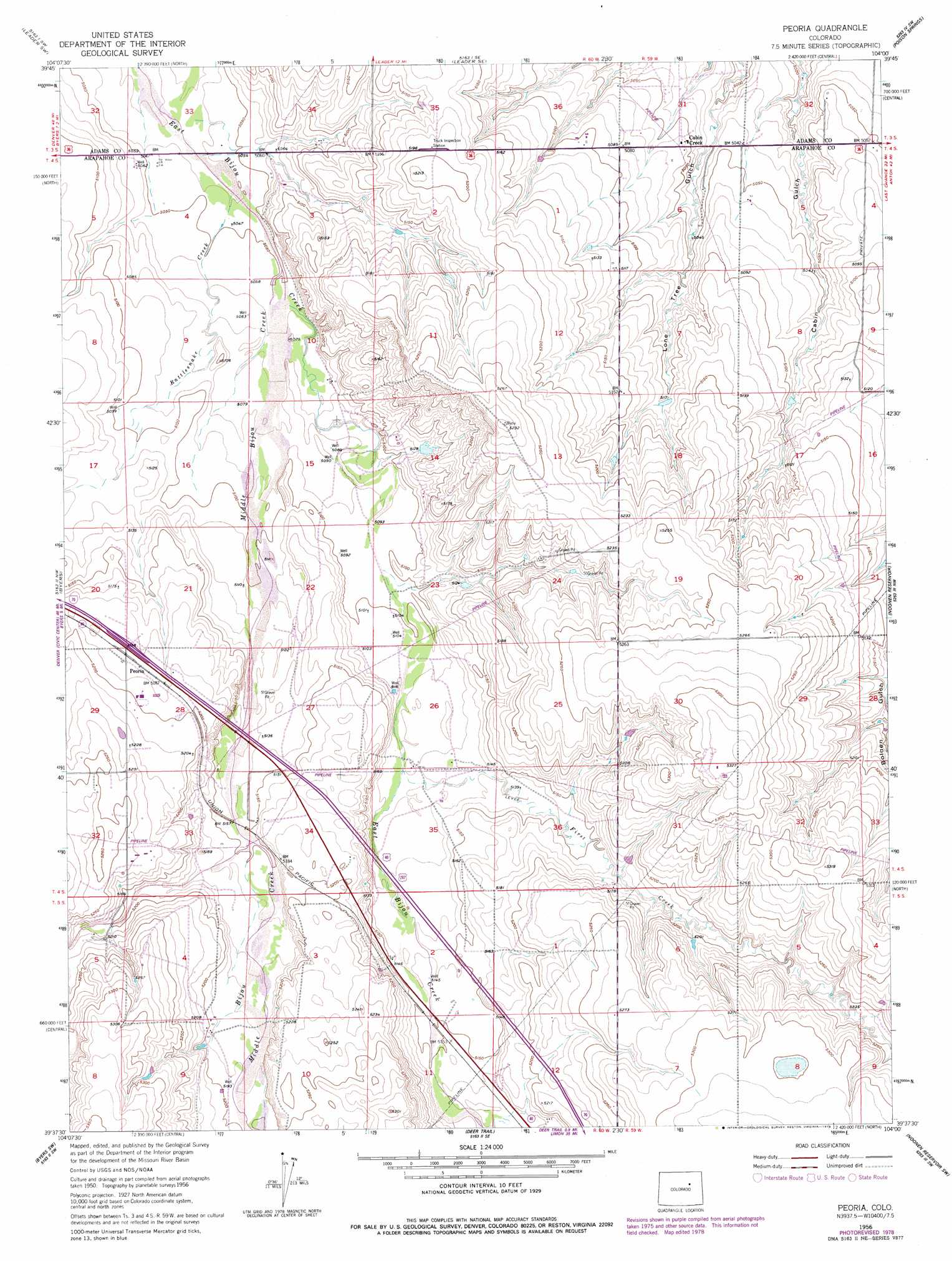
Peoria Topo Map Colorado
To zoom in, hover over the map of Peoria
USGS Topo Quad 39104f1 - 1:24,000 scale
| Topo Map Name: | Peoria |
| USGS Topo Quad ID: | 39104f1 |
| Print Size: | ca. 21 1/4" wide x 27" high |
| Southeast Coordinates: | 39.625° N latitude / 104° W longitude |
| Map Center Coordinates: | 39.6875° N latitude / 104.0625° W longitude |
| U.S. State: | CO |
| Filename: | o39104f1.jpg |
| Download Map JPG Image: | Peoria topo map 1:24,000 scale |
| Map Type: | Topographic |
| Topo Series: | 7.5´ |
| Map Scale: | 1:24,000 |
| Source of Map Images: | United States Geological Survey (USGS) |
| Alternate Map Versions: |
Peoria CO 1956, updated 1957 Download PDF Buy paper map Peoria CO 1956, updated 1957 Download PDF Buy paper map Peoria CO 1956, updated 1975 Download PDF Buy paper map Peoria CO 1956, updated 1979 Download PDF Buy paper map Peoria CO 2010 Download PDF Buy paper map Peoria CO 2013 Download PDF Buy paper map Peoria CO 2016 Download PDF Buy paper map |
1:24,000 Topo Quads surrounding Peoria
Living Springs |
Leader Nw |
Leader |
Potty Brown Creek |
Shamrock |
Roper School |
Leader Sw |
Leader Se |
Poison Springs |
Shamrock Se |
Strasburg |
Byers |
Peoria |
Noonen Reservoir |
Cottonwood Valley North |
Strasburg Se |
Byers Sw |
Deer Trail |
Noonen Reservoir Sw |
Cottonwood Valley South |
Kiowa Ne |
Bijou |
Cattle Gulch |
Agate |
Barking Dog Spring |
> Back to 39104e1 at 1:100,000 scale
> Back to 39104a1 at 1:250,000 scale
> Back to U.S. Topo Maps home
Peoria topo map: Gazetteer
Peoria: Populated Places
Cabin Creek elevation 1543m 5062′Peoria elevation 1582m 5190′
Peoria: Streams
First Creek elevation 1559m 5114′Middle Bijou Creek elevation 1541m 5055′
Rattlesnake Creek elevation 1537m 5042′
Peoria digital topo map on disk
Buy this Peoria topo map showing relief, roads, GPS coordinates and other geographical features, as a high-resolution digital map file on DVD: