Watkins Topo Map Colorado
To zoom in, hover over the map of Watkins
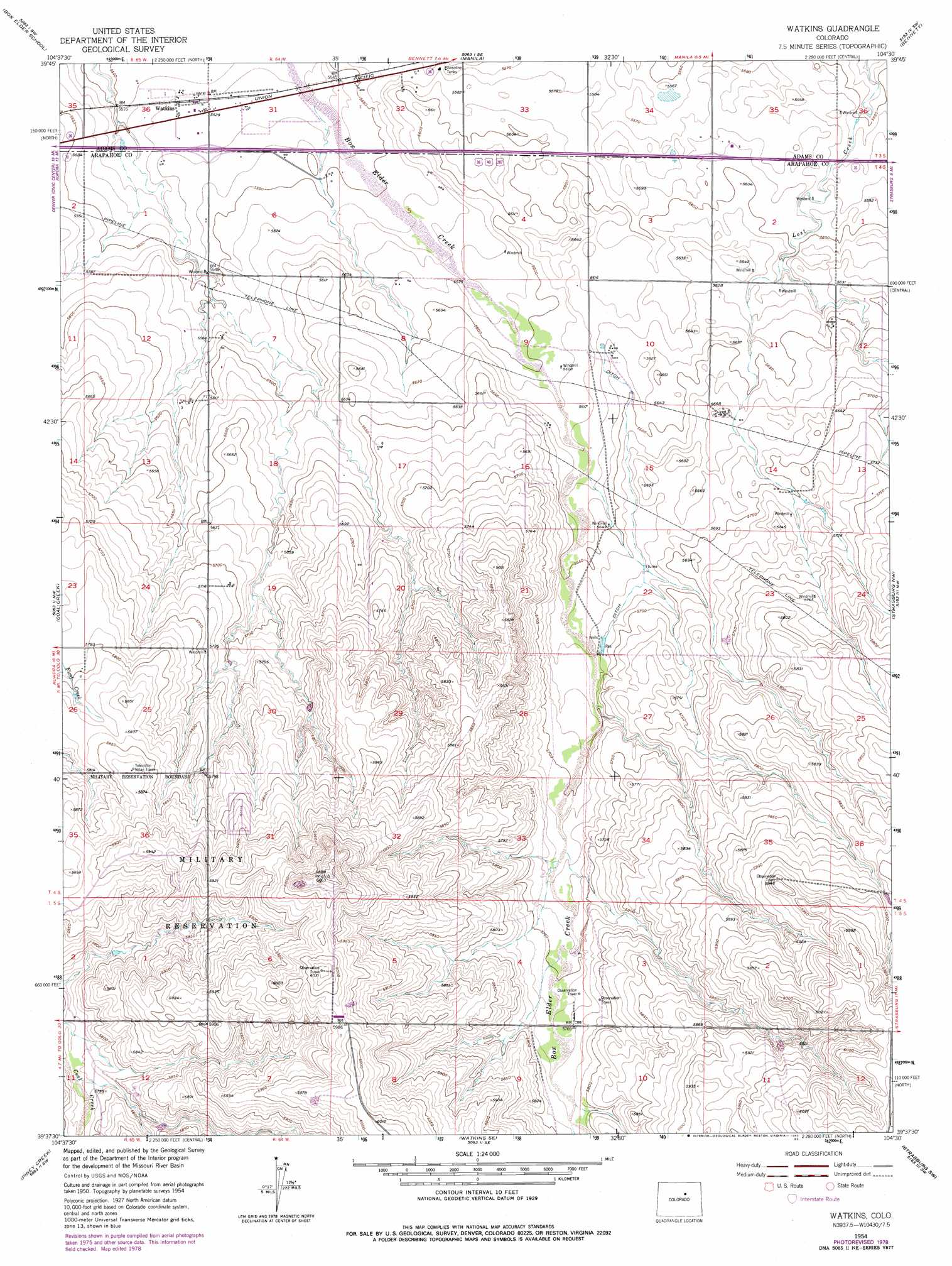
USGS Topo Quad 39104f5 - 1:24,000 scale
| Topo Map Name: | Watkins |
| USGS Topo Quad ID: | 39104f5 |
| Print Size: | ca. 21 1/4" wide x 27" high |
| Southeast Coordinates: | 39.625° N latitude / 104.5° W longitude |
| Map Center Coordinates: | 39.6875° N latitude / 104.5625° W longitude |
| U.S. State: | CO |
| Filename: | o39104f5.jpg |
| Download Map JPG Image: | Watkins topo map 1:24,000 scale |
| Map Type: | Topographic |
| Topo Series: | 7.5´ |
| Map Scale: | 1:24,000 |
| Source of Map Images: | United States Geological Survey (USGS) |
| Alternate Map Versions: |
Watkins CO 1954, updated 1956 Download PDF Buy paper map Watkins CO 1954, updated 1956 Download PDF Buy paper map Watkins CO 1954, updated 1967 Download PDF Buy paper map Watkins CO 1954, updated 1967 Download PDF Buy paper map Watkins CO 1954, updated 1980 Download PDF Buy paper map Watkins CO 1954, updated 1985 Download PDF Buy paper map Watkins CO 1954, updated 1985 Download PDF Buy paper map Watkins CO 2010 Download PDF Buy paper map Watkins CO 2013 Download PDF Buy paper map Watkins CO 2016 Download PDF Buy paper map |
1:24,000 Topo Quads surrounding Watkins
Brighton |
Mile High Lakes |
Horse Creek |
Sunnydale |
Living Springs |
Sable |
Box Elder School |
Manila |
Bennett |
Roper School |
Fitzsimons |
Coal Creek |
Watkins |
Strasburg Nw |
Strasburg |
Parker |
Piney Creek |
Watkins Se |
Strasburg Sw |
Strasburg Se |
Castle Rock North |
Ponderosa Park |
Cabin Gulch |
Kiowa Nw |
Kiowa Ne |
> Back to 39104e1 at 1:100,000 scale
> Back to 39104a1 at 1:250,000 scale
> Back to U.S. Topo Maps home
Watkins topo map: Gazetteer
Watkins: Airports
Harrington Ranch Airport elevation 1822m 5977′Watkins: Populated Places
Watkins elevation 1684m 5524′Watkins digital topo map on disk
Buy this Watkins topo map showing relief, roads, GPS coordinates and other geographical features, as a high-resolution digital map file on DVD: