Leader Se Topo Map Colorado
To zoom in, hover over the map of Leader Se
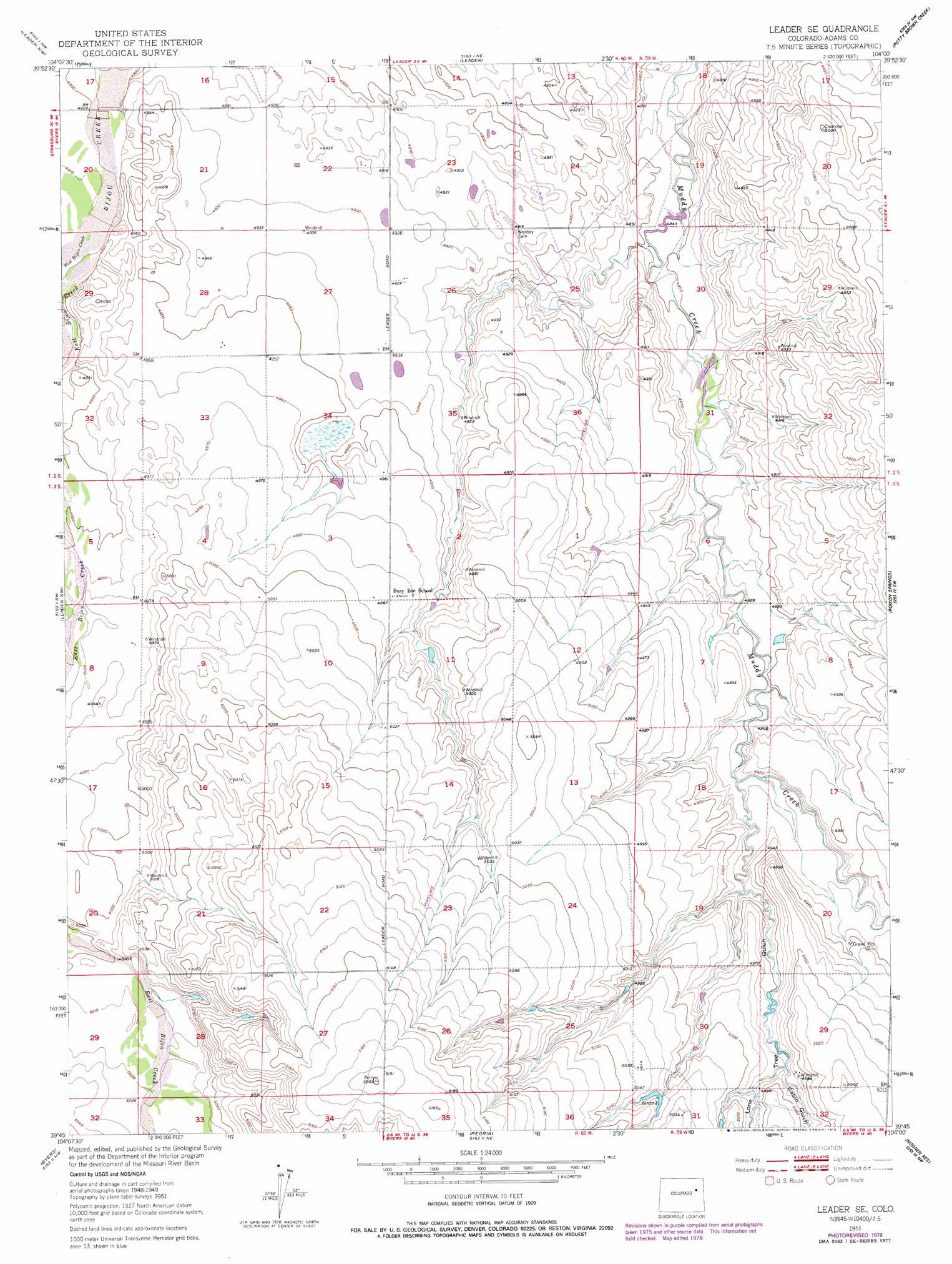
USGS Topo Quad 39104g1 - 1:24,000 scale
| Topo Map Name: | Leader Se |
| USGS Topo Quad ID: | 39104g1 |
| Print Size: | ca. 21 1/4" wide x 27" high |
| Southeast Coordinates: | 39.75° N latitude / 104° W longitude |
| Map Center Coordinates: | 39.8125° N latitude / 104.0625° W longitude |
| U.S. State: | CO |
| Filename: | o39104g1.jpg |
| Download Map JPG Image: | Leader Se topo map 1:24,000 scale |
| Map Type: | Topographic |
| Topo Series: | 7.5´ |
| Map Scale: | 1:24,000 |
| Source of Map Images: | United States Geological Survey (USGS) |
| Alternate Map Versions: |
Leader SE CO 1951, updated 1953 Download PDF Buy paper map Leader SE CO 1951, updated 1969 Download PDF Buy paper map Leader SE CO 1951, updated 1969 Download PDF Buy paper map Leader SE CO 1951, updated 1979 Download PDF Buy paper map Leader SE CO 2010 Download PDF Buy paper map Leader SE CO 2013 Download PDF Buy paper map Leader SE CO 2016 Download PDF Buy paper map |
1:24,000 Topo Quads surrounding Leader Se
South Roggen |
Wiggins Sw |
Hoyt |
Adena |
Vallery Se |
Living Springs |
Leader Nw |
Leader |
Potty Brown Creek |
Shamrock |
Roper School |
Leader Sw |
Leader Se |
Poison Springs |
Shamrock Se |
Strasburg |
Byers |
Peoria |
Noonen Reservoir |
Cottonwood Valley North |
Strasburg Se |
Byers Sw |
Deer Trail |
Noonen Reservoir Sw |
Cottonwood Valley South |
> Back to 39104e1 at 1:100,000 scale
> Back to 39104a1 at 1:250,000 scale
> Back to U.S. Topo Maps home
Leader Se topo map: Gazetteer
Leader Se: Dams
Bramkamp Dam elevation 1482m 4862′No Name 1-1 Number 1 Dam elevation 1477m 4845′
Leader Se: Reservoirs
Bramkamp Reservoir elevation 1482m 4862′No Name 1-1 Number 1 Reservoir elevation 1477m 4845′
Leader Se: Streams
East Bijou Creek elevation 1497m 4911′West Bijou Creek elevation 1497m 4911′
Leader Se: Valleys
Cabin Gulch elevation 1514m 4967′Lone Tree Gulch elevation 1497m 4911′
Leader Se digital topo map on disk
Buy this Leader Se topo map showing relief, roads, GPS coordinates and other geographical features, as a high-resolution digital map file on DVD: