Leader Sw Topo Map Colorado
To zoom in, hover over the map of Leader Sw
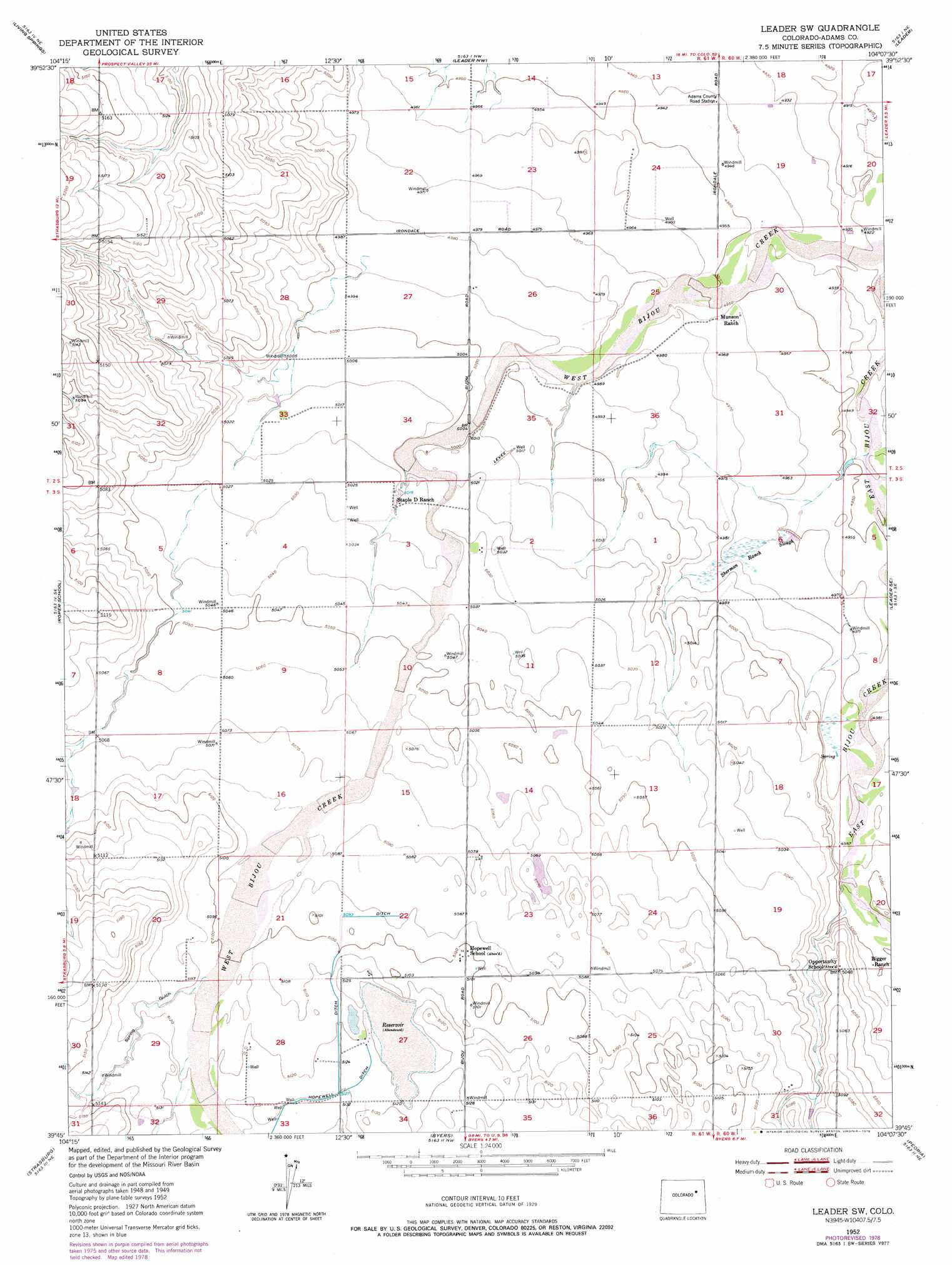
USGS Topo Quad 39104g2 - 1:24,000 scale
| Topo Map Name: | Leader Sw |
| USGS Topo Quad ID: | 39104g2 |
| Print Size: | ca. 21 1/4" wide x 27" high |
| Southeast Coordinates: | 39.75° N latitude / 104.125° W longitude |
| Map Center Coordinates: | 39.8125° N latitude / 104.1875° W longitude |
| U.S. State: | CO |
| Filename: | o39104g2.jpg |
| Download Map JPG Image: | Leader Sw topo map 1:24,000 scale |
| Map Type: | Topographic |
| Topo Series: | 7.5´ |
| Map Scale: | 1:24,000 |
| Source of Map Images: | United States Geological Survey (USGS) |
| Alternate Map Versions: |
Leader SW CO 1952, updated 1953 Download PDF Buy paper map Leader SW CO 1952, updated 1973 Download PDF Buy paper map Leader SW CO 1952, updated 1979 Download PDF Buy paper map Leader SW CO 2010 Download PDF Buy paper map Leader SW CO 2013 Download PDF Buy paper map Leader SW CO 2016 Download PDF Buy paper map |
1:24,000 Topo Quads surrounding Leader Sw
Prospect Valley |
South Roggen |
Wiggins Sw |
Hoyt |
Adena |
Sunnydale |
Living Springs |
Leader Nw |
Leader |
Potty Brown Creek |
Bennett |
Roper School |
Leader Sw |
Leader Se |
Poison Springs |
Strasburg Nw |
Strasburg |
Byers |
Peoria |
Noonen Reservoir |
Strasburg Sw |
Strasburg Se |
Byers Sw |
Deer Trail |
Noonen Reservoir Sw |
> Back to 39104e1 at 1:100,000 scale
> Back to 39104a1 at 1:250,000 scale
> Back to U.S. Topo Maps home
Leader Sw topo map: Gazetteer
Leader Sw: Airports
Singleton Ranch Airport elevation 1506m 4940′Leader Sw: Canals
Hopewell Ditch elevation 1564m 5131′Leader Sw: Streams
Sherman Ranch Slough elevation 1506m 4940′Leader Sw: Valleys
Spring Gulch elevation 1557m 5108′Leader Sw digital topo map on disk
Buy this Leader Sw topo map showing relief, roads, GPS coordinates and other geographical features, as a high-resolution digital map file on DVD: