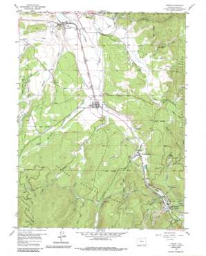
Fraser Topo Map Colorado
To zoom in, hover over the map of Fraser
USGS Topo Quad 39105h7 - 1:24,000 scale
| Topo Map Name: | Fraser |
| USGS Topo Quad ID: | 39105h7 |
| Print Size: | ca. 21 1/4" wide x 27" high |
| Southeast Coordinates: | 39.875° N latitude / 105.75° W longitude |
| Map Center Coordinates: | 39.9375° N latitude / 105.8125° W longitude |
| U.S. State: | CO |
| Filename: | o39105h7.jpg |
| Download Map JPG Image: | Fraser topo map 1:24,000 scale |
| Map Type: | Topographic |
| Topo Series: | 7.5´ |
| Map Scale: | 1:24,000 |
| Source of Map Images: | United States Geological Survey (USGS) |
| Alternate Map Versions: |
Fraser CO 1957, updated 1959 Download PDF Buy paper map Fraser CO 1957, updated 1963 Download PDF Buy paper map Fraser CO 1957, updated 1963 Download PDF Buy paper map Fraser CO 1957, updated 1972 Download PDF Buy paper map Fraser CO 1957, updated 1988 Download PDF Buy paper map Fraser CO 2011 Download PDF Buy paper map Fraser CO 2013 Download PDF Buy paper map Fraser CO 2016 Download PDF Buy paper map |
| FStopo: | US Forest Service topo Fraser is available: Download FStopo PDF Download FStopo TIF |
1:24,000 Topo Quads surrounding Fraser
> Back to 39105e1 at 1:100,000 scale
> Back to 39104a1 at 1:250,000 scale
> Back to U.S. Topo Maps home
Fraser topo map: Gazetteer
Fraser: Airports
Winter Park Highlands Airport elevation 2578m 8458′Fraser: Canals
Crooked Creek Number 1 Ditch elevation 2623m 8605′Crooked Creek Supply Ditch elevation 2696m 8845′
Saint Louis Ditch elevation 2634m 8641′
Saint Louis Number 2 Ditch elevation 2668m 8753′
Fraser: Populated Places
Fraser elevation 2615m 8579′Hideaway Park elevation 2681m 8795′
Maryvale elevation 2653m 8704′
Tabernash elevation 2540m 8333′
Winter Park elevation 2759m 9051′
Fraser: Post Offices
Fraser Post Office elevation 2607m 8553′Winter Park Post Office elevation 2675m 8776′
Fraser: Reservoirs
Lutz Reservoir elevation 2690m 8825′Fraser: Springs
Arrow Spring elevation 2922m 9586′Fraser: Streams
Buck Creek elevation 2753m 9032′Cabin Creek elevation 2589m 8494′
Cooper Creek elevation 2737m 8979′
Cub Creek elevation 2743m 8999′
East Elk Creek elevation 2827m 9274′
Elk Creek elevation 2600m 8530′
Hamilton Creek elevation 2589m 8494′
Hurd Creek elevation 2554m 8379′
Jim Creek elevation 2799m 9183′
King Creek elevation 2731m 8959′
Little Cabin Creek elevation 2597m 8520′
Little Vasques Creek elevation 2733m 8966′
Mary Jane Creek elevation 2794m 9166′
Meadow Creek elevation 2543m 8343′
Middle Fork Ranch Creek elevation 2680m 8792′
Pole Creek elevation 2543m 8343′
Ranch Creek elevation 2539m 8330′
Saint Louis Creek elevation 2598m 8523′
Silver Creek elevation 2532m 8307′
Skunk Creek elevation 2568m 8425′
South Fork Ranch Creek elevation 2656m 8713′
Spring Branch elevation 2616m 8582′
Trail Creek elevation 2572m 8438′
Vasquez Creek elevation 2661m 8730′
West Elk Creek elevation 2690m 8825′
Wolverine Creek elevation 2688m 8818′
Fraser: Summits
Marker Hill elevation 2755m 9038′Fraser: Tunnels
Arrow Tunnel elevation 2965m 9727′Fraser: Wells
Arrow Well elevation 2948m 9671′Fraser digital topo map on disk
Buy this Fraser topo map showing relief, roads, GPS coordinates and other geographical features, as a high-resolution digital map file on DVD:


