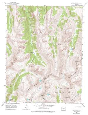
Mount Champion Topo Map Colorado
To zoom in, hover over the map of Mount Champion
USGS Topo Quad 39106b5 - 1:24,000 scale
| Topo Map Name: | Mount Champion |
| USGS Topo Quad ID: | 39106b5 |
| Print Size: | ca. 21 1/4" wide x 27" high |
| Southeast Coordinates: | 39.125° N latitude / 106.5° W longitude |
| Map Center Coordinates: | 39.1875° N latitude / 106.5625° W longitude |
| U.S. State: | CO |
| Filename: | o39106b5.jpg |
| Download Map JPG Image: | Mount Champion topo map 1:24,000 scale |
| Map Type: | Topographic |
| Topo Series: | 7.5´ |
| Map Scale: | 1:24,000 |
| Source of Map Images: | United States Geological Survey (USGS) |
| Alternate Map Versions: |
Mount Champion CO 1960, updated 1964 Download PDF Buy paper map Mount Champion CO 1960, updated 1968 Download PDF Buy paper map Mount Champion CO 1960, updated 1968 Download PDF Buy paper map Mount Champion CO 1960, updated 1978 Download PDF Buy paper map Mount Champion CO 1994, updated 1998 Download PDF Buy paper map Mount Champion CO 2011 Download PDF Buy paper map Mount Champion CO 2013 Download PDF Buy paper map Mount Champion CO 2016 Download PDF Buy paper map |
| FStopo: | US Forest Service topo Mount Champion is available: Download FStopo PDF Download FStopo TIF |
1:24,000 Topo Quads surrounding Mount Champion
> Back to 39106a1 at 1:100,000 scale
> Back to 39106a1 at 1:250,000 scale
> Back to U.S. Topo Maps home
Mount Champion topo map: Gazetteer
Mount Champion: Gaps
South Fork Pass elevation 3604m 11824′Mount Champion: Lakes
Blue Lake elevation 3811m 12503′Deadman Lake elevation 3342m 10964′
Fryingpan Lakes elevation 3360m 11023′
Granite Lakes elevation 3523m 11558′
Independence Lake elevation 3809m 12496′
Linkins Lake elevation 3662m 12014′
Lost Man Lake elevation 3797m 12457′
Scott Lake elevation 3666m 12027′
Sioux Lake elevation 3689m 12103′
Mount Champion: Mines
Champion Mine elevation 3894m 12775′Eureka Mine elevation 3762m 12342′
Mount Champion: Ranges
Williams Mountains elevation 4070m 13353′Mount Champion: Reservoirs
Lost Man Reservoir elevation 3235m 10613′Mount Champion: Streams
Jack Creek elevation 3290m 10793′Marten Creek elevation 3032m 9947′
Mount Champion: Summits
Deer Mountain elevation 4174m 13694′Geissler Mountain elevation 4052m 13293′
Mount Champion elevation 4154m 13628′
Mount Oklahoma elevation 4213m 13822′
Twining Peak elevation 4155m 13631′
Mount Champion: Tunnels
South Fork Tunnel elevation 3511m 11519′Mount Champion: Valleys
Deadman Gulch elevation 3342m 10964′Mount Champion digital topo map on disk
Buy this Mount Champion topo map showing relief, roads, GPS coordinates and other geographical features, as a high-resolution digital map file on DVD:


