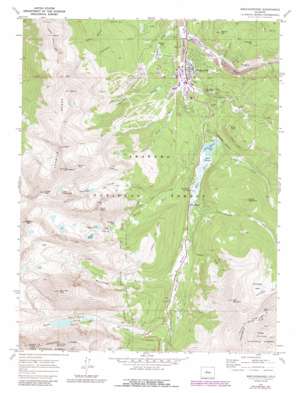
Breckenridge Topo Map Colorado
To zoom in, hover over the map of Breckenridge
USGS Topo Quad 39106d1 - 1:24,000 scale
| Topo Map Name: | Breckenridge |
| USGS Topo Quad ID: | 39106d1 |
| Print Size: | ca. 21 1/4" wide x 27" high |
| Southeast Coordinates: | 39.375° N latitude / 106° W longitude |
| Map Center Coordinates: | 39.4375° N latitude / 106.0625° W longitude |
| U.S. State: | CO |
| Filename: | o39106d1.jpg |
| Download Map JPG Image: | Breckenridge topo map 1:24,000 scale |
| Map Type: | Topographic |
| Topo Series: | 7.5´ |
| Map Scale: | 1:24,000 |
| Source of Map Images: | United States Geological Survey (USGS) |
| Alternate Map Versions: |
Breckenridge CO 1970, updated 1973 Download PDF Buy paper map Breckenridge CO 1970, updated 1973 Download PDF Buy paper map Breckenridge CO 1970, updated 1988 Download PDF Buy paper map Breckenridge CO 2011 Download PDF Buy paper map Breckenridge CO 2013 Download PDF Buy paper map Breckenridge CO 2016 Download PDF Buy paper map |
| FStopo: | US Forest Service topo Breckenridge is available: Download FStopo PDF Download FStopo TIF |
1:24,000 Topo Quads surrounding Breckenridge
> Back to 39106a1 at 1:100,000 scale
> Back to 39106a1 at 1:250,000 scale
> Back to U.S. Topo Maps home
Breckenridge topo map: Gazetteer
Breckenridge: Airports
Overlook Athletic Club Heliport elevation 3069m 10068′Breckenridge: Basins
Horseshoe Basin elevation 3668m 12034′Breckenridge: Cliffs
Rocky Point elevation 3175m 10416′Breckenridge: Dams
Goose Pasture Dam elevation 3014m 9888′Sawmill Dam elevation 3030m 9940′
Upper Blue Dam elevation 3998m 13116′
Breckenridge: Lakes
Lower Crystal Lake elevation 3656m 11994′Lower Mohawk Lake elevation 3606m 11830′
Mayflower Lakes elevation 3465m 11368′
Mohawk Lake elevation 3685m 12089′
Pacific Tarn elevation 4095m 13435′
Upper Crystal Lake elevation 3925m 12877′
Breckenridge: Mines
Breckenridge Mine elevation 3559m 11676′Briar Rose Mine elevation 3994m 13103′
Cally Mine elevation 3107m 10193′
Commodore Placer Mine elevation 3040m 9973′
Dewey Mine elevation 3116m 10223′
Excelsior Mine elevation 3218m 10557′
Gold Nugget Placer Mine elevation 3076m 10091′
Governor Mine elevation 3189m 10462′
Harrison Tunnel Mine elevation 3026m 9927′
Hendrix Gold Mining Property Mine elevation 3150m 10334′
Hunter Mine elevation 2939m 9642′
Leadville Land District Mine elevation 3047m 9996′
Lone Bug Mine elevation 3186m 10452′
Maxwell Mine elevation 3050m 10006′
Monitor Mine elevation 3197m 10488′
Monte Cristo Mine elevation 3293m 10803′
Navy Mine elevation 3485m 11433′
Nickel Plate Mine elevation 3180m 10433′
Pacific-Gold Dust Mine elevation 3089m 10134′
Palmer Pit elevation 2939m 9642′
Player Mine elevation 3058m 10032′
Puzzle Ouray Mine elevation 3174m 10413′
Red Wing Mine elevation 3075m 10088′
Royal Gorge Mine elevation 3485m 11433′
Siam Mountain Mine elevation 3023m 9917′
Silence Mine elevation 3050m 10006′
Standard Number One Mine elevation 3145m 10318′
Wellington Mine elevation 3020m 9908′
Willard Mine elevation 3176m 10419′
Breckenridge: Populated Places
Blue River elevation 3059m 10036′Breckenridge elevation 2965m 9727′
Peak Seven West elevation 3016m 9895′
Preston (historical) elevation 3161m 10370′
Tordal Estates elevation 3247m 10652′
Breckenridge: Ranges
Tenmile Range elevation 3865m 12680′Breckenridge: Reservoirs
Blue Lakes elevation 3475m 11400′Goose Pasture Tarn elevation 3014m 9888′
Sawmill Reservoir elevation 3030m 9940′
Upper Blue Reservoir elevation 3998m 13116′
Breckenridge: Ridges
Hoosier Ridge elevation 4067m 13343′Breckenridge: Springs
Blue Rock Spring elevation 3049m 10003′Breckenridge: Streams
Bemrose Creek elevation 3214m 10544′Crystal Creek elevation 3195m 10482′
Cucumber Creek elevation 2910m 9547′
Indiana Creek elevation 3014m 9888′
Monte Cristo Creek elevation 3176m 10419′
Pennsylvania Creek elevation 3097m 10160′
Quandary Creek elevation 3135m 10285′
Spruce Creek elevation 3030m 9940′
Breckenridge: Summits
Barney Ford Hill elevation 3019m 9904′Crystal Peak elevation 4213m 13822′
Father Dyer Peak elevation 4144m 13595′
Gibson Hill elevation 3187m 10456′
Little Mountain elevation 3062m 10045′
Mount Argentine elevation 3479m 11414′
Mount Helen elevation 4016m 13175′
North Star Mountain elevation 4086m 13405′
Pacific Peak elevation 4227m 13868′
Prospect Hill elevation 3259m 10692′
Quandary Peak elevation 4348m 14265′
Red Mountain elevation 4030m 13221′
Red Peak elevation 4020m 13188′
Shock Hill elevation 2991m 9812′
Tenmile Range Peak 10 elevation 4150m 13615′
Tenmile Range Peak 6 elevation 3835m 12582′
Tenmile Range Peak 7 elevation 3857m 12654′
Tenmile Range Peak 8 elevation 3955m 12975′
Tenmile Range Peak 9 elevation 3992m 13097′
Breckenridge: Swamps
Goose Pasture elevation 3019m 9904′Breckenridge: Trails
Burro Trail elevation 3118m 10229′Wheeler Trail elevation 3470m 11384′
Breckenridge: Tunnels
McCullough Tunnel elevation 3635m 11925′Quandary Tunnel elevation 3574m 11725′
Breckenridge: Valleys
Australia Gulch elevation 3049m 10003′Carter Gulch elevation 3034m 9954′
Cucumber Gulch elevation 2903m 9524′
Dry Gulch elevation 3048m 10000′
Ford Gulch elevation 3026m 9927′
Fredonia Gulch elevation 3164m 10380′
French Gulch elevation 3008m 9868′
Gibson Gulch elevation 2963m 9721′
Illinois Gulch elevation 2968m 9737′
Lehman Gulch elevation 2940m 9645′
McCullough Gulch elevation 3149m 10331′
Prospect Gulch elevation 2989m 9806′
Sawmill Gulch elevation 2928m 9606′
Breckenridge digital topo map on disk
Buy this Breckenridge topo map showing relief, roads, GPS coordinates and other geographical features, as a high-resolution digital map file on DVD:


