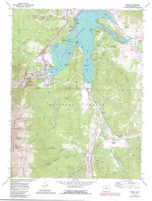
Frisco Topo Map Colorado
To zoom in, hover over the map of Frisco
USGS Topo Quad 39106e1 - 1:24,000 scale
| Topo Map Name: | Frisco |
| USGS Topo Quad ID: | 39106e1 |
| Print Size: | ca. 21 1/4" wide x 27" high |
| Southeast Coordinates: | 39.5° N latitude / 106° W longitude |
| Map Center Coordinates: | 39.5625° N latitude / 106.0625° W longitude |
| U.S. State: | CO |
| Filename: | o39106e1.jpg |
| Download Map JPG Image: | Frisco topo map 1:24,000 scale |
| Map Type: | Topographic |
| Topo Series: | 7.5´ |
| Map Scale: | 1:24,000 |
| Source of Map Images: | United States Geological Survey (USGS) |
| Alternate Map Versions: |
Frisco CO 1970, updated 1973 Download PDF Buy paper map Frisco CO 1970, updated 1973 Download PDF Buy paper map Frisco CO 1970, updated 1988 Download PDF Buy paper map Frisco CO 1970, updated 1988 Download PDF Buy paper map Frisco CO 2011 Download PDF Buy paper map Frisco CO 2013 Download PDF Buy paper map Frisco CO 2016 Download PDF Buy paper map |
| FStopo: | US Forest Service topo Frisco is available: Download FStopo PDF Download FStopo TIF |
1:24,000 Topo Quads surrounding Frisco
> Back to 39106e1 at 1:100,000 scale
> Back to 39106a1 at 1:250,000 scale
> Back to U.S. Topo Maps home
Frisco topo map: Gazetteer
Frisco: Airports
Breckenridge Airport elevation 2865m 9399′Summit Medical Center Heliport elevation 2758m 9048′
Frisco: Bays
Blue River Arm elevation 2750m 9022′Dillon Bay elevation 2750m 9022′
Frisco Bay elevation 2750m 9022′
Giberson Bay elevation 2750m 9022′
Heaton Bay elevation 2750m 9022′
Snake River Arm elevation 2750m 9022′
Frisco: Canals
Williams-Hamm Diversion Ditch elevation 2806m 9206′Frisco: Capes
Crown Point elevation 2753m 9032′Windy Point elevation 2752m 9028′
Frisco: Dams
Dillon Dam elevation 2678m 8786′Old Dillon Dam elevation 2796m 9173′
Frisco: Flats
Braddock Flats elevation 2813m 9229′Delaware Flats elevation 2829m 9281′
Frisco: Islands
Fishhook Island elevation 2752m 9028′Sentinel Island elevation 2759m 9051′
Silver Dollar Island elevation 2750m 9022′
Frisco: Lakes
Bills Ranch Lake elevation 2768m 9081′Lily Pad Lake elevation 3020m 9908′
Rainbow Lake elevation 2823m 9261′
Frisco: Mines
Como Claims elevation 3087m 10127′Frisco Mine elevation 2758m 9048′
Gold Cord Tunnel Mine elevation 3147m 10324′
Gold Run Gulch Claims Mine elevation 2937m 9635′
King Solomon Mine elevation 2802m 9192′
Naperville Tunnel Mine elevation 3105m 10187′
Frisco: Parks
Windy Point Fisherman Park elevation 2765m 9071′Frisco: Populated Places
Frisco elevation 2766m 9074′Gold Hill elevation 2849m 9347′
Masontown elevation 2845m 9333′
Frisco: Reservoirs
Dillon Reservoir elevation 2748m 9015′Old Dillon Reservoir elevation 2801m 9189′
Frisco: Springs
Iron Springs elevation 2803m 9196′Frisco: Streams
Meadow Creek elevation 2750m 9022′Miners Creek elevation 2750m 9022′
North Tenmile Creek elevation 2780m 9120′
Snake River elevation 2750m 9022′
Soda Creek elevation 2754m 9035′
Squaw Creek elevation 2751m 9025′
Swan River elevation 2790m 9153′
Tenmile Creek elevation 2750m 9022′
Frisco: Summits
Lake Hill elevation 2845m 9333′Ophir Mountain elevation 3102m 10177′
Royal Mountain elevation 3200m 10498′
Swan Mountain elevation 3282m 10767′
Tenmile Peak elevation 3930m 12893′
Tenmile Range Peak 1 elevation 3900m 12795′
Tenmile Range Peak 3 elevation 3845m 12614′
Tenmile Range Peak 4 elevation 3897m 12785′
Tenmile Range Peak 5 elevation 3916m 12847′
Frisco: Trails
Lily Pad Lake Trail elevation 2990m 9809′Miners Creek Trail elevation 3757m 12326′
Frisco: Valleys
Gold Run Gulch elevation 2851m 9353′Horseshoe Gulch elevation 2862m 9389′
Middle Barton Gulch elevation 2865m 9399′
North Barton Gulch elevation 2853m 9360′
Ryan Gulch elevation 2817m 9242′
Salt Lick Gulch elevation 2684m 8805′
Soda Gulch elevation 2758m 9048′
South Barton Gulch elevation 2865m 9399′
Frisco digital topo map on disk
Buy this Frisco topo map showing relief, roads, GPS coordinates and other geographical features, as a high-resolution digital map file on DVD:


