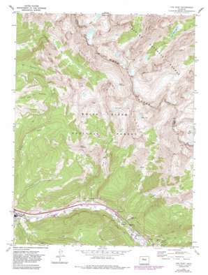
Vail East Topo Map Colorado
To zoom in, hover over the map of Vail East
USGS Topo Quad 39106f3 - 1:24,000 scale
| Topo Map Name: | Vail East |
| USGS Topo Quad ID: | 39106f3 |
| Print Size: | ca. 21 1/4" wide x 27" high |
| Southeast Coordinates: | 39.625° N latitude / 106.25° W longitude |
| Map Center Coordinates: | 39.6875° N latitude / 106.3125° W longitude |
| U.S. State: | CO |
| Filename: | o39106f3.jpg |
| Download Map JPG Image: | Vail East topo map 1:24,000 scale |
| Map Type: | Topographic |
| Topo Series: | 7.5´ |
| Map Scale: | 1:24,000 |
| Source of Map Images: | United States Geological Survey (USGS) |
| Alternate Map Versions: |
Vail East CO 1970, updated 1973 Download PDF Buy paper map Vail East CO 1970, updated 1973 Download PDF Buy paper map Vail East CO 1970, updated 1983 Download PDF Buy paper map Vail East CO 1970, updated 1988 Download PDF Buy paper map Vail East CO 1970, updated 1988 Download PDF Buy paper map Vail East CO 2011 Download PDF Buy paper map Vail East CO 2013 Download PDF Buy paper map Vail East CO 2016 Download PDF Buy paper map |
| FStopo: | US Forest Service topo Vail East is available: Download FStopo PDF Download FStopo TIF |
1:24,000 Topo Quads surrounding Vail East
> Back to 39106e1 at 1:100,000 scale
> Back to 39106a1 at 1:250,000 scale
> Back to U.S. Topo Maps home
Vail East topo map: Gazetteer
Vail East: Lakes
Booth Lake elevation 3498m 11476′Bubble Lake elevation 3431m 11256′
Pitkin Lake elevation 3471m 11387′
Upper Piney Lake elevation 3373m 11066′
Upper Slate Lake elevation 3312m 10866′
Vail East: Populated Places
Bighorn elevation 2584m 8477′Vail elevation 2496m 8188′
Vail East: Springs
Gore Creek Spring elevation 2719m 8920′Vail East: Streams
Bighorn Creek elevation 2567m 8421′Black Gore Creek elevation 2611m 8566′
Booth Creek elevation 2534m 8313′
Pitkin Creek elevation 2553m 8375′
Vail East: Summits
Bald Mountain elevation 3698m 12132′The Spider elevation 3855m 12647′
Vail East: Trails
Deluge Lake Trail elevation 3294m 10807′Vail East digital topo map on disk
Buy this Vail East topo map showing relief, roads, GPS coordinates and other geographical features, as a high-resolution digital map file on DVD:


