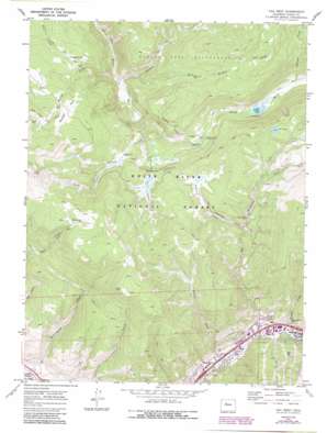
Vail West Topo Map Colorado
To zoom in, hover over the map of Vail West
USGS Topo Quad 39106f4 - 1:24,000 scale
| Topo Map Name: | Vail West |
| USGS Topo Quad ID: | 39106f4 |
| Print Size: | ca. 21 1/4" wide x 27" high |
| Southeast Coordinates: | 39.625° N latitude / 106.375° W longitude |
| Map Center Coordinates: | 39.6875° N latitude / 106.4375° W longitude |
| U.S. State: | CO |
| Filename: | o39106f4.jpg |
| Download Map JPG Image: | Vail West topo map 1:24,000 scale |
| Map Type: | Topographic |
| Topo Series: | 7.5´ |
| Map Scale: | 1:24,000 |
| Source of Map Images: | United States Geological Survey (USGS) |
| Alternate Map Versions: |
Vail West CO 1970, updated 1973 Download PDF Buy paper map Vail West CO 1970, updated 1973 Download PDF Buy paper map Vail West CO 1970, updated 1988 Download PDF Buy paper map Vail West CO 2011 Download PDF Buy paper map Vail West CO 2013 Download PDF Buy paper map Vail West CO 2016 Download PDF Buy paper map |
| FStopo: | US Forest Service topo Vail West is available: Download FStopo PDF Download FStopo TIF |
1:24,000 Topo Quads surrounding Vail West
> Back to 39106e1 at 1:100,000 scale
> Back to 39106a1 at 1:250,000 scale
> Back to U.S. Topo Maps home
Vail West topo map: Gazetteer
Vail West: Dams
Nottingham Dam elevation 2440m 8005′Vail West: Flats
Flagstone Park elevation 2892m 9488′Moniger Park elevation 3072m 10078′
Vail West: Lakes
Lost Lake elevation 3098m 10164′Piney Lake elevation 2849m 9347′
Vail West: Mines
Coyote Claims elevation 2985m 9793′Coyote Claims Mine elevation 2985m 9793′
Vail West: Populated Places
West Vail elevation 2419m 7936′Vail West: Reservoirs
Nottingham Reservoir elevation 2440m 8005′Vail West: Springs
Red Spring elevation 3102m 10177′Vail West: Streams
Buffehr Creek elevation 2422m 7946′Dickson Creek elevation 2656m 8713′
East Meadow Creek elevation 2644m 8674′
Freeman Creek elevation 2730m 8956′
Indian Creek elevation 2775m 9104′
Marugg Creek elevation 2852m 9356′
Meadow Creek elevation 2561m 8402′
Middle Creek elevation 2477m 8126′
Moniger Creek elevation 2560m 8398′
Red Sandstone Creek elevation 2460m 8070′
South Fork Dickson Creek elevation 2838m 9311′
South Fork Red Sandstone Creek elevation 2930m 9612′
Spraddle Creek elevation 2485m 8152′
Vail West: Trails
Lost Lake Trail elevation 3058m 10032′Nottingham Ridge Trail elevation 2814m 9232′
Vail West: Valleys
Nottingham Gulch elevation 2368m 7769′Vail West digital topo map on disk
Buy this Vail West topo map showing relief, roads, GPS coordinates and other geographical features, as a high-resolution digital map file on DVD:


