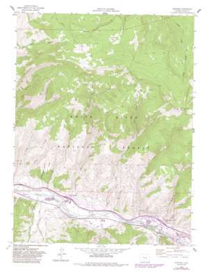
Edwards Topo Map Colorado
To zoom in, hover over the map of Edwards
USGS Topo Quad 39106f5 - 1:24,000 scale
| Topo Map Name: | Edwards |
| USGS Topo Quad ID: | 39106f5 |
| Print Size: | ca. 21 1/4" wide x 27" high |
| Southeast Coordinates: | 39.625° N latitude / 106.5° W longitude |
| Map Center Coordinates: | 39.6875° N latitude / 106.5625° W longitude |
| U.S. State: | CO |
| Filename: | o39106f5.jpg |
| Download Map JPG Image: | Edwards topo map 1:24,000 scale |
| Map Type: | Topographic |
| Topo Series: | 7.5´ |
| Map Scale: | 1:24,000 |
| Source of Map Images: | United States Geological Survey (USGS) |
| Alternate Map Versions: |
Edwards CO 1962, updated 1964 Download PDF Buy paper map Edwards CO 1962, updated 1964 Download PDF Buy paper map Edwards CO 1962, updated 1969 Download PDF Buy paper map Edwards CO 1962, updated 1969 Download PDF Buy paper map Edwards CO 1962, updated 1980 Download PDF Buy paper map Edwards CO 1962, updated 1983 Download PDF Buy paper map Edwards CO 1962, updated 1983 Download PDF Buy paper map Edwards CO 1962, updated 1988 Download PDF Buy paper map Edwards CO 2011 Download PDF Buy paper map Edwards CO 2013 Download PDF Buy paper map Edwards CO 2016 Download PDF Buy paper map |
| FStopo: | US Forest Service topo Edwards is available: Download FStopo PDF Download FStopo TIF |
1:24,000 Topo Quads surrounding Edwards
> Back to 39106e1 at 1:100,000 scale
> Back to 39106a1 at 1:250,000 scale
> Back to U.S. Topo Maps home
Edwards topo map: Gazetteer
Edwards: Canals
Brett Ditch elevation 2198m 7211′Creamery Ditch elevation 2322m 7618′
Dodd Ditch elevation 2232m 7322′
Howard and Winslow Ditch elevation 2276m 7467′
Howard Ditch elevation 2245m 7365′
June Creek Ditch elevation 2404m 7887′
Metcalf Ditch elevation 2275m 7463′
Nottingham and Puder Ditch elevation 2302m 7552′
Terrell and Ford Ditch elevation 2255m 7398′
Edwards: Dams
Benchmark Lake Dam elevation 2266m 7434′June Creek Dam elevation 2285m 7496′
Ute Spring Reservoir Dam elevation 2572m 8438′
Edwards: Flats
Rock Creek Park elevation 3068m 10065′Edwards: Lakes
Horse Pond elevation 3021m 9911′Edwards: Mines
Arrowhead Claims Mine elevation 3230m 10597′Arrowhead Number One Mine elevation 3112m 10209′
B and B Edwards Pit elevation 2236m 7335′
Edwards: Populated Places
Arrowhead Village elevation 2243m 7358′Avon elevation 2265m 7431′
Edwards elevation 2201m 7221′
Edwards: Reservoirs
Alex Spring Reservoir elevation 2550m 8366′Benchmark Lake Reservoir elevation 2266m 7434′
Clark Spring Reservoir elevation 3019m 9904′
Dead Buck Reservoir elevation 2450m 8038′
East Beard Reservoir elevation 2768m 9081′
Indian Grove Reservoir elevation 2928m 9606′
James Spring Reservoir elevation 3029m 9937′
Jouflas Spring Reservoir elevation 2748m 9015′
June Creek Reservoir elevation 2285m 7496′
Lost Reservoir Number One elevation 2677m 8782′
Lost Reservoir Number Three elevation 2818m 9245′
Lost Reservoir Number Two elevation 2604m 8543′
Lower Beard Number One Reservoir elevation 2571m 8435′
Spring Creek Number One Reservoir elevation 2475m 8120′
Spring Creek Number Two Reservoir elevation 2477m 8126′
Tames Number One Reservoir elevation 2558m 8392′
Tames Number Two Reservoir elevation 2515m 8251′
Ute Spring Reservoir elevation 2572m 8438′
West Beard Reservoir elevation 2759m 9051′
Edwards: Ridges
Casteel Ridge elevation 2446m 8024′Edwards: Springs
Fez Spring elevation 2552m 8372′Edwards: Streams
Beard Creek elevation 2173m 7129′Beaver Creek elevation 2262m 7421′
Berry Creek elevation 2184m 7165′
Buck Creek elevation 2256m 7401′
East Fork Red Canyon Creek elevation 2439m 8001′
June Creek elevation 2229m 7312′
Lake Creek elevation 2170m 7119′
McCoy Creek elevation 2223m 7293′
Metcalf Creek elevation 2272m 7454′
Spring Creek elevation 2167m 7109′
Tames Creek elevation 2171m 7122′
Edwards: Summits
Red and White Mountain elevation 3408m 11181′Edwards: Trails
Rock Creek Trail elevation 3101m 10173′Edwards: Valleys
Bachelor Gulch elevation 2317m 7601′Creamery Gulch elevation 2253m 7391′
Deadhorse Gulch elevation 2191m 7188′
Eagle Valley elevation 2280m 7480′
Swift Gulch elevation 2307m 7568′
Edwards digital topo map on disk
Buy this Edwards topo map showing relief, roads, GPS coordinates and other geographical features, as a high-resolution digital map file on DVD:


