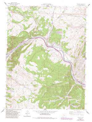
Wolcott Topo Map Colorado
To zoom in, hover over the map of Wolcott
USGS Topo Quad 39106f6 - 1:24,000 scale
| Topo Map Name: | Wolcott |
| USGS Topo Quad ID: | 39106f6 |
| Print Size: | ca. 21 1/4" wide x 27" high |
| Southeast Coordinates: | 39.625° N latitude / 106.625° W longitude |
| Map Center Coordinates: | 39.6875° N latitude / 106.6875° W longitude |
| U.S. State: | CO |
| Filename: | o39106f6.jpg |
| Download Map JPG Image: | Wolcott topo map 1:24,000 scale |
| Map Type: | Topographic |
| Topo Series: | 7.5´ |
| Map Scale: | 1:24,000 |
| Source of Map Images: | United States Geological Survey (USGS) |
| Alternate Map Versions: |
Wolcott CO 1962, updated 1964 Download PDF Buy paper map Wolcott CO 1962, updated 1964 Download PDF Buy paper map Wolcott CO 1962, updated 1970 Download PDF Buy paper map Wolcott CO 1962, updated 1970 Download PDF Buy paper map Wolcott CO 1962, updated 1983 Download PDF Buy paper map Wolcott CO 1962, updated 1988 Download PDF Buy paper map Wolcott CO 2011 Download PDF Buy paper map Wolcott CO 2013 Download PDF Buy paper map Wolcott CO 2016 Download PDF Buy paper map |
| FStopo: | US Forest Service topo Wolcott is available: Download FStopo PDF Download FStopo TIF |
1:24,000 Topo Quads surrounding Wolcott
> Back to 39106e1 at 1:100,000 scale
> Back to 39106a1 at 1:250,000 scale
> Back to U.S. Topo Maps home
Wolcott topo map: Gazetteer
Wolcott: Basins
Hells Pocket elevation 2427m 7962′Wolcott: Canals
Cash Ditch elevation 2348m 7703′CKP Ditch elevation 2465m 8087′
Oneill Holland Ditch elevation 2144m 7034′
Sherwood Ditch elevation 2126m 6975′
Wolcott: Lakes
Dry Lake elevation 2268m 7440′Wilmor Lake elevation 2169m 7116′
Wolcott: Mines
Lucky Strike Number One Mine elevation 2310m 7578′Wolcott: Populated Places
Carterville elevation 2314m 7591′Wolcott elevation 2130m 6988′
Wolcott: Reservoirs
Spalding Reservoir elevation 2423m 7949′Wolcott: Ridges
Bellyache Ridge elevation 2831m 9288′Wolcott: Streams
Alkali Creek elevation 2109m 6919′Cache Creek elevation 2207m 7240′
Mile Creek elevation 2096m 6876′
Muddy Creek elevation 2180m 7152′
Red Canyon Creek elevation 2155m 7070′
Rube Creek elevation 2091m 6860′
Squaw Creek elevation 2165m 7103′
Travis Creek elevation 2147m 7043′
Ute Creek elevation 2129m 6984′
Wolcott: Summits
Bocco Mountain elevation 2393m 7851′Wolcott: Trails
Cache Creek Access Trail elevation 2542m 8339′Red Canyon Stock Driveway elevation 2418m 7933′
Wolcott: Valleys
Bear Gulch elevation 2176m 7139′Dry Gulch elevation 2313m 7588′
Red Draw elevation 2256m 7401′
Wolcott digital topo map on disk
Buy this Wolcott topo map showing relief, roads, GPS coordinates and other geographical features, as a high-resolution digital map file on DVD:


