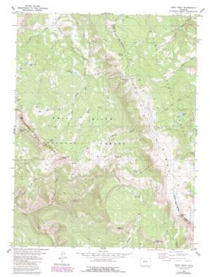
Piney Peak Topo Map Colorado
To zoom in, hover over the map of Piney Peak
USGS Topo Quad 39106g4 - 1:24,000 scale
| Topo Map Name: | Piney Peak |
| USGS Topo Quad ID: | 39106g4 |
| Print Size: | ca. 21 1/4" wide x 27" high |
| Southeast Coordinates: | 39.75° N latitude / 106.375° W longitude |
| Map Center Coordinates: | 39.8125° N latitude / 106.4375° W longitude |
| U.S. State: | CO |
| Filename: | o39106g4.jpg |
| Download Map JPG Image: | Piney Peak topo map 1:24,000 scale |
| Map Type: | Topographic |
| Topo Series: | 7.5´ |
| Map Scale: | 1:24,000 |
| Source of Map Images: | United States Geological Survey (USGS) |
| Alternate Map Versions: |
Piney Peak CO 1980, updated 1980 Download PDF Buy paper map Piney Peak CO 1980, updated 1988 Download PDF Buy paper map Piney Peak CO 1980, updated 1988 Download PDF Buy paper map Piney Peak CO 2011 Download PDF Buy paper map Piney Peak CO 2013 Download PDF Buy paper map Piney Peak CO 2016 Download PDF Buy paper map |
| FStopo: | US Forest Service topo Piney Peak is available: Download FStopo PDF Download FStopo TIF |
1:24,000 Topo Quads surrounding Piney Peak
> Back to 39106e1 at 1:100,000 scale
> Back to 39106a1 at 1:250,000 scale
> Back to U.S. Topo Maps home
Piney Peak topo map: Gazetteer
Piney Peak: Flats
Big Park elevation 3022m 9914′Piney Peak: Lakes
Beaver Dam Lake elevation 2912m 9553′Blue Lake elevation 3403m 11164′
Lone Lick Lakes elevation 2979m 9773′
Mahan Lake elevation 3365m 11040′
Slough Grass Lake elevation 2814m 9232′
Soda Lakes elevation 3111m 10206′
Twin Lakes elevation 3203m 10508′
Piney Peak: Parks
Long Park elevation 2797m 9176′Piney Peak: Ranges
Gore Range elevation 3486m 11437′Piney Peak: Springs
Mather Spring elevation 3262m 10702′Piney Peak Spring elevation 3335m 10941′
Soda Springs elevation 3234m 10610′
Piney Peak: Streams
Big Hole Creek elevation 2788m 9146′East Fork Three Licks Creek elevation 2913m 9557′
Horseshoe Creek elevation 2528m 8293′
Jenkins Creek elevation 2669m 8756′
Lone Lick Creek elevation 2521m 8270′
McPhee Creek elevation 2793m 9163′
North Fork Piney River elevation 2457m 8061′
Slate Creek elevation 2515m 8251′
Soda Creek elevation 2893m 9491′
Three Licks Creek elevation 2690m 8825′
Piney Peak: Summits
Chimmey Rock elevation 3351m 10994′Meridian Peak elevation 3783m 12411′
Petty Mountain elevation 3431m 11256′
Piney Peak elevation 3525m 11564′
Slate Mountain elevation 3378m 11082′
Piney Peak: Trails
Piney Lake Trail elevation 3163m 10377′Sheep Drive Trail elevation 3040m 9973′
Piney Peak digital topo map on disk
Buy this Piney Peak topo map showing relief, roads, GPS coordinates and other geographical features, as a high-resolution digital map file on DVD:


