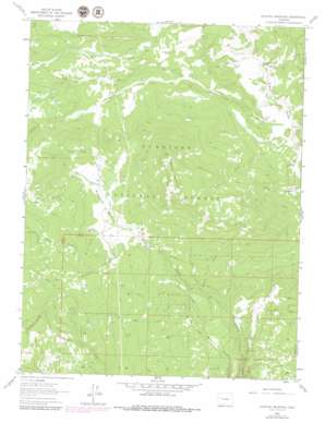
Electric Mountain Topo Map Colorado
To zoom in, hover over the map of Electric Mountain
USGS Topo Quad 39107a5 - 1:24,000 scale
| Topo Map Name: | Electric Mountain |
| USGS Topo Quad ID: | 39107a5 |
| Print Size: | ca. 21 1/4" wide x 27" high |
| Southeast Coordinates: | 39° N latitude / 107.5° W longitude |
| Map Center Coordinates: | 39.0625° N latitude / 107.5625° W longitude |
| U.S. State: | CO |
| Filename: | o39107a5.jpg |
| Download Map JPG Image: | Electric Mountain topo map 1:24,000 scale |
| Map Type: | Topographic |
| Topo Series: | 7.5´ |
| Map Scale: | 1:24,000 |
| Source of Map Images: | United States Geological Survey (USGS) |
| Alternate Map Versions: |
Electric Mountain CO 1961, updated 1963 Download PDF Buy paper map Electric Mountain CO 1961, updated 1971 Download PDF Buy paper map Electric Mountain CO 1961, updated 1971 Download PDF Buy paper map Electric Mountain CO 1961, updated 1979 Download PDF Buy paper map Electric Mountain CO 2001, updated 2004 Download PDF Buy paper map Electric Mountain CO 2011 Download PDF Buy paper map Electric Mountain CO 2013 Download PDF Buy paper map Electric Mountain CO 2016 Download PDF Buy paper map |
| FStopo: | US Forest Service topo Electric Mountain is available: Download FStopo PDF Download FStopo TIF |
1:24,000 Topo Quads surrounding Electric Mountain
> Back to 39107a1 at 1:100,000 scale
> Back to 39106a1 at 1:250,000 scale
> Back to U.S. Topo Maps home
Electric Mountain topo map: Gazetteer
Electric Mountain: Canals
Bulk Park Ditch elevation 2738m 8982′Columbine Ditch Nuber One elevation 2681m 8795′
Columbine Ditch Nuber Two elevation 2661m 8730′
Columbine Ditch Number Five elevation 2652m 8700′
Columbine Ditch Number Three elevation 2582m 8471′
Dyke Ditch Number Two elevation 2711m 8894′
Twin Spruce Ditch elevation 2658m 8720′
Electric Mountain: Cliffs
Lombard Slides elevation 3149m 10331′Electric Mountain: Flats
Hubbard Park elevation 2678m 8786′Poison Park elevation 2498m 8195′
Electric Mountain: Mines
Molly Group Mine elevation 2845m 9333′Electric Mountain: Pillars
Chimney Rocks elevation 2831m 9288′Electric Mountain: Springs
Grouse Spring elevation 2379m 7805′Electric Mountain: Streams
Beaver Creek elevation 2656m 8713′Big Alder Creek elevation 2399m 7870′
Branch of Bee Creek elevation 2368m 7769′
Cottonwood Creek elevation 2118m 6948′
Cow Creek elevation 2449m 8034′
Elk Creek elevation 2755m 9038′
Fawn Creek elevation 2597m 8520′
Little Alder Creek elevation 2399m 7870′
Little Dyke Creek elevation 2705m 8874′
Lone Pine Creek elevation 2136m 7007′
Main Hubbard Creek elevation 2652m 8700′
Middle Hubbard Creek elevation 2652m 8700′
Morman Creek elevation 2323m 7621′
Pilot Creek elevation 2244m 7362′
Slide Creek elevation 2289m 7509′
Trail Creek elevation 2435m 7988′
West Hubbard Creek elevation 2600m 8530′
Willow Creek elevation 2169m 7116′
Wolf Creek elevation 2381m 7811′
Electric Mountain: Summits
Electric Mountain elevation 3138m 10295′Electric Mountain: Trails
Terror Trail elevation 2817m 9242′Electric Mountain digital topo map on disk
Buy this Electric Mountain topo map showing relief, roads, GPS coordinates and other geographical features, as a high-resolution digital map file on DVD:


