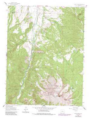
Mount Sopris Topo Map Colorado
To zoom in, hover over the map of Mount Sopris
USGS Topo Quad 39107c2 - 1:24,000 scale
| Topo Map Name: | Mount Sopris |
| USGS Topo Quad ID: | 39107c2 |
| Print Size: | ca. 21 1/4" wide x 27" high |
| Southeast Coordinates: | 39.25° N latitude / 107.125° W longitude |
| Map Center Coordinates: | 39.3125° N latitude / 107.1875° W longitude |
| U.S. State: | CO |
| Filename: | o39107c2.jpg |
| Download Map JPG Image: | Mount Sopris topo map 1:24,000 scale |
| Map Type: | Topographic |
| Topo Series: | 7.5´ |
| Map Scale: | 1:24,000 |
| Source of Map Images: | United States Geological Survey (USGS) |
| Alternate Map Versions: |
Mount Sopris CO 1961, updated 1963 Download PDF Buy paper map Mount Sopris CO 1961, updated 1963 Download PDF Buy paper map Mount Sopris CO 1961, updated 1966 Download PDF Buy paper map Mount Sopris CO 1961, updated 1984 Download PDF Buy paper map Mount Sopris CO 1961, updated 1988 Download PDF Buy paper map Mount Sopris CO 2011 Download PDF Buy paper map Mount Sopris CO 2013 Download PDF Buy paper map Mount Sopris CO 2016 Download PDF Buy paper map |
| FStopo: | US Forest Service topo Mount Sopris is available: Download FStopo PDF Download FStopo TIF |
1:24,000 Topo Quads surrounding Mount Sopris
> Back to 39107a1 at 1:100,000 scale
> Back to 39106a1 at 1:250,000 scale
> Back to U.S. Topo Maps home
Mount Sopris topo map: Gazetteer
Mount Sopris: Canals
Bain-Thomas Ditch elevation 1959m 6427′East Mesa Ditch elevation 1977m 6486′
Ella Ditch elevation 1930m 6332′
Sweet Jessup Canal elevation 2006m 6581′
Mount Sopris: Dams
Thomas Dam elevation 2087m 6847′Mount Sopris: Lakes
Lewis Lake elevation 2085m 6840′Mount Sopris: Reservoirs
Saint John Reservoir elevation 2430m 7972′Thomas Lakes elevation 3126m 10255′
Thomas Reservoir Number 2 elevation 2087m 6847′
Mount Sopris: Ridges
The Crown elevation 2548m 8359′Mount Sopris: Streams
Assignation Creek elevation 2257m 7404′Camp Foster Creek elevation 1963m 6440′
Nettle Creek elevation 1985m 6512′
Perham Creek elevation 2030m 6660′
Potato Bill Creek elevation 1963m 6440′
Prince Creek elevation 1907m 6256′
Thomas Creek elevation 1921m 6302′
Thompson Creek elevation 1939m 6361′
Mount Sopris: Summits
Holgate Mesa elevation 2299m 7542′Mount Sopris elevation 3841m 12601′
Mount Sopris: Valleys
Smith Gulch elevation 1992m 6535′Mount Sopris digital topo map on disk
Buy this Mount Sopris topo map showing relief, roads, GPS coordinates and other geographical features, as a high-resolution digital map file on DVD:


