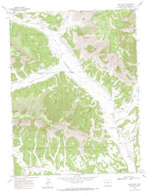
Long Point Topo Map Colorado
To zoom in, hover over the map of Long Point
USGS Topo Quad 39108d3 - 1:24,000 scale
| Topo Map Name: | Long Point |
| USGS Topo Quad ID: | 39108d3 |
| Print Size: | ca. 21 1/4" wide x 27" high |
| Southeast Coordinates: | 39.375° N latitude / 108.25° W longitude |
| Map Center Coordinates: | 39.4375° N latitude / 108.3125° W longitude |
| U.S. State: | CO |
| Filename: | o39108d3.jpg |
| Download Map JPG Image: | Long Point topo map 1:24,000 scale |
| Map Type: | Topographic |
| Topo Series: | 7.5´ |
| Map Scale: | 1:24,000 |
| Source of Map Images: | United States Geological Survey (USGS) |
| Alternate Map Versions: |
Long Point CO 1968, updated 1972 Download PDF Buy paper map Long Point CO 2010 Download PDF Buy paper map Long Point CO 2013 Download PDF Buy paper map Long Point CO 2016 Download PDF Buy paper map |
1:24,000 Topo Quads surrounding Long Point
> Back to 39108a1 at 1:100,000 scale
> Back to 39108a1 at 1:250,000 scale
> Back to U.S. Topo Maps home
Long Point topo map: Gazetteer
Long Point: Canals
Clear Creek Ditch elevation 1678m 5505′Conwell Ditch elevation 1642m 5387′
Creek and Newman Ditch elevation 1615m 5298′
De La Matyr and Anderson Ditch elevation 1757m 5764′
Hobo Ditch elevation 1696m 5564′
HVS and S Ditch elevation 1676m 5498′
Long Point: Cliffs
Long Point elevation 2403m 7883′Long Point: Pillars
Chimney Rock elevation 2371m 7778′Long Point: Streams
Clear Creek elevation 1659m 5442′Conn Creek elevation 1596m 5236′
Kimball Creek elevation 1645m 5396′
Logan Wash elevation 1576m 5170′
North Dry Fork elevation 1705m 5593′
South Dry Fork elevation 1702m 5583′
Long Point: Valleys
Bloat Gulch elevation 1640m 5380′Boudish Gulch elevation 1637m 5370′
Gibler Gulch elevation 1647m 5403′
Hopple Gulch elevation 1685m 5528′
Weaver Gulch elevation 1728m 5669′
Long Point digital topo map on disk
Buy this Long Point topo map showing relief, roads, GPS coordinates and other geographical features, as a high-resolution digital map file on DVD:


