Yankee Gulch Topo Map Colorado
To zoom in, hover over the map of Yankee Gulch
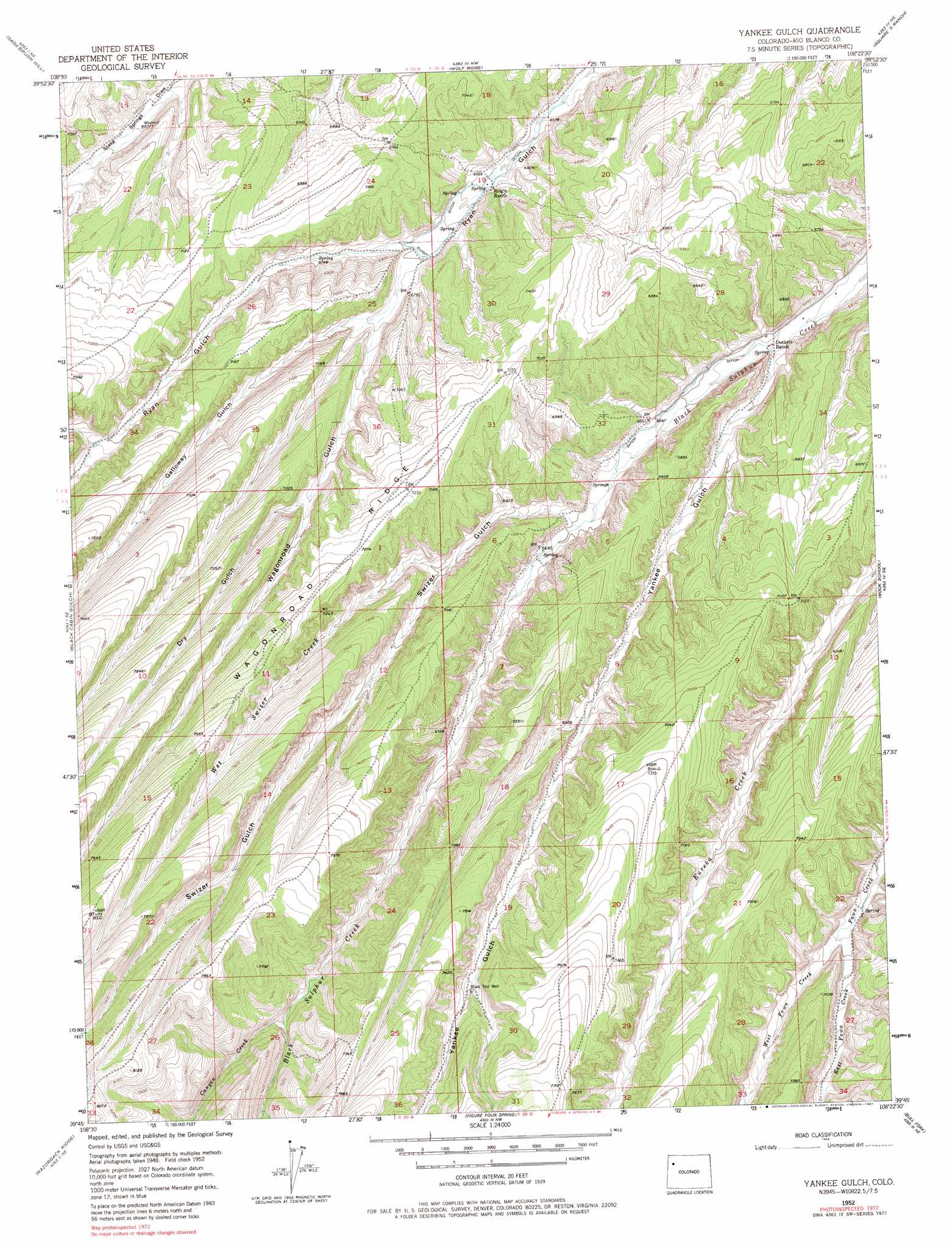
USGS Topo Quad 39108g4 - 1:24,000 scale
| Topo Map Name: | Yankee Gulch |
| USGS Topo Quad ID: | 39108g4 |
| Print Size: | ca. 21 1/4" wide x 27" high |
| Southeast Coordinates: | 39.75° N latitude / 108.375° W longitude |
| Map Center Coordinates: | 39.8125° N latitude / 108.4375° W longitude |
| U.S. State: | CO |
| Filename: | o39108g4.jpg |
| Download Map JPG Image: | Yankee Gulch topo map 1:24,000 scale |
| Map Type: | Topographic |
| Topo Series: | 7.5´ |
| Map Scale: | 1:24,000 |
| Source of Map Images: | United States Geological Survey (USGS) |
| Alternate Map Versions: |
Yankee Gulch CO 1952, updated 1954 Download PDF Buy paper map Yankee Gulch CO 1952, updated 1964 Download PDF Buy paper map Yankee Gulch CO 1952, updated 1969 Download PDF Buy paper map Yankee Gulch CO 1952, updated 1969 Download PDF Buy paper map Yankee Gulch CO 1952, updated 1981 Download PDF Buy paper map Yankee Gulch CO 2010 Download PDF Buy paper map Yankee Gulch CO 2013 Download PDF Buy paper map Yankee Gulch CO 2016 Download PDF Buy paper map |
1:24,000 Topo Quads surrounding Yankee Gulch
Gillam Draw |
Calamity Ridge |
Barcus Creek |
Barcus Creek Se |
White River City |
Philadelphia Creek |
Sagebrush Hill |
Wolf Ridge |
Square S Ranch |
Greasewood Gulch |
White Coyote Draw |
Black Cabin Gulch |
Yankee Gulch |
Rock School |
Jessup Gulch |
Brushy Point |
Razorback Ridge |
Figure Four Spring |
Bull Fork |
Cutoff Gulch |
Calf Canyon |
Henderson Ridge |
Desert Gulch |
Mount Blaine |
Circle Dot Gulch |
> Back to 39108e1 at 1:100,000 scale
> Back to 39108a1 at 1:250,000 scale
> Back to U.S. Topo Maps home
Yankee Gulch topo map: Gazetteer
Yankee Gulch: Ridges
Wagonroad Ridge elevation 2205m 7234′Yankee Gulch: Streams
Canyon Creek elevation 2232m 7322′East Fawn Creek elevation 2067m 6781′
West Fawn Creek elevation 2067m 6781′
Wet Swizer Creek elevation 2011m 6597′
Yankee Gulch: Valleys
Dry Ryan Gulch elevation 2146m 7040′Galloway Gulch elevation 2055m 6742′
Swizer Gulch elevation 2011m 6597′
Wagonroad Gulch elevation 2043m 6702′
Yankee Gulch elevation 1970m 6463′
Yankee Gulch digital topo map on disk
Buy this Yankee Gulch topo map showing relief, roads, GPS coordinates and other geographical features, as a high-resolution digital map file on DVD: