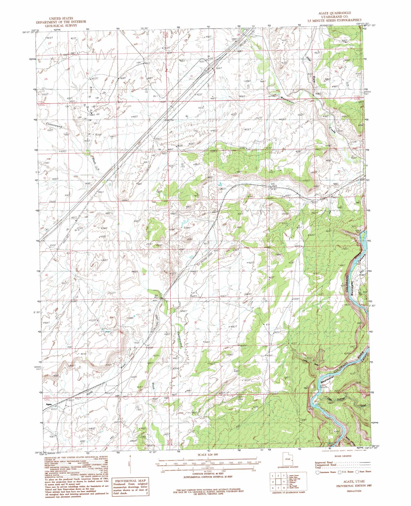
Agate Topo Map Utah
To zoom in, hover over the map of Agate
USGS Topo Quad 39109a2 - 1:24,000 scale
| Topo Map Name: | Agate |
| USGS Topo Quad ID: | 39109a2 |
| Print Size: | ca. 21 1/4" wide x 27" high |
| Southeast Coordinates: | 39° N latitude / 109.125° W longitude |
| Map Center Coordinates: | 39.0625° N latitude / 109.1875° W longitude |
| U.S. State: | UT |
| Filename: | o39109a2.jpg |
| Download Map JPG Image: | Agate topo map 1:24,000 scale |
| Map Type: | Topographic |
| Topo Series: | 7.5´ |
| Map Scale: | 1:24,000 |
| Source of Map Images: | United States Geological Survey (USGS) |
| Alternate Map Versions: |
Westwater 4 SW UT 1954 Download PDF Buy paper map Agate UT 1985, updated 1986 Download PDF Buy paper map Agate UT 2011 Download PDF Buy paper map Agate UT 2014 Download PDF Buy paper map |
1:24,000 Topo Quads surrounding Agate
Preacher Canyon |
Dry Canyon |
Bryson Canyon |
Bar X Wash |
Badger Wash |
Flume Canyon |
Antone Canyon |
Harley Dome |
Bitter Creek Well |
Ruby Canyon |
Cisco Springs |
Danish Flat |
Agate |
Westwater |
Sieber Canyon |
White House |
Cisco |
Big Triangle |
Marble Canyon |
Bieser Creek |
Cisco Sw |
Dewey |
Blue Chief Mesa |
Steamboat Mesa |
Two V Basin |
> Back to 39109a1 at 1:100,000 scale
> Back to 39108a1 at 1:250,000 scale
> Back to U.S. Topo Maps home
Agate topo map: Gazetteer
Agate: Basins
Little Hole elevation 1334m 4376′Agate: Populated Places
Agate elevation 1322m 4337′Cottonwood elevation 1382m 4534′
Agate: Streams
Little Dolores River elevation 1296m 4251′Westwater Creek elevation 1308m 4291′
Agate: Valleys
Coal Draw elevation 1334m 4376′Marble Canyon elevation 1296m 4251′
Agate digital topo map on disk
Buy this Agate topo map showing relief, roads, GPS coordinates and other geographical features, as a high-resolution digital map file on DVD: