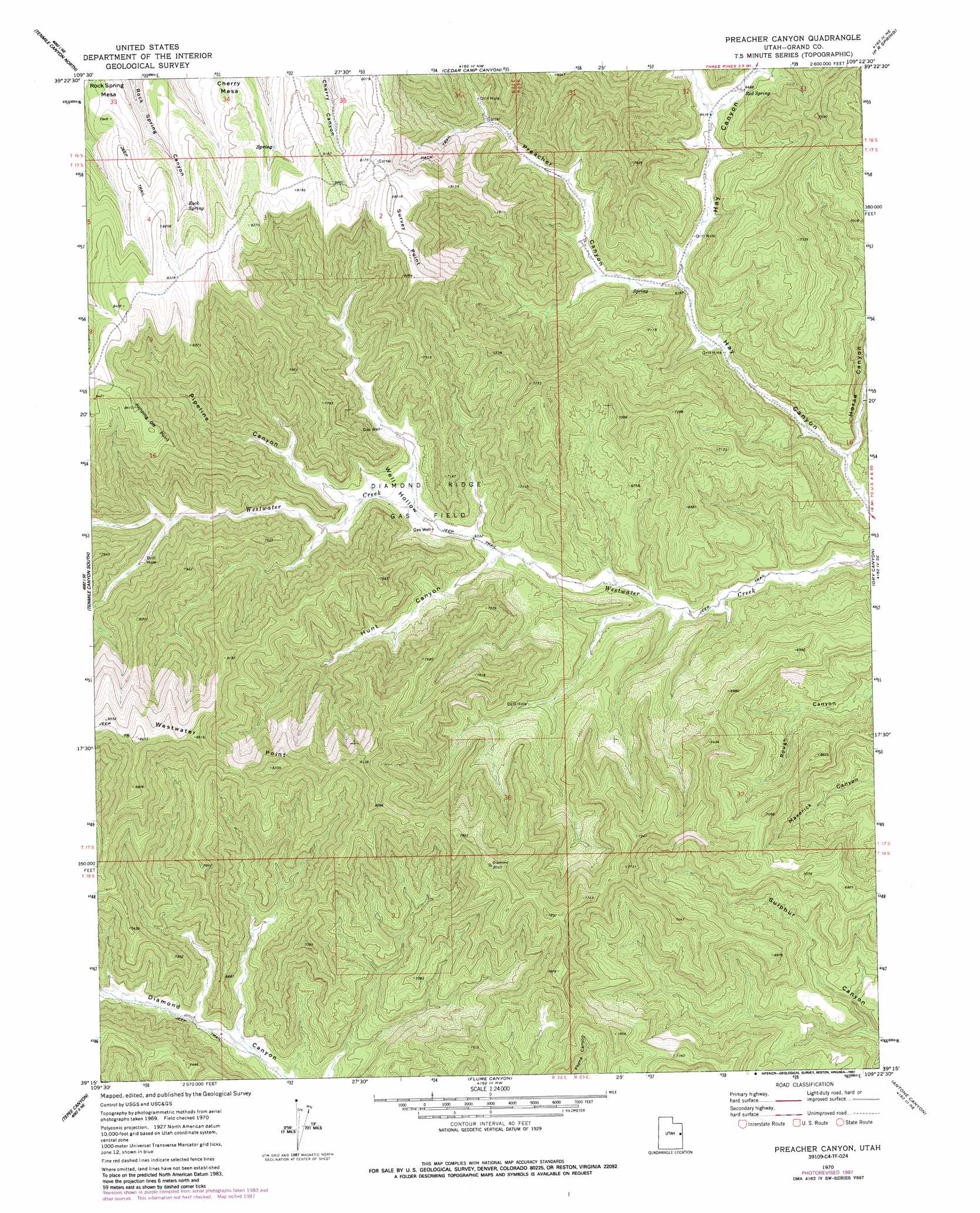
Preacher Canyon Topo Map Utah
To zoom in, hover over the map of Preacher Canyon
USGS Topo Quad 39109c4 - 1:24,000 scale
| Topo Map Name: | Preacher Canyon |
| USGS Topo Quad ID: | 39109c4 |
| Print Size: | ca. 21 1/4" wide x 27" high |
| Southeast Coordinates: | 39.25° N latitude / 109.375° W longitude |
| Map Center Coordinates: | 39.3125° N latitude / 109.4375° W longitude |
| U.S. State: | UT |
| Filename: | o39109c4.jpg |
| Download Map JPG Image: | Preacher Canyon topo map 1:24,000 scale |
| Map Type: | Topographic |
| Topo Series: | 7.5´ |
| Map Scale: | 1:24,000 |
| Source of Map Images: | United States Geological Survey (USGS) |
| Alternate Map Versions: |
Preacher Canyon UT 1970, updated 1973 Download PDF Buy paper map Preacher Canyon UT 1970, updated 1987 Download PDF Buy paper map Preacher Canyon UT 2011 Download PDF Buy paper map Preacher Canyon UT 2014 Download PDF Buy paper map |
1:24,000 Topo Quads surrounding Preacher Canyon
Flat Rock Mesa |
Wolf Point |
Pine Spring Canyon |
Seep Canyon |
Tom Patterson Canyon |
Black Knolls |
Tenmile Canyon North |
Cedar Camp Canyon |
P R Spring |
San Arroyo Ridge |
Supply Canyon |
Tenmile Canyon South |
Preacher Canyon |
Dry Canyon |
Bryson Canyon |
Bogart Canyon |
Tepee Canyon |
Flume Canyon |
Antone Canyon |
Harley Dome |
Sego Canyon |
Calf Canyon |
Cisco Springs |
Danish Flat |
Agate |
> Back to 39109a1 at 1:100,000 scale
> Back to 39108a1 at 1:250,000 scale
> Back to U.S. Topo Maps home
Preacher Canyon topo map: Gazetteer
Preacher Canyon: Capes
Westwater Point elevation 2638m 8654′Preacher Canyon: Oilfields
Diamond Ridge Gas Field elevation 2026m 6646′Preacher Canyon: Springs
Red Spring elevation 1989m 6525′Rock Spring elevation 2427m 7962′
Preacher Canyon: Summits
Jumping Off Point elevation 2556m 8385′Survey Point elevation 2506m 8221′
Preacher Canyon: Valleys
Horse Canyon elevation 1789m 5869′Hunt Canyon elevation 1930m 6332′
Pipeline Canyon elevation 1996m 6548′
Preacher Canyon elevation 1883m 6177′
Well Hollow elevation 1997m 6551′
Preacher Canyon digital topo map on disk
Buy this Preacher Canyon topo map showing relief, roads, GPS coordinates and other geographical features, as a high-resolution digital map file on DVD: