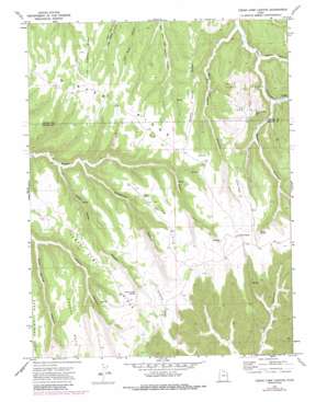
Cedar Camp Canyon Topo Map Utah
To zoom in, hover over the map of Cedar Camp Canyon
USGS Topo Quad 39109d4 - 1:24,000 scale
| Topo Map Name: | Cedar Camp Canyon |
| USGS Topo Quad ID: | 39109d4 |
| Print Size: | ca. 21 1/4" wide x 27" high |
| Southeast Coordinates: | 39.375° N latitude / 109.375° W longitude |
| Map Center Coordinates: | 39.4375° N latitude / 109.4375° W longitude |
| U.S. State: | UT |
| Filename: | o39109d4.jpg |
| Download Map JPG Image: | Cedar Camp Canyon topo map 1:24,000 scale |
| Map Type: | Topographic |
| Topo Series: | 7.5´ |
| Map Scale: | 1:24,000 |
| Source of Map Images: | United States Geological Survey (USGS) |
| Alternate Map Versions: |
Cedar Camp Canyon UT 1970, updated 1973 Download PDF Buy paper map Cedar Camp Canyon UT 1970, updated 1982 Download PDF Buy paper map Cedar Camp Canyon UT 1970, updated 1987 Download PDF Buy paper map Cedar Camp Canyon UT 2011 Download PDF Buy paper map Cedar Camp Canyon UT 2014 Download PDF Buy paper map |
1:24,000 Topo Quads surrounding Cedar Camp Canyon
> Back to 39109a1 at 1:100,000 scale
> Back to 39108a1 at 1:250,000 scale
> Back to U.S. Topo Maps home
Cedar Camp Canyon topo map: Gazetteer
Cedar Camp Canyon: Flats
Willow Flats elevation 2340m 7677′Cedar Camp Canyon: Oilfields
Fence Canyon Gas Field elevation 2345m 7693′Cedar Camp Canyon: Populated Places
Three Pines elevation 2389m 7837′Cedar Camp Canyon: Ridges
Cedar Camp Ridge elevation 2309m 7575′Little Asphalt Ridge elevation 2255m 7398′
Pretty Valley Ridge elevation 2329m 7641′
Snowshoe Ridge elevation 2408m 7900′
Cedar Camp Canyon: Springs
Cedar Camp Spring elevation 2335m 7660′Shale Spring elevation 2340m 7677′
Cedar Camp Canyon: Summits
Cherry Mesa elevation 2345m 7693′Wire Fence Point elevation 2382m 7814′
Cedar Camp Canyon: Valleys
Cedar Camp Canyon elevation 2089m 6853′Cherry Canyon elevation 2102m 6896′
Meadow Canyon elevation 2108m 6916′
Snowshoe Canyon elevation 2109m 6919′
Whetrock Canyon elevation 2124m 6968′
Wire Fence Canyon elevation 2092m 6863′
Cedar Camp Canyon digital topo map on disk
Buy this Cedar Camp Canyon topo map showing relief, roads, GPS coordinates and other geographical features, as a high-resolution digital map file on DVD:


