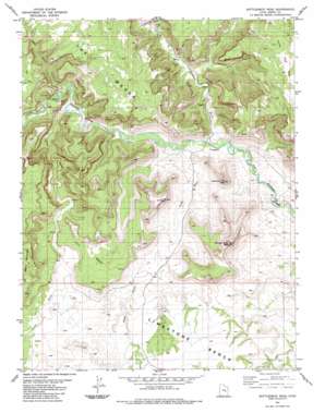
Bottleneck Peak Topo Map Utah
To zoom in, hover over the map of Bottleneck Peak
USGS Topo Quad 39110a6 - 1:24,000 scale
| Topo Map Name: | Bottleneck Peak |
| USGS Topo Quad ID: | 39110a6 |
| Print Size: | ca. 21 1/4" wide x 27" high |
| Southeast Coordinates: | 39° N latitude / 110.625° W longitude |
| Map Center Coordinates: | 39.0625° N latitude / 110.6875° W longitude |
| U.S. State: | UT |
| Filename: | o39110a6.jpg |
| Download Map JPG Image: | Bottleneck Peak topo map 1:24,000 scale |
| Map Type: | Topographic |
| Topo Series: | 7.5´ |
| Map Scale: | 1:24,000 |
| Source of Map Images: | United States Geological Survey (USGS) |
| Alternate Map Versions: |
Red Plateau SW UT 1953, updated 1954 Download PDF Buy paper map Red Plateau SW UT 1953, updated 1964 Download PDF Buy paper map Bottleneck Peak UT 1983, updated 1983 Download PDF Buy paper map Bottleneck Peak UT 2011 Download PDF Buy paper map Bottleneck Peak UT 2014 Download PDF Buy paper map |
1:24,000 Topo Quads surrounding Bottleneck Peak
> Back to 39110a1 at 1:100,000 scale
> Back to 39110a1 at 1:250,000 scale
> Back to U.S. Topo Maps home
Bottleneck Peak topo map: Gazetteer
Bottleneck Peak: Benches
Limestone Bench elevation 1752m 5748′Bottleneck Peak: Flats
Prickly Pear Flat elevation 1939m 6361′Bottleneck Peak: Summits
Assembly Hall Peak elevation 1886m 6187′Bottleneck Peak elevation 1947m 6387′
No Mans Mountain elevation 2017m 6617′
Window Blind Peak elevation 2138m 7014′
Bottleneck Peak: Valleys
Buckhorn Wash elevation 1554m 5098′Calf Canyon elevation 1595m 5232′
Cane Wash elevation 1583m 5193′
Good Water Canyon elevation 1576m 5170′
Little Grand Canyon elevation 1576m 5170′
Pine Canyon elevation 1612m 5288′
Road Draw elevation 1557m 5108′
Bottleneck Peak digital topo map on disk
Buy this Bottleneck Peak topo map showing relief, roads, GPS coordinates and other geographical features, as a high-resolution digital map file on DVD:


