Sids Mountain Topo Map Utah
To zoom in, hover over the map of Sids Mountain
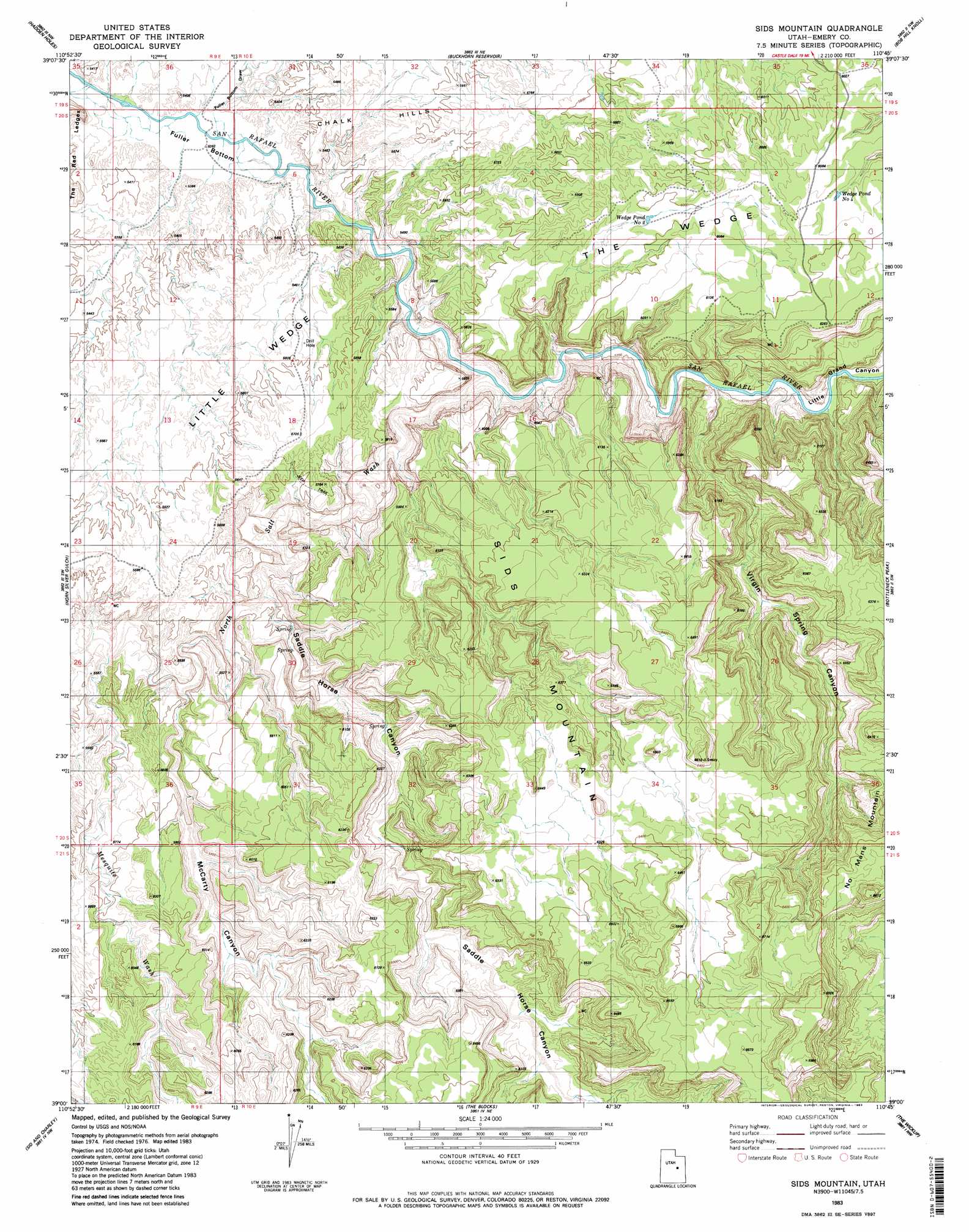
USGS Topo Quad 39110a7 - 1:24,000 scale
| Topo Map Name: | Sids Mountain |
| USGS Topo Quad ID: | 39110a7 |
| Print Size: | ca. 21 1/4" wide x 27" high |
| Southeast Coordinates: | 39° N latitude / 110.75° W longitude |
| Map Center Coordinates: | 39.0625° N latitude / 110.8125° W longitude |
| U.S. State: | UT |
| Filename: | o39110a7.jpg |
| Download Map JPG Image: | Sids Mountain topo map 1:24,000 scale |
| Map Type: | Topographic |
| Topo Series: | 7.5´ |
| Map Scale: | 1:24,000 |
| Source of Map Images: | United States Geological Survey (USGS) |
| Alternate Map Versions: |
Wilsonville SE UT 1953 Download PDF Buy paper map Wilsonville SE UT 1954 Download PDF Buy paper map Sids Mountain UT 1983, updated 1983 Download PDF Buy paper map Sids Mountain UT 2011 Download PDF Buy paper map Sids Mountain UT 2014 Download PDF Buy paper map |
1:24,000 Topo Quads surrounding Sids Mountain
Red Point |
Huntington |
Cleveland |
Cow Flats |
Flattop Mountain |
Castle Dale |
Hadden Holes |
Buckhorn Reservoir |
Bob Hill Knoll |
Chimney Rock |
Molen |
Horn Silver Gulch |
Sids Mountain |
Bottleneck Peak |
Devils Hole |
Short Canyon |
Sid And Charley |
The Blocks |
The Wickiup |
Drowned Hole Draw |
Big Bend Draw |
Copper Globe |
San Rafael Knob |
Twin Knolls |
Arsons Garden |
> Back to 39110a1 at 1:100,000 scale
> Back to 39110a1 at 1:250,000 scale
> Back to U.S. Topo Maps home
Sids Mountain topo map: Gazetteer
Sids Mountain: Flats
Fuller Bottom elevation 1603m 5259′Sids Mountain: Lakes
Wedge Pond Number 2 elevation 1820m 5971′Wedge Pond Number 4 elevation 1870m 6135′
Sids Mountain: Plains
Little Wedge Plateau elevation 1694m 5557′Sids Mountain: Summits
Sids Mountain elevation 2012m 6601′Sids Mountain: Valleys
Fuller Bottom Draw elevation 1610m 5282′McCarty Canyon elevation 1642m 5387′
Mesquite Wash elevation 1658m 5439′
North Salt Wash elevation 1593m 5226′
Saddle Horse Canyon elevation 1631m 5351′
Virgin Spring Canyon elevation 1584m 5196′
Sids Mountain digital topo map on disk
Buy this Sids Mountain topo map showing relief, roads, GPS coordinates and other geographical features, as a high-resolution digital map file on DVD: