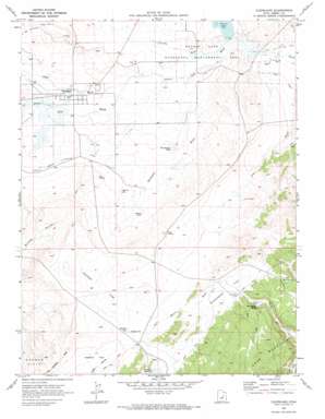
Cleveland Topo Map Utah
To zoom in, hover over the map of Cleveland
USGS Topo Quad 39110c7 - 1:24,000 scale
| Topo Map Name: | Cleveland |
| USGS Topo Quad ID: | 39110c7 |
| Print Size: | ca. 21 1/4" wide x 27" high |
| Southeast Coordinates: | 39.25° N latitude / 110.75° W longitude |
| Map Center Coordinates: | 39.3125° N latitude / 110.8125° W longitude |
| U.S. State: | UT |
| Filename: | o39110c7.jpg |
| Download Map JPG Image: | Cleveland topo map 1:24,000 scale |
| Map Type: | Topographic |
| Topo Series: | 7.5´ |
| Map Scale: | 1:24,000 |
| Source of Map Images: | United States Geological Survey (USGS) |
| Alternate Map Versions: |
Cleveland UT 1969, updated 1972 Download PDF Buy paper map Cleveland UT 2011 Download PDF Buy paper map Cleveland UT 2014 Download PDF Buy paper map |
1:24,000 Topo Quads surrounding Cleveland
> Back to 39110a1 at 1:100,000 scale
> Back to 39110a1 at 1:250,000 scale
> Back to U.S. Topo Maps home
Cleveland topo map: Gazetteer
Cleveland: Flats
Greasewood Flat elevation 1809m 5935′Jackass Flat elevation 1782m 5846′
Cleveland: Lakes
Desert Lake elevation 1700m 5577′Hadden Pit elevation 1772m 5813′
Old Ramage Pond elevation 1738m 5702′
Cleveland: Parks
Desert Lake Waterfowl Management Area elevation 1707m 5600′Cleveland: Populated Places
Cleveland elevation 1744m 5721′Cleveland: Post Offices
Cleveland Post Office elevation 1751m 5744′Cleveland: Reservoirs
C C C Pond elevation 1755m 5757′Hadden Reservoir elevation 1773m 5816′
Russel Pond elevation 1763m 5784′
Cleveland: Springs
Bull Hollow Spring elevation 1833m 6013′Goat Spring elevation 1867m 6125′
Cleveland: Summits
Big Hill elevation 1783m 5849′The Peaks elevation 1787m 5862′
The Rocks elevation 1800m 5905′
Cleveland: Valleys
Bull Hollow elevation 1812m 5944′Desert Lake Wash elevation 1701m 5580′
Sand Wash elevation 1711m 5613′
Shoemaker Wash elevation 1707m 5600′
Timothy Wash elevation 1701m 5580′
Cleveland digital topo map on disk
Buy this Cleveland topo map showing relief, roads, GPS coordinates and other geographical features, as a high-resolution digital map file on DVD:


