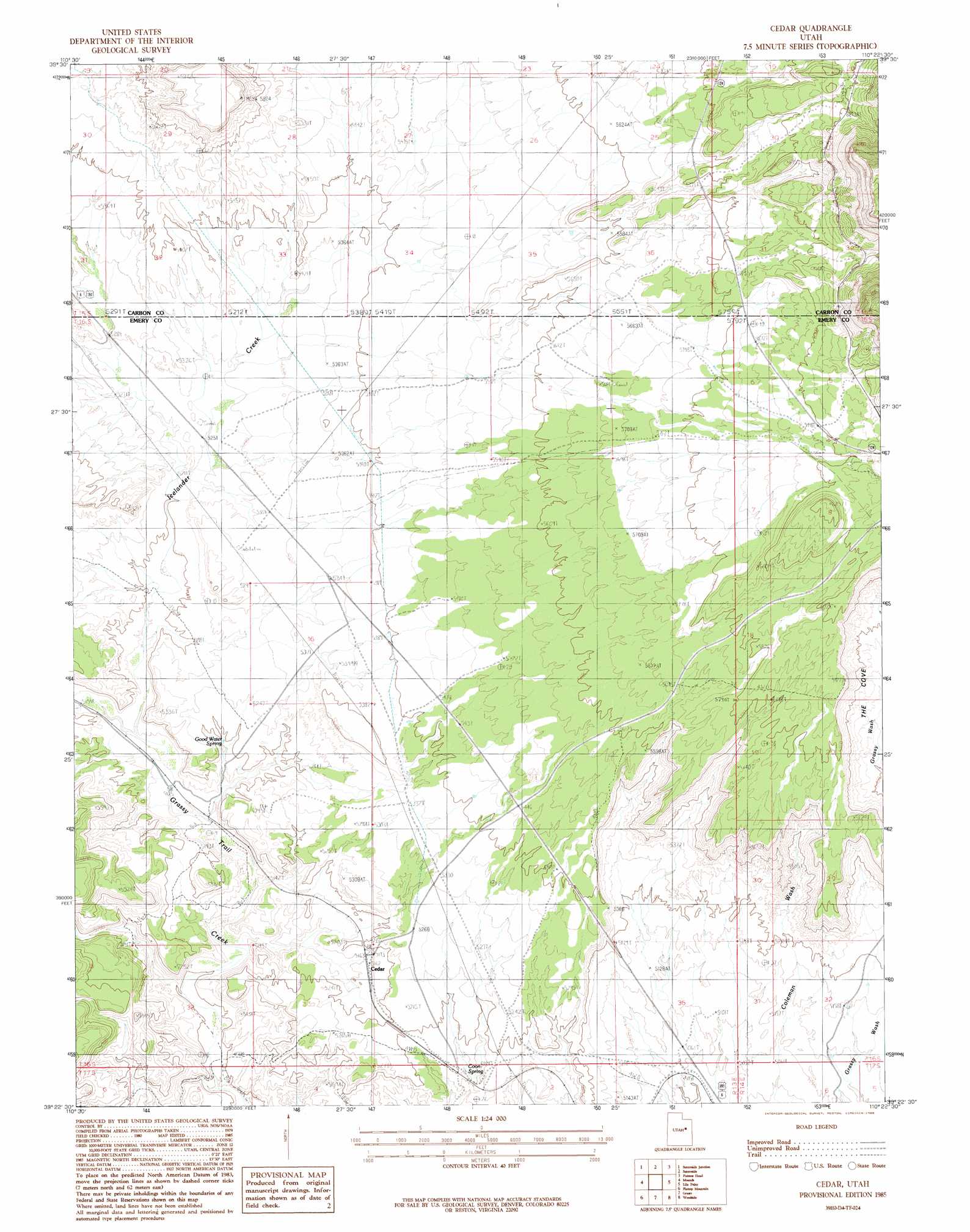
Cedar Topo Map Utah
To zoom in, hover over the map of Cedar
USGS Topo Quad 39110d4 - 1:24,000 scale
| Topo Map Name: | Cedar |
| USGS Topo Quad ID: | 39110d4 |
| Print Size: | ca. 21 1/4" wide x 27" high |
| Southeast Coordinates: | 39.375° N latitude / 110.375° W longitude |
| Map Center Coordinates: | 39.4375° N latitude / 110.4375° W longitude |
| U.S. State: | UT |
| Filename: | o39110d4.jpg |
| Download Map JPG Image: | Cedar topo map 1:24,000 scale |
| Map Type: | Topographic |
| Topo Series: | 7.5´ |
| Map Scale: | 1:24,000 |
| Source of Map Images: | United States Geological Survey (USGS) |
| Alternate Map Versions: |
Cedar UT 1985, updated 1985 Download PDF Buy paper map Cedar UT 2011 Download PDF Buy paper map Cedar UT 2014 Download PDF Buy paper map |
1:24,000 Topo Quads surrounding Cedar
Deadman Canyon |
Pine Canyon |
Mount Bartles |
Bruin Point |
Twin Hollow |
Wellington |
Sunnyside Junction |
Sunnyside |
Patmos Head |
Summerhouse Ridge |
Olsen Reservoir |
Mounds |
Cedar |
Lila Point |
Lighthouse Canyon |
Cow Flats |
Flattop Mountain |
Grassy |
Woodside |
Turtle Canyon |
Bob Hill Knoll |
Chimney Rock |
Dry Mesa |
Cliff |
Jenny Canyon |
> Back to 39110a1 at 1:100,000 scale
> Back to 39110a1 at 1:250,000 scale
> Back to U.S. Topo Maps home
Cedar topo map: Gazetteer
Cedar: Populated Places
Cedar elevation 1586m 5203′Cedar: Springs
Coon Spring elevation 1561m 5121′Good Water Spring elevation 1582m 5190′
Cedar: Streams
Horse Creek elevation 1533m 5029′Icelander Creek elevation 1563m 5127′
Cedar: Valleys
Fan Canyon elevation 1866m 6122′Horse Canyon elevation 1813m 5948′
Middle Canyon elevation 1825m 5987′
The Cove elevation 1650m 5413′
Cedar digital topo map on disk
Buy this Cedar topo map showing relief, roads, GPS coordinates and other geographical features, as a high-resolution digital map file on DVD: