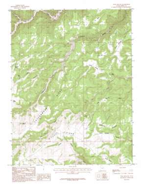
Twin Hollow Topo Map Utah
To zoom in, hover over the map of Twin Hollow
USGS Topo Quad 39110f2 - 1:24,000 scale
| Topo Map Name: | Twin Hollow |
| USGS Topo Quad ID: | 39110f2 |
| Print Size: | ca. 21 1/4" wide x 27" high |
| Southeast Coordinates: | 39.625° N latitude / 110.125° W longitude |
| Map Center Coordinates: | 39.6875° N latitude / 110.1875° W longitude |
| U.S. State: | UT |
| Filename: | o39110f2.jpg |
| Download Map JPG Image: | Twin Hollow topo map 1:24,000 scale |
| Map Type: | Topographic |
| Topo Series: | 7.5´ |
| Map Scale: | 1:24,000 |
| Source of Map Images: | United States Geological Survey (USGS) |
| Alternate Map Versions: |
Twin Hollow UT 1985, updated 1985 Download PDF Buy paper map Twin Hollow UT 2011 Download PDF Buy paper map Twin Hollow UT 2014 Download PDF Buy paper map |
1:24,000 Topo Quads surrounding Twin Hollow
> Back to 39110e1 at 1:100,000 scale
> Back to 39110a1 at 1:250,000 scale
> Back to U.S. Topo Maps home
Twin Hollow topo map: Gazetteer
Twin Hollow: Flats
Dry Farm Flat elevation 2224m 7296′Sage Brush Flat elevation 2219m 7280′
Twin Hollow: Ridges
Bishop Ridge elevation 2559m 8395′Cottonwood Ridge elevation 2626m 8615′
Twin Hollow: Springs
Buckhorn Spring elevation 2471m 8106′Clay Bank Spring elevation 2398m 7867′
Elbow Spring elevation 2450m 8038′
Indian Spring elevation 2045m 6709′
Petes Spring elevation 2394m 7854′
Pine Spring elevation 2395m 7857′
Pine Spring elevation 2333m 7654′
Twin Hollow: Streams
Stone Cabin Creek elevation 1899m 6230′Twin Hollow: Summits
Flat Iron Mesa elevation 2254m 7395′Flat Top elevation 2186m 7171′
Horse Haven Summit elevation 2371m 7778′
Twin Hollow: Valleys
Bishop Canyon elevation 2256m 7401′Indian Swale elevation 2079m 6820′
Stone Cabin Draw elevation 1911m 6269′
Twin Hollow elevation 2219m 7280′
Twin Hollow digital topo map on disk
Buy this Twin Hollow topo map showing relief, roads, GPS coordinates and other geographical features, as a high-resolution digital map file on DVD:


