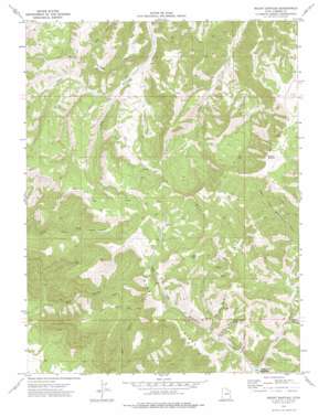
Mount Bartles Topo Map Utah
To zoom in, hover over the map of Mount Bartles
USGS Topo Quad 39110f4 - 1:24,000 scale
| Topo Map Name: | Mount Bartles |
| USGS Topo Quad ID: | 39110f4 |
| Print Size: | ca. 21 1/4" wide x 27" high |
| Southeast Coordinates: | 39.625° N latitude / 110.375° W longitude |
| Map Center Coordinates: | 39.6875° N latitude / 110.4375° W longitude |
| U.S. State: | UT |
| Filename: | o39110f4.jpg |
| Download Map JPG Image: | Mount Bartles topo map 1:24,000 scale |
| Map Type: | Topographic |
| Topo Series: | 7.5´ |
| Map Scale: | 1:24,000 |
| Source of Map Images: | United States Geological Survey (USGS) |
| Alternate Map Versions: |
Mount Bartles UT 1972, updated 1976 Download PDF Buy paper map Mount Bartles UT 2011 Download PDF Buy paper map Mount Bartles UT 2014 Download PDF Buy paper map |
1:24,000 Topo Quads surrounding Mount Bartles
> Back to 39110e1 at 1:100,000 scale
> Back to 39110a1 at 1:250,000 scale
> Back to U.S. Topo Maps home
Mount Bartles topo map: Gazetteer
Mount Bartles: Ridges
Twist Ridge elevation 2612m 8569′West Ridge elevation 2639m 8658′
Mount Bartles: Springs
Dancehall Spring elevation 2748m 9015′Hanging Rock Spring elevation 2505m 8218′
Mount Bartles: Summits
Mount Bartles elevation 3027m 9931′Mount Bartles: Valleys
Graveyard Canyon elevation 2348m 7703′Hanging Rock Canyon elevation 2388m 7834′
Left Fork Whitmore Canyon elevation 2313m 7588′
Little Spring Canyon elevation 2434m 7985′
Right Fork Cow Canyon elevation 2250m 7381′
Right Fork Whitmore Canyon elevation 2315m 7595′
South Patterfore Canyon elevation 2407m 7896′
Spring Canyon elevation 2407m 7896′
Mount Bartles digital topo map on disk
Buy this Mount Bartles topo map showing relief, roads, GPS coordinates and other geographical features, as a high-resolution digital map file on DVD:


