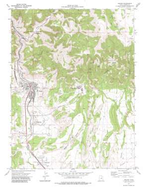
Helper Topo Map Utah
To zoom in, hover over the map of Helper
USGS Topo Quad 39110f7 - 1:24,000 scale
| Topo Map Name: | Helper |
| USGS Topo Quad ID: | 39110f7 |
| Print Size: | ca. 21 1/4" wide x 27" high |
| Southeast Coordinates: | 39.625° N latitude / 110.75° W longitude |
| Map Center Coordinates: | 39.6875° N latitude / 110.8125° W longitude |
| U.S. State: | UT |
| Filename: | o39110f7.jpg |
| Download Map JPG Image: | Helper topo map 1:24,000 scale |
| Map Type: | Topographic |
| Topo Series: | 7.5´ |
| Map Scale: | 1:24,000 |
| Source of Map Images: | United States Geological Survey (USGS) |
| Alternate Map Versions: |
Helper UT 1972, updated 1976 Download PDF Buy paper map Helper UT 1972, updated 1983 Download PDF Buy paper map Helper UT 1972, updated 1983 Download PDF Buy paper map Helper UT 2011 Download PDF Buy paper map Helper UT 2014 Download PDF Buy paper map |
1:24,000 Topo Quads surrounding Helper
> Back to 39110e1 at 1:100,000 scale
> Back to 39110a1 at 1:250,000 scale
> Back to U.S. Topo Maps home
Helper topo map: Gazetteer
Helper: Canals
Glen Canal elevation 1785m 5856′Helper: Mines
Aberdeen Mine elevation 2182m 7158′Castle Gate Mine Number 1 elevation 1902m 6240′
Castle Gate Mine Number 2 elevation 1903m 6243′
Castle Gate Mine Number 4 elevation 1904m 6246′
Ketchum Mine elevation 1948m 6391′
Milburn Mine elevation 2182m 7158′
Helper: Populated Places
Heiner elevation 1840m 6036′Helper elevation 1773m 5816′
Kenilworth elevation 1990m 6528′
Martin elevation 1812m 5944′
Spring Glen elevation 1759m 5770′
Helper: Post Offices
Ewell Post Office (historical) elevation 1761m 5777′Panther Carbon Post Office (historical) elevation 1850m 6069′
Helper: Streams
Willow Creek elevation 1853m 6079′Helper: Valleys
Alrad Canyon elevation 1907m 6256′Barn Canyon elevation 1884m 6181′
Consumers Wash elevation 1743m 5718′
Cordingly Canyon elevation 1936m 6351′
Dry Canyon elevation 1999m 6558′
Garley Canyon elevation 1730m 5675′
Gentile Wash elevation 1834m 6017′
Hardscrabble Canyon elevation 1834m 6017′
Helper Canyon elevation 1794m 5885′
Kenilworth Wash elevation 1794m 5885′
Panther Canyon elevation 1823m 5980′
Price Canyon elevation 1819m 5967′
Spring Canyon elevation 1802m 5912′
Warehouse Canyon elevation 1719m 5639′
Helper digital topo map on disk
Buy this Helper topo map showing relief, roads, GPS coordinates and other geographical features, as a high-resolution digital map file on DVD:


