Currant Canyon Topo Map Utah
To zoom in, hover over the map of Currant Canyon
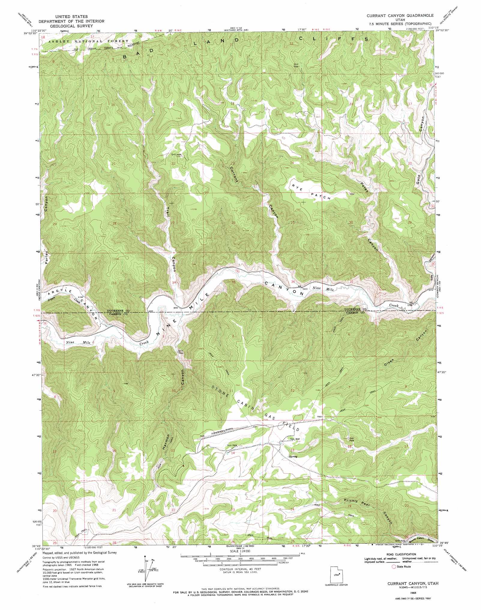
USGS Topo Quad 39110g3 - 1:24,000 scale
| Topo Map Name: | Currant Canyon |
| USGS Topo Quad ID: | 39110g3 |
| Print Size: | ca. 21 1/4" wide x 27" high |
| Southeast Coordinates: | 39.75° N latitude / 110.25° W longitude |
| Map Center Coordinates: | 39.8125° N latitude / 110.3125° W longitude |
| U.S. State: | UT |
| Filename: | o39110g3.jpg |
| Download Map JPG Image: | Currant Canyon topo map 1:24,000 scale |
| Map Type: | Topographic |
| Topo Series: | 7.5´ |
| Map Scale: | 1:24,000 |
| Source of Map Images: | United States Geological Survey (USGS) |
| Alternate Map Versions: |
Currant Canyon UT 1968, updated 1971 Download PDF Buy paper map Currant Canyon UT 1996, updated 2000 Download PDF Buy paper map Currant Canyon UT 2011 Download PDF Buy paper map Currant Canyon UT 2014 Download PDF Buy paper map |
| FStopo: | US Forest Service topo Currant Canyon is available: Download FStopo PDF Download FStopo TIF |
1:24,000 Topo Quads surrounding Currant Canyon
Buck Knoll |
Duchesne Sw |
Duchesne Se |
Myton Sw |
Myton Se |
Lance Canyon |
Anthro Mountain |
Anthro Mountain Ne |
Gilsonite Draw |
Wilkin Ridge |
Minnie Maud Creek East |
Wood Canyon |
Currant Canyon |
Cowboy Bench |
Pinnacle Canyon |
Pine Canyon |
Mount Bartles |
Bruin Point |
Twin Hollow |
Cedar Ridge Canyon |
Sunnyside Junction |
Sunnyside |
Patmos Head |
Summerhouse Ridge |
Steer Ridge Canyon |
> Back to 39110e1 at 1:100,000 scale
> Back to 39110a1 at 1:250,000 scale
> Back to U.S. Topo Maps home
Currant Canyon topo map: Gazetteer
Currant Canyon: Airports
Interplanetary Airstrip (historical) elevation 2321m 7614′Currant Canyon: Flats
Rye Patch elevation 2122m 6961′Currant Canyon: Oilfields
Stone Cabin Gas Field elevation 2313m 7588′Currant Canyon: Streams
Argyle Creek elevation 1854m 6082′Currant Canyon: Valleys
Argyle Canyon elevation 1869m 6131′Currant Canyon elevation 1822m 5977′
Harmon Canyon elevation 1841m 6040′
Petes Canyon elevation 1774m 5820′
Prickly Pear Canyon elevation 2022m 6633′
Trail Canyon elevation 1846m 6056′
Currant Canyon digital topo map on disk
Buy this Currant Canyon topo map showing relief, roads, GPS coordinates and other geographical features, as a high-resolution digital map file on DVD: