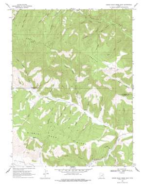
Minnie Maud Creek East Topo Map Utah
To zoom in, hover over the map of Minnie Maud Creek East
USGS Topo Quad 39110g5 - 1:24,000 scale
| Topo Map Name: | Minnie Maud Creek East |
| USGS Topo Quad ID: | 39110g5 |
| Print Size: | ca. 21 1/4" wide x 27" high |
| Southeast Coordinates: | 39.75° N latitude / 110.5° W longitude |
| Map Center Coordinates: | 39.8125° N latitude / 110.5625° W longitude |
| U.S. State: | UT |
| Filename: | o39110g5.jpg |
| Download Map JPG Image: | Minnie Maud Creek East topo map 1:24,000 scale |
| Map Type: | Topographic |
| Topo Series: | 7.5´ |
| Map Scale: | 1:24,000 |
| Source of Map Images: | United States Geological Survey (USGS) |
| Alternate Map Versions: |
Minnie Maud Creek East UT 1969, updated 1971 Download PDF Buy paper map Minnie Maud Creek East UT 1969, updated 1978 Download PDF Buy paper map Minnie Maud Creek East UT 2011 Download PDF Buy paper map Minnie Maud Creek East UT 2014 Download PDF Buy paper map |
1:24,000 Topo Quads surrounding Minnie Maud Creek East
> Back to 39110e1 at 1:100,000 scale
> Back to 39110a1 at 1:250,000 scale
> Back to U.S. Topo Maps home
Minnie Maud Creek East topo map: Gazetteer
Minnie Maud Creek East: Flats
Whitmore Park elevation 2262m 7421′Minnie Maud Creek East: Lakes
Sky-high Pond elevation 2578m 8458′Minnie Maud Creek East: Ridges
Argyle Ridge elevation 2783m 9130′Minnie Maud Creek East: Streams
Minnie Maud Creek elevation 2099m 6886′Minnie Maud Creek East: Valleys
Badger Canyon elevation 2171m 7122′Bear Canyon elevation 2256m 7401′
Big Bear Canyon elevation 2120m 6955′
Brundage Cove elevation 2154m 7066′
Cottonwood Canyon elevation 2244m 7362′
Hidden Hollow elevation 2194m 7198′
Indian Canyon elevation 2220m 7283′
Jim Canyon elevation 2275m 7463′
Lion Canyon elevation 2159m 7083′
Little Bear Canyon elevation 2166m 7106′
Lower Water Hollow Canyon elevation 2185m 7168′
North Hollow elevation 2117m 6945′
Pasture Canyon elevation 2177m 7142′
Pinnacle Canyon elevation 2197m 7208′
Pole Canyon elevation 2148m 7047′
Rocky Canyon elevation 2219m 7280′
Sorenson Draw elevation 2218m 7276′
Squaw Fill elevation 2201m 7221′
Twist Trail elevation 2296m 7532′
Upper Water Hollow Canyon elevation 2287m 7503′
Vans Canyon elevation 2317m 7601′
Wash Canyon elevation 2167m 7109′
Water Canyon elevation 2229m 7312′
Whitmore Canyon elevation 2255m 7398′
Williams Canyon elevation 2198m 7211′
Minnie Maud Creek East digital topo map on disk
Buy this Minnie Maud Creek East topo map showing relief, roads, GPS coordinates and other geographical features, as a high-resolution digital map file on DVD:


