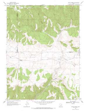
Matts Summit Topo Map Utah
To zoom in, hover over the map of Matts Summit
USGS Topo Quad 39110g7 - 1:24,000 scale
| Topo Map Name: | Matts Summit |
| USGS Topo Quad ID: | 39110g7 |
| Print Size: | ca. 21 1/4" wide x 27" high |
| Southeast Coordinates: | 39.75° N latitude / 110.75° W longitude |
| Map Center Coordinates: | 39.8125° N latitude / 110.8125° W longitude |
| U.S. State: | UT |
| Filename: | o39110g7.jpg |
| Download Map JPG Image: | Matts Summit topo map 1:24,000 scale |
| Map Type: | Topographic |
| Topo Series: | 7.5´ |
| Map Scale: | 1:24,000 |
| Source of Map Images: | United States Geological Survey (USGS) |
| Alternate Map Versions: |
Matts Summit UT 1969, updated 1971 Download PDF Buy paper map Matts Summit UT 1996, updated 1999 Download PDF Buy paper map Matts Summit UT 2011 Download PDF Buy paper map Matts Summit UT 2014 Download PDF Buy paper map |
| FStopo: | US Forest Service topo Matts Summit is available: Download FStopo PDF Download FStopo TIF |
1:24,000 Topo Quads surrounding Matts Summit
> Back to 39110e1 at 1:100,000 scale
> Back to 39110a1 at 1:250,000 scale
> Back to U.S. Topo Maps home
Matts Summit topo map: Gazetteer
Matts Summit: Flats
Emma Park elevation 2245m 7365′Matts Summit: Parks
Bamberger Monument elevation 2193m 7194′Matts Summit: Reservoirs
Little Boulder Dam elevation 2183m 7162′Pace Pond elevation 2485m 8152′
Matts Summit: Springs
Box Spring elevation 2230m 7316′Pipe Spring elevation 2280m 7480′
Matts Summit: Streams
Summit Creek elevation 2165m 7103′West Fork Willow Creek elevation 2229m 7312′
Matts Summit: Summits
Matts Summit elevation 2270m 7447′Matts Summit: Valleys
Anderson Hollow elevation 2461m 8074′Buck Canyon elevation 2438m 7998′
Deep Canyon elevation 2135m 7004′
Jack Canyon elevation 2243m 7358′
Jones Hollow elevation 2281m 7483′
Logge Canyon elevation 2307m 7568′
Mathis Canyon elevation 2104m 6902′
Matts Summit digital topo map on disk
Buy this Matts Summit topo map showing relief, roads, GPS coordinates and other geographical features, as a high-resolution digital map file on DVD:


