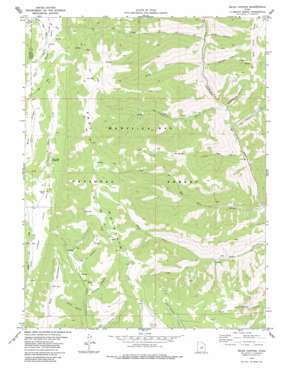
Rilda Canyon Topo Map Utah
To zoom in, hover over the map of Rilda Canyon
USGS Topo Quad 39111d2 - 1:24,000 scale
| Topo Map Name: | Rilda Canyon |
| USGS Topo Quad ID: | 39111d2 |
| Print Size: | ca. 21 1/4" wide x 27" high |
| Southeast Coordinates: | 39.375° N latitude / 111.125° W longitude |
| Map Center Coordinates: | 39.4375° N latitude / 111.1875° W longitude |
| U.S. State: | UT |
| Filename: | o39111d2.jpg |
| Download Map JPG Image: | Rilda Canyon topo map 1:24,000 scale |
| Map Type: | Topographic |
| Topo Series: | 7.5´ |
| Map Scale: | 1:24,000 |
| Source of Map Images: | United States Geological Survey (USGS) |
| Alternate Map Versions: |
Rilda Canyon UT 1979, updated 1979 Download PDF Buy paper map Rilda Canyon UT 1979, updated 1984 Download PDF Buy paper map Rilda Canyon UT 2001, updated 2004 Download PDF Buy paper map Rilda Canyon UT 2011 Download PDF Buy paper map Rilda Canyon UT 2014 Download PDF Buy paper map |
| FStopo: | US Forest Service topo Rilda Canyon is available: Download FStopo PDF Download FStopo TIF |
1:24,000 Topo Quads surrounding Rilda Canyon
> Back to 39111a1 at 1:100,000 scale
> Back to 39110a1 at 1:250,000 scale
> Back to U.S. Topo Maps home
Rilda Canyon topo map: Gazetteer
Rilda Canyon: Forests
Manti-La Sal National Forest - Manti Division elevation 2532m 8307′Rilda Canyon: Mines
Coenwal Mine elevation 2382m 7814′Hunington Number 4 Mine elevation 2454m 8051′
Rilda Canyon: Ridges
Bald Ridge elevation 2836m 9304′Rilda Canyon: Streams
Horse Creek elevation 2319m 7608′Left Fork Huntington Creek elevation 2346m 7696′
Mill Fork elevation 2147m 7043′
Paradise Creek elevation 2649m 8690′
Spoon Creek elevation 2755m 9038′
Rilda Canyon: Summits
East Mountain elevation 3272m 10734′Trail Mountain elevation 3076m 10091′
Rilda Canyon: Valleys
Biddlecome Hollow elevation 2259m 7411′Blind Canyon elevation 2294m 7526′
Crandall Canyon elevation 2251m 7385′
Flat Canyon elevation 2778m 9114′
Grange Hole elevation 2296m 7532′
Horse Canyon elevation 2326m 7631′
Left Fork Rilda Canyon elevation 2347m 7700′
Little Bear Canyon elevation 2211m 7253′
Marinus Canyon elevation 2674m 8772′
Right Fork Rilda Canyon elevation 2347m 7700′
Scad Valley elevation 2658m 8720′
Tie Fork Canyon elevation 2236m 7335′
Upper Joes Valley elevation 2578m 8458′
Vicks Canyon elevation 2329m 7641′
Winks Canyon elevation 2633m 8638′
Rilda Canyon digital topo map on disk
Buy this Rilda Canyon topo map showing relief, roads, GPS coordinates and other geographical features, as a high-resolution digital map file on DVD:


