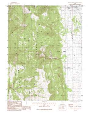
Fountain Green South Topo Map Utah
To zoom in, hover over the map of Fountain Green South
USGS Topo Quad 39111e6 - 1:24,000 scale
| Topo Map Name: | Fountain Green South |
| USGS Topo Quad ID: | 39111e6 |
| Print Size: | ca. 21 1/4" wide x 27" high |
| Southeast Coordinates: | 39.5° N latitude / 111.625° W longitude |
| Map Center Coordinates: | 39.5625° N latitude / 111.6875° W longitude |
| U.S. State: | UT |
| Filename: | o39111e6.jpg |
| Download Map JPG Image: | Fountain Green South topo map 1:24,000 scale |
| Map Type: | Topographic |
| Topo Series: | 7.5´ |
| Map Scale: | 1:24,000 |
| Source of Map Images: | United States Geological Survey (USGS) |
| Alternate Map Versions: |
Fountain Green South UT 1983, updated 1983 Download PDF Buy paper map Fountain Green South UT 1983, updated 1984 Download PDF Buy paper map Fountain Green South UT 2001, updated 2004 Download PDF Buy paper map Fountain Green South UT 2011 Download PDF Buy paper map Fountain Green South UT 2014 Download PDF Buy paper map |
| FStopo: | US Forest Service topo Fountain Green South is available: Download FStopo PDF Download FStopo TIF |
1:24,000 Topo Quads surrounding Fountain Green South
> Back to 39111e1 at 1:100,000 scale
> Back to 39110a1 at 1:250,000 scale
> Back to U.S. Topo Maps home
Fountain Green South topo map: Gazetteer
Fountain Green South: Basins
Devils Gate Basin elevation 2300m 7545′The Basin elevation 2089m 6853′
Fountain Green South: Flats
Dandelion Flat elevation 2351m 7713′Dutchman Flat elevation 2348m 7703′
South Flat elevation 2519m 8264′
Fountain Green South: Gaps
Devils Gate elevation 2036m 6679′Fountain Green South: Lakes
Hamburger Lake elevation 2428m 7965′Fountain Green South: Populated Places
Freedom elevation 1764m 5787′Jerusalem elevation 1811m 5941′
Fountain Green South: Ridges
Chris Ridge elevation 2425m 7956′Tidds Ridge elevation 2551m 8369′
Fountain Green South: Springs
Cement Spring elevation 2316m 7598′Cool Spring elevation 2758m 9048′
Joe Spring elevation 2576m 8451′
Larch Cristensen Spring elevation 1889m 6197′
Minnie Spring elevation 2543m 8343′
Mud Spring elevation 2363m 7752′
Rock Spring elevation 2537m 8323′
Squaw Spring elevation 1842m 6043′
Fountain Green South: Streams
Birch Creek elevation 1775m 5823′Crooked Creek elevation 1834m 6017′
Hardscrabble Creek elevation 2107m 6912′
Quaking Aspen Creek elevation 2154m 7066′
Fountain Green South: Summits
Cedar Hill elevation 1751m 5744′Marble Hill elevation 2513m 8244′
Fountain Green South: Valleys
Basin Canyon elevation 2013m 6604′Box Canyon elevation 2020m 6627′
Buck Hollow elevation 2273m 7457′
Bulge Hollow elevation 1789m 5869′
Chris Canyon elevation 2120m 6955′
Death Hollow elevation 2183m 7162′
Fountain Green Pole Canyon elevation 1824m 5984′
Hog Gulch elevation 2330m 7644′
Kern Canyon elevation 1784m 5853′
Left Fork Maple Canyon elevation 2072m 6797′
Maple Canyon elevation 1831m 6007′
Middle Fork Maple Canyon elevation 2097m 6879′
Mill Hollow elevation 2132m 6994′
Minnie Spring Hollow elevation 2416m 7926′
Moore Canyon elevation 2185m 7168′
Moroni Pole Canyon elevation 1753m 5751′
Reddick Canyon elevation 2133m 6998′
Rees Valley elevation 2123m 6965′
Right Fork Maple Canyon elevation 2072m 6797′
Tidds Canyon elevation 1878m 6161′
Fountain Green South digital topo map on disk
Buy this Fountain Green South topo map showing relief, roads, GPS coordinates and other geographical features, as a high-resolution digital map file on DVD:


