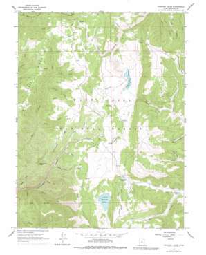
Fairview Lakes Topo Map Utah
To zoom in, hover over the map of Fairview Lakes
USGS Topo Quad 39111f3 - 1:24,000 scale
| Topo Map Name: | Fairview Lakes |
| USGS Topo Quad ID: | 39111f3 |
| Print Size: | ca. 21 1/4" wide x 27" high |
| Southeast Coordinates: | 39.625° N latitude / 111.25° W longitude |
| Map Center Coordinates: | 39.6875° N latitude / 111.3125° W longitude |
| U.S. State: | UT |
| Filename: | o39111f3.jpg |
| Download Map JPG Image: | Fairview Lakes topo map 1:24,000 scale |
| Map Type: | Topographic |
| Topo Series: | 7.5´ |
| Map Scale: | 1:24,000 |
| Source of Map Images: | United States Geological Survey (USGS) |
| Alternate Map Versions: |
Fairview Lakes UT 1965, updated 1968 Download PDF Buy paper map Fairview Lakes UT 1965, updated 1979 Download PDF Buy paper map Fairview Lakes UT 2001, updated 2004 Download PDF Buy paper map Fairview Lakes UT 2011 Download PDF Buy paper map Fairview Lakes UT 2014 Download PDF Buy paper map |
| FStopo: | US Forest Service topo Fairview Lakes is available: Download FStopo PDF Download FStopo TIF |
1:24,000 Topo Quads surrounding Fairview Lakes
> Back to 39111e1 at 1:100,000 scale
> Back to 39110a1 at 1:250,000 scale
> Back to U.S. Topo Maps home
Fairview Lakes topo map: Gazetteer
Fairview Lakes: Dams
Beaver Dam elevation 2670m 8759′Fairview Lakes Dam elevation 2734m 8969′
Lower Gooseberry Reservoir Dam elevation 2569m 8428′
Fairview Lakes: Populated Places
Beaver Dams Summer Homes Area elevation 2716m 8910′Fairview Lakes: Reservoirs
Beaver Dam Reservoir elevation 2669m 8756′Boulger Reservoir elevation 2668m 8753′
Fairview Lakes elevation 2734m 8969′
Lower Gooseberry Reservoir elevation 2569m 8428′
Fairview Lakes: Ridges
Beaver Ridge elevation 2807m 9209′Cottonwood Ridge elevation 2760m 9055′
Oak Creek Ridge elevation 2728m 8950′
Winterquarters Ridge elevation 2842m 9324′
Fairview Lakes: Streams
Blind Fork elevation 2241m 7352′Burnt Fork elevation 2351m 7713′
Durphys Fork elevation 2507m 8225′
Hys Fork elevation 2535m 8316′
Japanese Creek elevation 2569m 8428′
Neils Fork elevation 2349m 7706′
Swens Fork elevation 2548m 8359′
White Pine Fork elevation 2447m 8028′
Fairview Lakes: Summits
Pine Crown Peak elevation 2781m 9124′Fairview Lakes: Tunnels
Narrows Tunnel elevation 2698m 8851′Fairview Lakes: Valleys
Boulger Canyon elevation 2671m 8763′Brooks Canyon elevation 2592m 8503′
Left Fork Cottonwood Canyon elevation 2565m 8415′
North Fork Swens Canyon elevation 2670m 8759′
Spring Cabin Hollow elevation 2521m 8270′
Fairview Lakes digital topo map on disk
Buy this Fairview Lakes topo map showing relief, roads, GPS coordinates and other geographical features, as a high-resolution digital map file on DVD:


