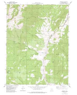
Birdseye Topo Map Utah
To zoom in, hover over the map of Birdseye
USGS Topo Quad 39111h5 - 1:24,000 scale
| Topo Map Name: | Birdseye |
| USGS Topo Quad ID: | 39111h5 |
| Print Size: | ca. 21 1/4" wide x 27" high |
| Southeast Coordinates: | 39.875° N latitude / 111.5° W longitude |
| Map Center Coordinates: | 39.9375° N latitude / 111.5625° W longitude |
| U.S. State: | UT |
| Filename: | o39111h5.jpg |
| Download Map JPG Image: | Birdseye topo map 1:24,000 scale |
| Map Type: | Topographic |
| Topo Series: | 7.5´ |
| Map Scale: | 1:24,000 |
| Source of Map Images: | United States Geological Survey (USGS) |
| Alternate Map Versions: |
Birdseye UT 1979, updated 1979 Download PDF Buy paper map Birdseye UT 2001, updated 2004 Download PDF Buy paper map Birdseye UT 2011 Download PDF Buy paper map Birdseye UT 2014 Download PDF Buy paper map |
| FStopo: | US Forest Service topo Birdseye is available: Download FStopo PDF Download FStopo TIF |
1:24,000 Topo Quads surrounding Birdseye
> Back to 39111e1 at 1:100,000 scale
> Back to 39110a1 at 1:250,000 scale
> Back to U.S. Topo Maps home
Birdseye topo map: Gazetteer
Birdseye: Mines
Birdseye Quarry elevation 2253m 7391′Birdseye: Parks
Jackson Wildlife Management Area elevation 1805m 5921′Birdseye: Populated Places
Birdseye elevation 1655m 5429′Pines elevation 1685m 5528′
Birdseye: Ridges
Mahogany Ridge elevation 2463m 8080′Birdseye: Springs
Burdick Spring elevation 1875m 6151′Cottonwood Spring elevation 1782m 5846′
Cox Canyon Spring elevation 2013m 6604′
Oak Spring elevation 2115m 6938′
Peery Mill Spring elevation 2372m 7782′
Birdseye: Streams
Aggie Creek elevation 1617m 5305′Bennie Creek elevation 1644m 5393′
Crab Creek elevation 1590m 5216′
Left Fork Crab Creek elevation 2040m 6692′
Nebo Creek elevation 1698m 5570′
Right Fork Crab Creek elevation 2025m 6643′
Birdseye: Summits
Cedar Knoll elevation 1795m 5889′Loafer Mountain elevation 3206m 10518′
Nielson Knoll elevation 1973m 6473′
Santaquin Peak elevation 3250m 10662′
Birdseye: Valleys
Anderson Hollow elevation 1636m 5367′Barney Hollow elevation 2109m 6919′
Blind Canyon elevation 1644m 5393′
Cat Canyon elevation 1590m 5216′
Cox Canyon elevation 1718m 5636′
Deer Hollow elevation 2107m 6912′
Gardner Hollow elevation 1693m 5554′
Hudson Hollow elevation 1672m 5485′
Hyle Hollow elevation 1776m 5826′
Ives Canyon elevation 1790m 5872′
Old Cart Hollow elevation 1797m 5895′
Paces Hollow elevation 1768m 5800′
Rock Hill Hollow elevation 1692m 5551′
Thomas Hollow elevation 1771m 5810′
Wildcat Canyon elevation 1638m 5374′
Birdseye digital topo map on disk
Buy this Birdseye topo map showing relief, roads, GPS coordinates and other geographical features, as a high-resolution digital map file on DVD:


