Clear Lake Topo Map Utah
To zoom in, hover over the map of Clear Lake
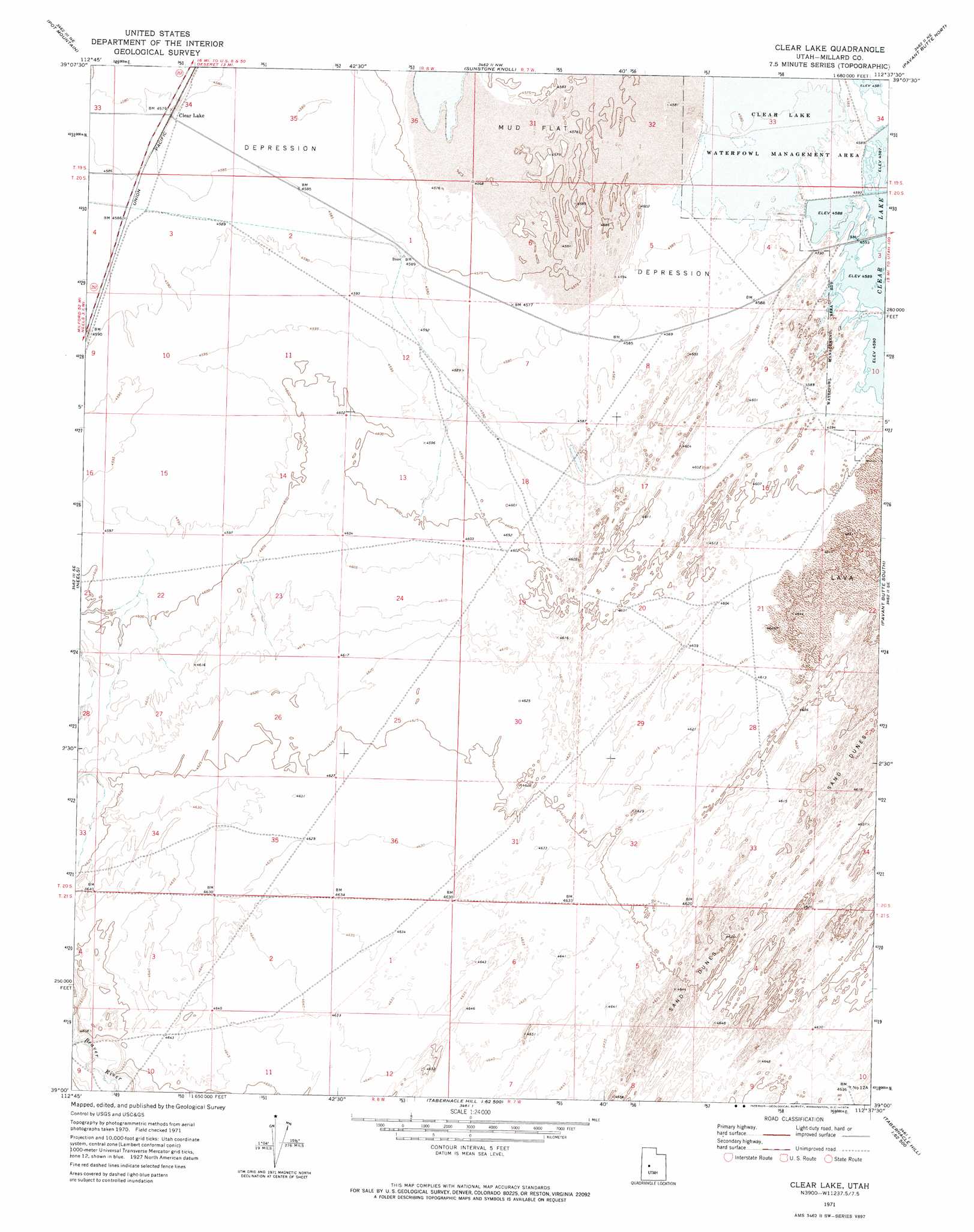
USGS Topo Quad 39112a6 - 1:24,000 scale
| Topo Map Name: | Clear Lake |
| USGS Topo Quad ID: | 39112a6 |
| Print Size: | ca. 21 1/4" wide x 27" high |
| Southeast Coordinates: | 39° N latitude / 112.625° W longitude |
| Map Center Coordinates: | 39.0625° N latitude / 112.6875° W longitude |
| U.S. State: | UT |
| Filename: | o39112a6.jpg |
| Download Map JPG Image: | Clear Lake topo map 1:24,000 scale |
| Map Type: | Topographic |
| Topo Series: | 7.5´ |
| Map Scale: | 1:24,000 |
| Source of Map Images: | United States Geological Survey (USGS) |
| Alternate Map Versions: |
Clear Lake UT 1971, updated 1974 Download PDF Buy paper map Clear Lake UT 2010 Download PDF Buy paper map Clear Lake UT 2014 Download PDF Buy paper map |
1:24,000 Topo Quads surrounding Clear Lake
Clay Knoll |
Crafts Lake |
Hinckley |
Delta |
Harding |
Rocky Knoll |
Pot Mountain |
Sunstone Knoll |
Pavant Butte North |
Mccornick |
Red Pass |
Neels |
Clear Lake |
Pavant Butte South |
The Sink |
Candland Spring |
Borden |
Sand Ridge |
Tabernacle Hill |
Meadow |
Cat Canyon |
Cruz |
Black Point |
Sixmile Point |
Kanosh |
> Back to 39112a1 at 1:100,000 scale
> Back to 39112a1 at 1:250,000 scale
> Back to U.S. Topo Maps home
Clear Lake digital topo map on disk
Buy this Clear Lake topo map showing relief, roads, GPS coordinates and other geographical features, as a high-resolution digital map file on DVD: