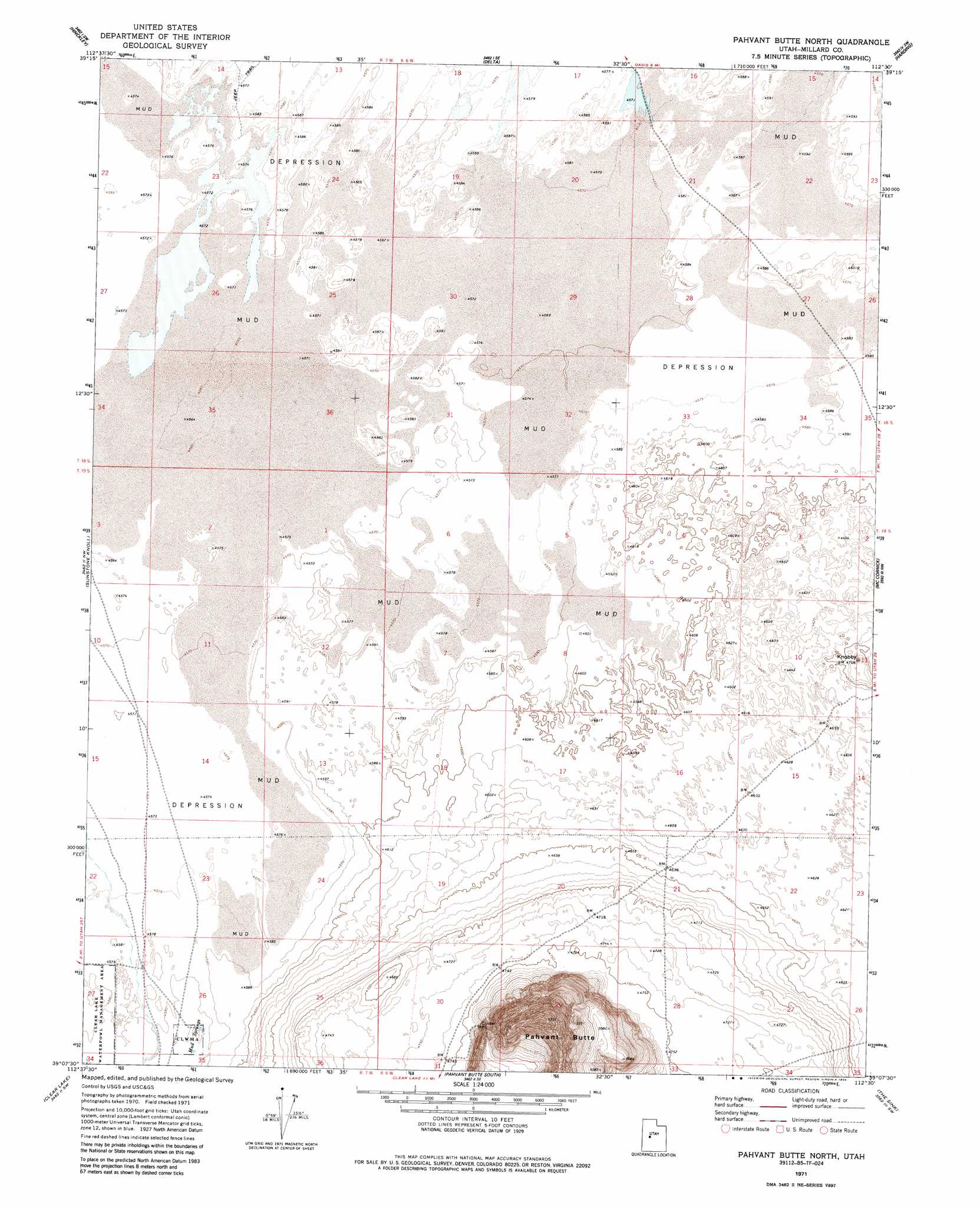
Pavant Butte North Topo Map Utah
To zoom in, hover over the map of Pavant Butte North
USGS Topo Quad 39112b5 - 1:24,000 scale
| Topo Map Name: | Pavant Butte North |
| USGS Topo Quad ID: | 39112b5 |
| Print Size: | ca. 21 1/4" wide x 27" high |
| Southeast Coordinates: | 39.125° N latitude / 112.5° W longitude |
| Map Center Coordinates: | 39.1875° N latitude / 112.5625° W longitude |
| U.S. State: | UT |
| Filename: | o39112b5.jpg |
| Download Map JPG Image: | Pavant Butte North topo map 1:24,000 scale |
| Map Type: | Topographic |
| Topo Series: | 7.5´ |
| Map Scale: | 1:24,000 |
| Source of Map Images: | United States Geological Survey (USGS) |
| Alternate Map Versions: |
Pavant Butte North UT 1971, updated 1974 Download PDF Buy paper map Pahvant Butte North UT 1971, updated 1988 Download PDF Buy paper map Pahvant Butte North UT 1971, updated 1988 Download PDF Buy paper map Pahvant Butte North UT 2010 Download PDF Buy paper map Pahvant Butte North UT 2014 Download PDF Buy paper map |
1:24,000 Topo Quads surrounding Pavant Butte North
Smelter Knolls East |
Sutherland |
Delta Ne |
Strong |
Oak City North |
Crafts Lake |
Hinckley |
Delta |
Harding |
Oak City South |
Pot Mountain |
Sunstone Knoll |
Pavant Butte North |
Mccornick |
Duggins Creek |
Neels |
Clear Lake |
Pavant Butte South |
The Sink |
Holden |
Borden |
Sand Ridge |
Tabernacle Hill |
Meadow |
Fillmore |
> Back to 39112a1 at 1:100,000 scale
> Back to 39112a1 at 1:250,000 scale
> Back to U.S. Topo Maps home
Pavant Butte North topo map: Gazetteer
Pavant Butte North: Springs
Mud Lake Spring elevation 1399m 4589′Mud Springs elevation 1397m 4583′
Pavant Butte North: Summits
Knobby elevation 1433m 4701′Pahvant Butte elevation 1750m 5741′
Pavant Butte North digital topo map on disk
Buy this Pavant Butte North topo map showing relief, roads, GPS coordinates and other geographical features, as a high-resolution digital map file on DVD: